The Best Camping in Santee
Looking for the best camping in Santee? We've got you covered with the top trails, trips, hiking, backpacking, camping and more around Santee. The detailed guides, photos, and reviews are all submitted by the Outbound community.
Top camping spots in and near Santee
-
Santee, California
Kubota Trail and Toyen Trail Loop
1.37 mi / 85 ft gainKubota Trail and Toyen Trail Loop is an out-and-back trail that takes you by a lake located near Rancho Palos Verdes, California.Read more -
Jamul, California
Hiking Otay Mountain
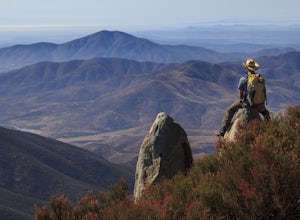
5.015.3 mi / 2903 ft gainThe trek begins on the Otay Mountain Truck Trail at Pio Pico Resort & Campground. You can either park and hike the entire trail, or drive up to a point a couple miles and park before the road becomes steep and rough. The distance on here is if you hiked the whole way. If you have a 4-wheel dr...Read more -
Encinitas, California
San Elijo State Beach Campground
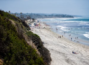
4.5This campground is located right next to the beach as well as next to the San Elijo Lagoon. Head to the beach during the day for a swim. This is also a great place to catch a sunset. If you want to stretch your legs and get moving a bit, you can hike around the San Elijo Lagoon to the east of the...Read more -
Escondido, California
Camp at Dixon Lake
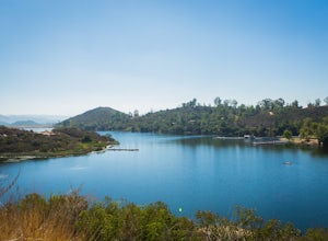
2.1 mi / 295 ft gainDixon Lake is Escondido's best kept secret! A man-made reservoir located right next to Daley Ranch, Dixon Lake offers overnight camping, boat rentals, fishing, and hiking, along with picnic areas, a kids park, and more. The campground is open year-round and is located next to the lake with a lof...Read more -
Descanso, California
Harvey Moore Trail
9.59 mi / 1165 ft gainHarvey Moore Trail is a loop trail where you may see beautiful wildflowers located near Descanso, California.Read more -
Julian, California
Camping at Paso Picacho
Paso Picacho, 5 miles north of Cuyamaca Rancho State Park, sits at an elevation of 5,000 feet. The most popular hikes start from this camp, including the 2 mile hike up Stonewall Peak (elevation 5,700 feet), and the 3.5 mile hike up Cuyamaca Peak (elevation 6,512 feet), both which offer breathtak...Read more -
Julian, California
Hike Stonewall Peak
4.73.82 mi / 820 ft gainThis hike is one of the most popular in the Cuyamaca Rancho State Park. When you reach Stonewall Peak's summit, enjoy the view of the surrounding park and nearby Lake Cuyamaca. The hike up the east side is a popular and relatively easy trail. Although you'll be gaining 800 feet, the hike is relat...Read more -
Julian, California
Kelly Ditch Trail
11.76 mi / 2500 ft gainKelly Ditch Trail is an out-and-back trail where you may see beautiful wildflowers located near Julian, California.Read more -
Carlsbad, California
South Carlsbad Campground
5.0South Carlsbad Campground is a picturesque experience. Imagine gorgeous sea cliffs overlooking a lovely beach, with ample activities to pursue (or just lay in the sun and enjoy some quiet time). The most popular campsites, 1-70 and 156-222, are perched on the edge of a bluff and feature the best ...Read more -
Carlsbad, California
South Carlsbad State Beach
3.83 mi / 23 ft gainSouth Carlsbad State Beach is an out-and-back trail that takes you past scenic surroundings located near Carlsbad, California.Read more -
Julian, California
Oriflamme Canyon Trail
16.08 mi / 2835 ft gainOriflamme Canyon Trail is a loop trail that takes you past scenic surroundings located near Julian, California.Read more -
Pine Valley, California
PCT: Boulder Oaks to Pioneer Mail
25.66 mi / 4239 ft gainPCT: Boulder Oaks to Pioneer Mail is a point-to-point trail that takes you by a waterfall located near Campo, California.Read more -
Mount Laguna, California
Sunset to Big Laguna Loop
5.5 mi / 427 ft gainSunset to Big Laguna Loop is a loop trail that takes you by a lake located near Mount Laguna, California.Read more -
Mount Laguna, California
Lightning Ridge
1.64 mi / 233 ft gainLightning Ridge is a loop trail that is good for all skill levels located near Mount Laguna, California.Read more -
Mount Laguna, California
Monument Peak and Foster Point Loop Trail
7.94 mi / 1040 ft gainMonument Peak and Foster Point Loop Trail is a loop trail where you may see beautiful wildflowers located near Mount Laguna, California.Read more -
Mount Laguna, California
Pacific Crest Trail to Mount Laguna and Foster Point
5.95 mi / 623 ft gainPacific Crest Trail to Mount Laguna and Foster Point is an out-and-back trail where you may see beautiful wildflowers located near Mount Laguna, California.Read more


