The Best Camping in Nederland
Looking for the best camping in Nederland? We've got you covered with the top trails, trips, hiking, backpacking, camping and more around Nederland. The detailed guides, photos, and reviews are all submitted by the Outbound community.
Top camping spots in and near Nederland
-
Nederland, Colorado
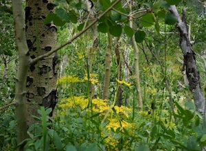
Aspen Alley Trail Loop
2.53 mi / 331 ft gainAspen Alley Trail Loop is a loop trail where you may see beautiful wildflowers located near Nederland, Colorado.Read more -
Nederland, Colorado
Hike to the Lost Lakes via the Hessie Trail
4 mi / 1000 ft gainAccessed by Hessie Trailhead, Lost Lake is a relatively moderate 4 mile round-trip hike with about 1,000 feet of elevation. The core of the hike is uphill and on a gravel path, 2/3rds of the hike runs parallel to a rushing waterfall. After parking your car, head towards the Hessie Trailhead. Yo...Read more -
Eldora, Colorado
Lost Lake via Hessie Trail
4.05 mi / 830 ft gainLost Lake via Hessie Trail is an out-and-back trail that takes you by a lake located near Nederland, Colorado.Read more -
Eldora, Colorado
Devils Thumb Pass and King Lake Trail
15.26 mi / 3255 ft gainDevils Thumb Pass and King Lake Trail is a loop trail that takes you by a lake located near Nederland, Colorado.Read more -
Eldora, Colorado
Devil's Thumb Lake Trail
12.14 mi / 2346 ft gainDevil's Thumb Lake Trail is an out-and-back trail that takes you by a lake located near Nederland, Colorado.Read more -
Nederland, Colorado
King Lake via Hessie Trailhead
5.011.32 mi / 2375 ft gainThe normal route from the east side is via the Hessie trailhead outside Nederland Colorado. From the west it is most often accessed via the short trail from Rollins pass, which is open in the summer. As noted above, it is also a lake and area ripe for creating your own adventure. The description ...Read more -
Nederland, Colorado
Hiking the Indian Peaks Wilderness' Lost Lake
4.34.5 mi / 1000 ft gainLost Lake of the Indian Peaks Wilderness area is a scenic short hike (about 3 hours) with a lot to see. The trailhead is tucked at the end of a road that passes through Eldora, a charming village of cabins and old abandoned buildings. You will pass by the lost "town" of Hessie on foot, which is w...Read more -
Nederland, Colorado
South Arapaho Peak via Arapaho Glacier Trail
13.2 mi / 3547 ft gainSouth Arapaho Peak via Arapaho Glacier Trail is an out-and-back trail that takes you by a lake located near Nederland, Colorado.Read more -
Nederland, Colorado
Upper Diamond Lake via Fourth of July Trailhead
4.88.12 mi / 2037 ft gainThe trail begins at the 4th of July trailhead, which is located near the Eldora ski area and can be crowded during the summer and weekends. The road is rough in places but passable by any car when dry. From the parking area begin hiking the Arapaho pass trail, which will gently gain elevation thr...Read more -
Nederland, Colorado
Diamond Lake Trail
5.39 mi / 1194 ft gainDiamond Lake Trail is an out-and-back trail that takes you by a lake located near Nederland, Colorado.Read more -
Nederland, Colorado
Backpack to Caribou Lake
4.08.2 miThis is one of the most beautiful hikes I have ever done in Colorado. It is a great trip for photographers, fisherman or anyone who enjoys mountain views, forests filled with wildlife and peaceful meadows. Distances: Arapaho Pass: 3.2 miles, Caribou Lake: 4.2 miles, Caribou Pass: 6.4 miles, Meado...Read more -
Nederland, Colorado
Hike to Arapaho Pass and Lake Dorothy
4.37.5 mi / 2080 ft gainBegin by parking at the 4th of July trailhead. This can be reached by conituing past the Eldora ski area and up a rough but passable (for all vehicles) gravel road to the trailhead. The trail is easy to find, and will continue to rise for the next 1.15 miles.At just over a mile there is a fork fo...Read more -
Nederland, Colorado
Caribou Lake via Arapaho Pass Trail
9.02 mi / 2474 ft gainCaribou Lake via Arapaho Pass Trail is an out-and-back trail that takes you by a lake located near Nederland, Colorado.Read more -
Nederland, Colorado
Explore the Historic Railroad Route up Rollins Pass
5.0Rollin's Pass Road is a dirt road that follows an old railroad route from the historic town of Tolland, over the Continental Divide, and into Fraser. The road no longer allows you to drive over the summit, due to a partial tunnel collapse, but the road still takes you to within a short hike of th...Read more -
Nederland, Colorado
3 Crater Lakes via South Boulder Creek
5.06.92 mi / 1804 ft gainAfter turning on to Co. 16 (Tolland Rd.) from 119 at Rollinsville, drive about 8 miles down the dirt road along South Boulder Creek. The road will dead end at Moffat Tunnel where you'll find ample parking in a gravel lot with restrooms. You'll begin your hike along sweeping meadows until you ent...Read more -
Nederland, Colorado
Clayton Lake and Rogers Pass Trail
5.59 mi / 1739 ft gainClayton Lake and Rogers Pass Trail is an out-and-back trail that takes you by a lake located near Winter Park, Colorado.Read more


