The Best Camping in Lake City
Looking for the best camping in Lake City? We've got you covered with the top trails, trips, hiking, backpacking, camping and more around Lake City. The detailed guides, photos, and reviews are all submitted by the Outbound community.
Top camping spots in and near Lake City
-
Lake City, Colorado
Alpine Gulch Trail
9.31 mi / 2943 ft gainAlpine Gulch Trail is an out-and-back trail that takes you by a waterfall located near Lake City, Colorado.Read more -
Lake City, Colorado
Colorado Trail : Segment 22
16.9 mi / 3757 ft gainColorado Trail : Segment 22 is a point-to-point trail where you may see local wildlife located near Lake City, Colorado.Read more -
Powderhorn, Colorado
Big Blue Trail
22.37 mi / 3586 ft gainBig Blue Trail is an out-and-back trail that takes you by a river located near Lake City, Colorado.Read more -
Lake City, Colorado
Wetterhorn Basin via West Fork Trail
7.86 mi / 2523 ft gainWetterhorn Basin via West Fork Trail is an out-and-back trail that takes you by a waterfall located near Lake City, Colorado.Read more -
Lake City, Colorado
Backpack to Wetterhorn Basin
13 mi / 3000 ft gainThis trip is for the lover of solitude and the appreciator of the unscathed backcountry. Wetterhorn Basin is in the heart of the beautiful San Juan Mountain range in Southwestern Colorado.With a 4WD high clearance vehicle start at the West Cimarron Trailhead at 10,750 feet (38.1117N -107.5533W),...Read more -
Silverton, Colorado
Explore Animas Forks
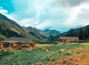
5.00.25 mi / 40 ft gainThe ghost town of Animas Forks, CO is located in the San Juan Mountains at an elevation of 11,200 feet. There are several original buildings remaining. The best way to explore the region is by Jeep or other high-clearance 4×4. The cabins began being built by prospectors in 1873. Three rivers meet...Read more -
Gunnison, Colorado
Alpine Trail to Big Blue Campground
14.15 mi / 3878 ft gainAlpine Trail to Big Blue Campground is a point-to-point trail that takes you by a river located near Cimarron, Colorado.Read more -
Silverton, Colorado
Drive to California Pass
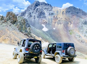
California Pass’s summit is a jaw dropping 12,960 feet above sea level. A long way from the valley floor, California Gulch, but, as drivers start their trek, the valley floor starts to shrink and gives way to steep climbs and switchbacks. Off road vehicles are needed to reach the top, and drivers...Read more -
Silverton, Colorado
Explore Hurricane Pass and Lake Como
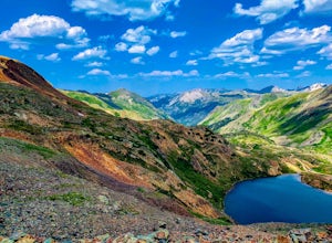
Spending much of the trek above tree line, Hurricane Pass is situated at 12,730 feet above sea level and offers up views of Poughkeepsie Gulch (a more extreme off-road trail) and sapphire blue mountain lakes, such as Lake Como. One of the most beautiful roads in the lower 48 states, Hurricane Pas...Read more -
Creede, Colorado
Colorado Trail: Segment 21
14.44 mi / 3009 ft gainColorado Trail: Segment 21 is a point-to-point trail where you may see beautiful wildflowers located near Creede, Colorado.Read more -
Ouray, Colorado
Backpack to Dragon's Back via Horsethief Trail
5.016 mi / 3520 ft gainThe Uncompahgre Wilderness stretches out through the mountains and forests of southwestern Colorado, with worn trails lingering beside abandoned 19th-century mines and crossing old alpine sheep pastures. Dragon's Back is the unofficial name for Point 12,968', a small but beautiful summit at the b...Read more -
Silverton, Colorado
Colorado Trail: Segment 24
21.63 mi / 3533 ft gainColorado Trail: Segment 24 is a point-to-point trail where you may see local wildlife located near Silverton, Colorado.Read more -
Ridgway, Colorado
Running to Grizzly Bear Mine
Bear Creek Trail, which leads to Grizzly Mine, is located just 2 miles outside of Ouray, Colorado on Highway 550 immediately following the first tunnel. There's two parking lots, a large one and a small one, the trail leads from the small parking lot over the tunnel and highway. There are no bath...Read more -
Creede, Colorado
Squaw Creek, Continental Divide and Weminuche Trail Loop
28.91 mi / 4639 ft gainSquaw Creek, Continental Divide and Weminuche Trail Loop is a loop trail that takes you by a lake located near Creede, Colorado.Read more -
Silverton, Colorado
Highland Mary Lake Trail
5.12 mi / 1447 ft gainHighland Mary Lake Trail is an out-and-back trail that takes you past scenic surroundings located near Montrose, Colorado.Read more -
Ridgway, Colorado
Owl Creek Pass Road
18.6 mi / 3360 ft gainOwl Creek Pass Road OHV Route is a point-to-point trail that takes you by a lake located near Ridgway, Colorado.Read more


