The Best Camping in Franktown
Looking for the best camping in Franktown? We've got you covered with the top trails, trips, hiking, backpacking, camping and more around Franktown. The detailed guides, photos, and reviews are all submitted by the Outbound community.
Top camping spots in and near Franktown
-
Sedalia, Colorado
Indian Creek and Steven's Gulch Loop Trail
19.88 mi / 4259 ft gainIndian Creek and Steven's Gulch Loop Trail is a loop trail that takes you by a lake located near Littleton, Colorado.Read more -
Palmer Lake, Colorado
Harrison Plane Crash from Palmer Lake
11.1 mi / 2031 ft gainHarrison Plane Crash from Palmer Lake is an out-and-back trail where you may see beautiful wildflowers located near Dinosaur, Colorado.Read more -
Pine, Colorado
Dispersed Camp at the Buffalo Creek Area in Pike National Forest
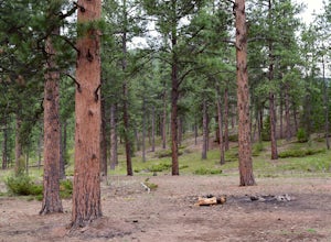
3.850 miles from Denver, nestled in Pike National Forest, there are dozens of free dispersed camping sites. With quick access to the Colorado Trail and Buffalo Creek Mountain Bike Area, these campsites make for a perfect weekend getaway. The campsites begin on Forest Road 550, and are clearly marked...Read more -
Sedalia, Colorado
Goose Creek and Matukat OHV Road
27.22 mi / 4085 ft gainGoose Creek and Matukat OHV Road is a point-to-point trail where you may see beautiful wildflowers located near Sedalia, Colorado.Read more -
Woodland Park, Colorado
Lovell Gulch Trail
5.22 mi / 814 ft gainLovell Gulch Trail is a loop trail that takes you by a river located near Woodland Park, Colorado.Read more -
Woodland Park, Colorado
Climb at Turkey Rocks
5.0Looking for a place to hone your crack climbing technique? Turkey Rocks is the place with some old school ethics and stiff grades. Turkey can be accessed from the town of Westcreek north of Woodland Park. From here, head west on Abbey Road and then south on West Creek Ave. About a mile down t...Read more -
Colorado Springs, Colorado
Camp along Rampart Range Road
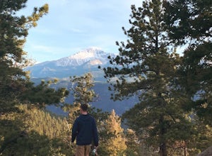
Along Rampart Range Road there are about 30 free BLM camping spots that offer scenic views of Pikes Peak and the surrounding forest. The road in is about 6 miles of gravel, however a 2WD Sedan was able to make the journey just fine! The camping spots are designated by a pre-existing fire ring and...Read more -
Pine, Colorado
Hike to Buffalo Creek Falls
0.5 mi / 500 ft gainA quarter mile hike takes you to the base of the falls. From there, look for a trail on the right that will lead to an overlook on a bridge. You can continue exploring along South Buffalo Creek further upstream, as well, where there are more cascades and pools to enjoy. Afterwards, spend some tim...Read more -
Pine, Colorado
Wigwam Trail 609
5.011.28 mi / 2382 ft gainWigwam Trail 609 is a point-to-point trail that takes you by a river located near Bailey, Colorado.Read more -
39.3383054109609,-105.401287078857, Colorado
Colorado Trail (Wellington Lake Road to Long Gulch Trailhead)
15.49 mi / 3442 ft gainColorado Trail (Wellington Lake Road to Long Gulch Trailhead) is a point-to-point trail that takes you by a river located near Jefferson, Colorado.Read more -
39.3383220066784,-105.401254892349, Colorado
Rolling Creek Trail via Colorado Trail
13.26 mi / 3963 ft gainRolling Creek Trail via Colorado Trail is an out-and-back trail that takes you by a river located near Bailey, Colorado.Read more -
Evergreen, Colorado
Maxwell Falls Bluffs Cliffside Trail Loop
5.14 mi / 1079 ft gainMaxwell Falls Bluffs Cliffside Trail Loop is a loop trail that takes you by a waterfall located near Conifer, Colorado.Read more -
Evergreen, Colorado
Maxwell Falls Lower Trail
3.99 mi / 902 ft gainMaxwell Falls Lower Trail is a loop trail that takes you by a waterfall located near Evergreen, Colorado.Read more -
Sedalia, Colorado
Goose Creek Trail 612 to McCurdy Trail
12.66 mi / 2408 ft gainGoose Creek Trail 612 to McCurdy Trail is an out-and-back trail where you may see beautiful wildflowers located near Lake George, Colorado.Read more -
Sedalia, Colorado
Backpack the Lost Creek Loop
33.5 mi / 6200 ft gainLost Creek Wilderness may be my favorite part of Colorado. It contains varied terrain and geography, and is less crowded than most places. This loop will take you through everything the wilderness area has to offer. You will get sweeping panoramas of mountain ranges to the south, as well has m...Read more -
Sedalia, Colorado
Camp at Goose Creek
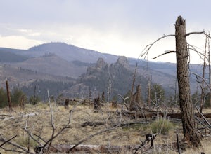
3.08 mi / 1300 ft gainGoose Creek is a fantastic spot to hike or camp. There is a dirt road leading to the trailhead, and it winds through the mountains and offers a great view of the valley. The dirt road is relatively easy and well-maintained. The burn scar from the Hayman fire is still really evident, so there are ...Read more


