The Best Camping in Montrose
Looking for the best camping in Montrose? We've got you covered with the top trails, trips, hiking, backpacking, camping and more around Montrose. The detailed guides, photos, and reviews are all submitted by the Outbound community.
Top camping spots in and near Montrose
-
Crawford, Colorado
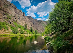
Warner Route
4.33 mi / 3228 ft gainWarner Route is an out-and-back trail that takes you by a river located near Montrose, Colorado.Read more -
Montrose, Colorado
Drive the East Portal Road
Want an easier way to get to the bottom of the canyon without the rugged hiking trails? Drive to the bottom via the East Portal Road. Open once the harsh winter breaks, this road switchbacks its way to the bottom at the meeting place of Curecanti National Recreation area and Black Canyon of the G...Read more -
Montrose, Colorado
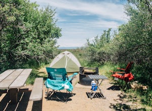
Camp at Black Canyon of the Gunnison's South Rim Campground
5.0The South Rim Campground is located about 6 miles inside Black Canyon of the Gunnison National Park. There are a total of 88 sites, 34 of which are available year-round. Reservations are definitely recommended, but are not required - loop C is first-come, first-served. Loop B fills up first, as i...Read more -
Montrose, Colorado
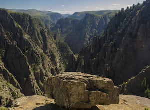
Hike to Tomichi Point and Gunnison Point Overlooks
5.02 miTo access the South Rim of the Black Canyon of the Gunnison National Park, take US 50 and CO 347 to the south entrance, 15 miles east of Montrose. There is no bridge between the north and south rims of the canyon - make sure you enter from the Montrose side.After passing through the entrance stat...Read more -
Crawford, Colorado
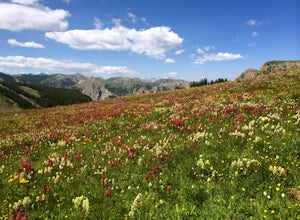
Chasm View Nature Trail
0.54 mi / 528 ft gainChasm View Nature Trail is a loop trail where you may see beautiful wildflowers located near Olathe, Colorado.Read more -
Ridgway, Colorado
Ridgway Reservoir
7.09 mi / 932 ft gainRidgway Reservoir is an out-and-back trail that takes you by a lake located near Ridgway, Colorado.Read more -
Ridgway, Colorado
Owl Creek Pass Road
18.6 mi / 3360 ft gainOwl Creek Pass Road OHV Route is a point-to-point trail that takes you by a lake located near Ridgway, Colorado.Read more -
Gunnison, Colorado
Alpine Trail to Big Blue Campground
14.15 mi / 3878 ft gainAlpine Trail to Big Blue Campground is a point-to-point trail that takes you by a river located near Cimarron, Colorado.Read more -
Lake City, Colorado
Backpack to Wetterhorn Basin
13 mi / 3000 ft gainThis trip is for the lover of solitude and the appreciator of the unscathed backcountry. Wetterhorn Basin is in the heart of the beautiful San Juan Mountain range in Southwestern Colorado.With a 4WD high clearance vehicle start at the West Cimarron Trailhead at 10,750 feet (38.1117N -107.5533W),...Read more -
Lake City, Colorado
Wetterhorn Basin via West Fork Trail
7.86 mi / 2523 ft gainWetterhorn Basin via West Fork Trail is an out-and-back trail that takes you by a waterfall located near Lake City, Colorado.Read more -
Ouray, Colorado
Backpack to Dragon's Back via Horsethief Trail
5.016 mi / 3520 ft gainThe Uncompahgre Wilderness stretches out through the mountains and forests of southwestern Colorado, with worn trails lingering beside abandoned 19th-century mines and crossing old alpine sheep pastures. Dragon's Back is the unofficial name for Point 12,968', a small but beautiful summit at the b...Read more -
Powderhorn, Colorado
Big Blue Trail
22.37 mi / 3586 ft gainBig Blue Trail is an out-and-back trail that takes you by a river located near Lake City, Colorado.Read more -
Telluride, Colorado
Sneffels Highline Trail
12.32 mi / 4432 ft gainSneffels Highline Trail is an out-and-back trail where you may see beautiful wildflowers located near Telluride, Colorado.Read more -
Mesa County, Colorado
Backpack along the Gunnison River in the Dominguez-Escalante NCA
5.03.4 miIf you're looking to take your first backpacking adventure, but want something that is manageable yet thrilling, this is what you're looking for. Located along the Gunnison River in Western Colorado, the Dominguez-Escalante National Conservation area is easy to access yet full of adventure and be...Read more -
Mesa County, Colorado
Big Dominguez Canyon
12.1 mi / 1266 ft gainBig Dominguez Canyon is an out-and-back trail that takes you by a waterfall located near Whitewater, Colorado.Read more -
Telluride, Colorado
Bear Creek, Wasatch, and Bridal Veil Trails Loop
15.12 mi / 4390 ft gainBear Creek, Wasatch, and Bridal Veil Trails Loop is a loop trail that takes you by a lake located near Telluride, Colorado.Read more


