The Best Camping in Klamath County
Looking for the best camping in Klamath County? We've got you covered with the top trails, trips, hiking, backpacking, camping and more around Klamath County. The detailed guides, photos, and reviews are all submitted by the Outbound community.
Top camping spots in and near Klamath County
-
Klamath Falls, Oregon
Stuart Falls Trail
11.69 mi / 1427 ft gainStuart Falls Trail is an out-and-back trail that takes you by a waterfall located near Crater Lake, Oregon.Read more -
Klamath County, Oregon
Mazama Village to Rim Village at Crater Lake
8.36 mi / 1844 ft gainMazama Village to Rim Village at Crater Lake is an out-and-back trail where you may see beautiful wildflowers located near Chiloquin, Oregon.Read more -
Klamath County, Oregon
The Rim at Crater Lake NP
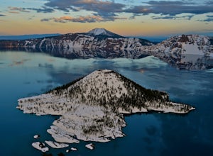
4.330.99 mi / 4124 ft gainWhy Go? Avoid the crowds in summer and have the entire 33 mile long rim and 21 square miles of beautiful Crater Lake to yourself. Sunrises and sunsets that will take your breath away; stars and a milky way you can get lost in for days. Expect solitude and beautiful scenery, nothing less. The 360 ...Read more -
Crescent, Oregon
PCT: OR Section D - Highway 138 to Highway 58 (Willamette Pass)
58.8 mi / 7687 ft gainPCT: OR Section D - Highway 138 to Highway 58 (Willamette Pass) is a point-to-point trail that takes you by a lake located near Crater Lake, Oregon.Read more -
Klamath Falls, Oregon
South Pass Lake Trail
17.6 mi / 4006 ft gainSouth Pass Lake Trail is an out-and-back trail that takes you by a lake located near Klamath Falls, Oregon.Read more -
Butte Falls, Oregon
Twin Ponds Trail to Summit Lake
5.54 mi / 899 ft gainTwin Ponds Trail to Summit Lake is an out-and-back trail where you may see beautiful wildflowers located near Butte Falls, Oregon.Read more -
Klamath Falls, Oregon
PCT: OR Section C - Highway 140 to Highway 138 (Cascade Crest)
68.33 mi / 9022 ft gainPCT: OR Section C - Highway 140 to Highway 138 (Cascade Crest) is a point-to-point trail that takes you by a lake located near Ashland, Oregon.Read more -
Crescent, Oregon
Base of Mt. Thielsen via Mt. Thielsen Trail
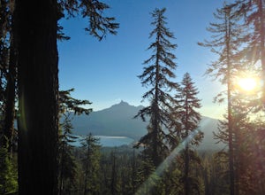
4.77.26 mi / 1926 ft gainThe Trail begins at Mt. Thielsen Trailhead/Sno Park and takes you up through a vast forest of pines. As you ascend, Diamond Lake will slowly start to peak through. Continue straight at mile marker 1.6 and keep an eye out for Mt. Thielsen ahead. Just before entering Mount Thielsen Wilderness aroun...Read more -
Douglas County, Oregon
Mt. Bailey and Hemlock Butte Cabin
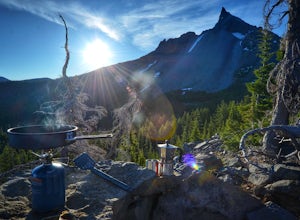
11.09 mi / 3192 ft gainThe trail starts at 5200 feet and climbs through the forest for 1.6 miles to an opening with a great view off diamond lake and the beautiful and very recognizable Mt. Thielsen. There are several small outcropping here that make a perfect spot to stop and get out the backpacking stove for some mou...Read more -
Crescent, Oregon
Miller Lake to Maidu Lake
7.53 mi / 1004 ft gainMiller Lake to Maidu Lake Trail is an out-and-back trail that takes you through a nice forest located near Chemult, Oregon.Read more -
Jackson County, Oregon
Backpack to Devil's Peak and the Seven Lakes Basin
3.013.7 mi / 3050 ft gainStarting at at elevation of 5250 feet, the trail climbs steadily from the trailhead for approximately 3.3 miles to pass at 6900 feet. From here you will come to a junction where going right will lead to Devils Peak and the PCT and going left (straight) will take down into the basin. If you starte...Read more -
Crescent, Oregon
Tipsoo Peak Trail
6.54 mi / 1470 ft gainTipsoo Peak Trail is an out-and-back trail where you may see local wildlife located near Chemult, Oregon.Read more -
Prospect, Oregon
National Creek Falls Trail
0.78 mi / 154 ft gainNational Creek Falls Trail is an out-and-back trail that takes you by a waterfall located near Prospect, Oregon.Read more -
Paisley, Oregon
Soak in the Summer Lake Hot Springs
5.0From Bend drive 32 miles south on Highway 97, through La Pine to Highway 31 (2 miles south of La Pine). Turn left (east) on Highway 31 and continue for 92 miles. Summer Lake Hot Springs is on the left side of the road at mile marker 92.This is a very rustic area, with old barns and farm equipment...Read more -
Douglas County, Oregon
Maidu Lake Trail
19.23 mi / 2552 ft gainMaidu Lake Trail is an out-and-back trail that takes you by a lake located near Idleyld Park, Oregon.Read more


