The Best Camping in Payson
Looking for the best camping in Payson? We've got you covered with the top trails, trips, hiking, backpacking, camping and more around Payson. The detailed guides, photos, and reviews are all submitted by the Outbound community.
Top camping spots in and near Payson
-
Payson, Arizona
Cracker Jack Mine OHV Trail
12.23 mi / 1696 ft gainCracker Jack Mine OHV Trail is a point-to-point trail that takes you by a river located near Payson, Arizona.Read more -
Payson, Arizona
Hike Barnhardt Trail
4.88 mi / 1912 ft gainTo get to the trailhead, use the turnoff of highway 87 labeled Barnhardt trail (has a marked sign coming from both Payson and Phoenix). Barnhardt road is just over 4 miles and is unpaved. The road can be driven on by lower clearance cars because the terrain is not too rocky. Once at the trailhead...Read more -
Payson, Arizona
Mogollon Rim via Washington Park
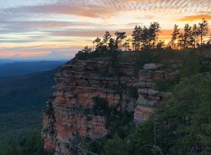
4.04.32 mi / 1138 ft gainThis trail begins at the Washington Park Trailhead which meets up with passage #27 of the AZT. You begin traveling northbound as you ascend the great Mogollon Rim. The trail takes you through a gorgeous forest and rewards you with an awesome cliff side view at the summit. 2.25 miles into the tra...Read more -
Payson, Arizona
Hike the Colonel Devin Trail
4 mi / 1116 ft gainThe hike will begin at Washington Park in Payson, Arizona. To reach Washington Park, take AZ87 to Forest Road 199 (Houston Mesa Road) and turn east. Continue for 10 miles until you reach Forest Road 64 and turn west. Traveling less than a mile you will turn north on Forest Road 32 and in 3 miles ...Read more -
Payson, Arizona
Cabin Loop: Houston Brothers - U-Bar
20.48 mi / 2740 ft gainCabin Loop: Houston Brothers - U-Bar is a loop trail where you may see beautiful wildflowers located near Happy Jack, Arizona.Read more -
Payson, Arizona
Horton Springs Loop
4.48.42 mi / 1896 ft gainThis is a more scenic and bit more strenuous loop hike to the spring, taking in the Derrick Trail, part of the Highline Trail, and the Horton Creek Trail.After parking the cars near Upper Tonto Creek Campground follow the Derrick Trail and hike gently uphill for 1.4 miles through the rim country ...Read more -
Payson, Arizona
Fred Haught Trail
7.65 mi / 942 ft gainFred Haught Trail is an out-and-back trail that takes you through a nice forest located near Happy Jack, Arizona.Read more -
Payson, Arizona
Cabin Loop Trail
18.82 mi / 2028 ft gainPeople think Arizona is all just desert, but this hike will show you otherwise. Up on the Mogollon Rim, this trail takes you past old cabins, through lush forest, and near many creeks. Day 1: (10 miles) Drive on Rim Road to the General Springs Trail Head. The cabin marks the start of the tr...Read more -
Payson, Arizona
Mazatzal Divide
30.73 mi / 5095 ft gainMazatzal Divide is a point-to-point trail that takes you past scenic surroundings located near Payson, Arizona.Read more -
Coconino County, Arizona
Camp at Knoll Lake
5.0The Campground is seasonal and is located on the left just before the lake. There are 33 well-developed units that offer fire-rings, grills, drinking water and vault toilets. No reservations are accepted and you will need to check in with the camp host. From central Phoenix, take Loop 202 east to...Read more -
Payson, Arizona
Mount Ord Trail
14.73 mi / 4019 ft gainMount Ord Trail is an out-and-back trail that takes you past scenic surroundings located near Tonto Basin, Arizona.Read more -
Pine, Arizona
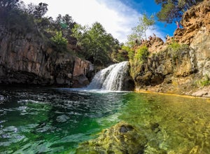
Fossil Creek Falls
4.82.42 mi / 328 ft gainThe journey is definitely worth it! Don't let the description discourage you from visiting here. This is simply to help you be prepared so that you can enjoy this wonderful place as safely as possible! Fossil Creek Rd can only be accessed from Camp Verde via FH 9 (Hwy 260) and FR 708 due to road...Read more -
Payson, Arizona
Dispersed Camping on Mogollon Rim (FR 9350)
4.7Dispersed camping with a view! With no site fees and no reservations, this camping spot is incredibly popular. Note that several campsites are bordered by a 200' vertical drop. This area is not recommended for families with young children or people who are uneasy with heights. All campsites ha...Read more -
Happy Jack, Arizona
Car Camp the Mogollon Rim
4.8The Mogollon Rim is part of the Colorado Plateau in eastern Arizona above Payson. The rim stretches across the Coconino National Forest and at some parts drops off nearly 2,000ft. This area is ideal for over-night car-camping. The expansive vistas above thousands of acres of national forest land ...Read more -
Yavapai County, Arizona
Verde Hot Springs
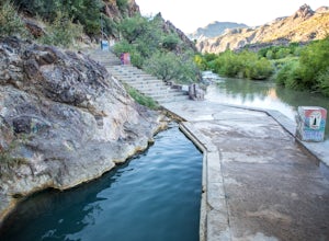
3.32.46 mi / 118 ft gainThe pools at the Verde Hot springs are the remnants from an old resort built in the 1920's. The resort was a once thriving tourist attraction and also rumored to be one of Al Capone's hideouts. In the 1960's a fire destroyed the resort only leaving behind the foundation and the thermal pools al...Read more -
Yavapai County, Arizona
Verde River Trail
14.06 mi / 1260 ft gainVerde River Trail is an out-and-back trail that takes you by a hot springs located near Pine, Arizona.Read more


