The Best Camping in Fort McDowell
Looking for the best camping in Fort McDowell? We've got you covered with the top trails, trips, hiking, backpacking, camping and more around Fort McDowell. The detailed guides, photos, and reviews are all submitted by the Outbound community.
Top camping spots in and near Fort McDowell
-
Mesa, Arizona
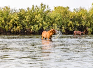
Photograph the Salt River Wild Horses at Coon Bluff
5.0Wild horses have roamed the banks of the lower Salt River since long before the Tonto National Forest was created in 1902. It is thought that these wild horses have descended from a herd brought to the area by a Spanish missionary in the 1600's. In 2015 the United States Forest Service had pu...Read more -
Mesa, Arizona
Buckhorn Campground Nature Trail
0.37 mi / 36 ft gainBuckhorn Campground Nature Trail is a loop trail where you may see beautiful wildflowers located near Mesa, Arizona.Read more -
Rio Verde, Arizona
Palo Verde Trail
7.19 mi / 748 ft gainPalo Verde Trail is an out-and-back trail that takes you by a lake located near Carefree, Arizona.Read more -
Apache Junction, Arizona
Apache Trail to Roosevelt Dam
38.88 mi / 5003 ft gainApache Trail to Roosevelt Dam is a point-to-point trail that takes you by a lake located near Apache Junction, Arizona.Read more -
Apache Junction, Arizona
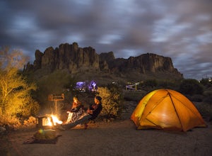
Camp at Lost Dutchman State Park
4.8Lost Dutchman State Park is located near the Superstition Mountains in central Phoenix, about 40 miles from Phoenix. There is a $7 day use fee to enter the park, which is waived if you’re camping ($15/night). The park offers 134 campsites, each with a picnic table, barbeque grill, and fire pit, a...Read more -
Apache Junction, Arizona
Praying Hands to Slot Rock
4.29 mi / 1053 ft gainPraying Hands to Slot Rock is a loop trail where you may see beautiful wildflowers located near Apache Junction, Arizona.Read more -
Maricopa County, Arizona
Battleship Mountain
11.43 mi / 1722 ft gainBattleship Mountain is an out-and-back trail that takes you by a river located near Roosevelt, Arizona.Read more -
Apache Junction, Arizona
White Rock Springs Camp Loop via First Water Trailhead
4.724.18 mi / 3635 ft gainThe Superstition Wilderness is a stunning 160,200 acre area outside Apache Junction, AZ, with over 170 miles of (variously maintained) trail networks. There are any number of trips you can design to fit your time and skill level. This adventure offers a three day/ two night backpacking trip cover...Read more -
Maricopa County, Arizona
Second Water To Boulder Canyon Camp
9.12 mi / 951 ft gainSecond Water To Boulder Canyon Camp is an out-and-back trail where you may see beautiful wildflowers located near Tortilla Flat, Arizona.Read more -
Scottsdale, Arizona
Maricopa Trail: Bronco Trailhead to Cave Creek Rangers Station
9.73 mi / 1371 ft gainMaricopa Trail: Bronco Trailhead to Cave Creek Rangers Station is a point-to-point trail where you may see wildflowers located near Carefree, Arizona.Read more -
Gold Canyon, Arizona
Superstition Peak 5057 via Carney Springs
5.07.71 mi / 2831 ft gainThis is the true beast hike of the Superstitions. If you think Flatiron is a toughy, give this a whirl! You will be poked, prodded, slapped, smacked, jolted, tripped and stabbed the entire way, but rewarded with arguably the finest sights the valley of the sun has to offer: the entire Superstitio...Read more -
Gold Canyon, Arizona
Bluff Spring Trail to Peralta Trail Bypass
7.7 mi / 1673 ft gainBluff Spring Trail to Peralta Trail Bypass Is a loop trail that takes you past scenic surroundings located near Gold Canyon, Arizona.Read more -
Apache Junction, Arizona
Reavis Falls Trail
12.83 mi / 3228 ft gainReavis Falls Trail is an out-and-back trail that takes you by a river located near Roosevelt, Arizona.Read more -
Roosevelt, Arizona
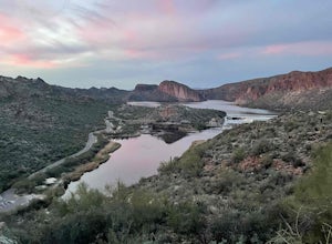
Camp At Burnt Corral Campground On Apache Lake
4.5Located in the Superstition Wilderness about 65 miles northeast of Phoenix, AZ, Apache Lake is one of the most popular recreational lakes in Arizona because it has something for everyone: hiking, boating, fishing, water skiing, camping, swimming, and more! The Burnt Corral Campground is located o...Read more -
Payson, Arizona
Mount Ord Trail
14.73 mi / 4019 ft gainMount Ord Trail is an out-and-back trail that takes you past scenic surroundings located near Tonto Basin, Arizona.Read more -
Payson, Arizona
Mazatzal Divide
30.73 mi / 5095 ft gainMazatzal Divide is a point-to-point trail that takes you past scenic surroundings located near Payson, Arizona.Read more

