The Best Camping in Monticello
Looking for the best camping in Monticello? We've got you covered with the top trails, trips, hiking, backpacking, camping and more around Monticello. The detailed guides, photos, and reviews are all submitted by the Outbound community.
Top camping spots in and near Monticello
-
Monticello, Utah
Salt Creek Canyon Trail
12.33 mi / 1555 ft gainSalt Creek Canyon Trail is an out-and-back trail that is moderately difficult located near Blanding, Utah.Read more -
Monticello, Utah
Backpack Salt Creek
33 mi / 1000 ft gainThe Needles District of Canyonlands receives 6 times as many backpackers as its more popular neighbor across the Colorado River, Island in the Sky. The Needles has an excellent trail network that is incredibly diverse, featuring amazing rock features as well as grassy meadows and savannahs. Whil...Read more -
Monticello, Utah
Rock Climbing in Indian Creek
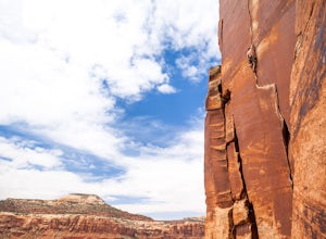
5.0Just outside the Needles District of Canyonlands National Park and 40 miles south of Moab lies one of the greatest crack climbing destinations in the world. Indian Creek is home to world famous routes such as "Supercrack of the Desert" 5.10 "Way Rambo" 5.12- and "Incredible Hand Crack" 5.10c.This...Read more -
Egnar, Colorado
Raft the Dolores River
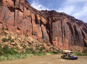
On years with enough moisture and runoff, kayakers, rafters, tubers and SUP-ers all take to the Dolores River. This section of water from Slick Rock to Bed Rock provides a two night, three day float through red canyon walls, meandering bends in the river, a a few notable side canyons. The water l...Read more -
Moab, Utah
Camp at Hamburger Rock
Hamburger Rock is a small BLM campground with 10 sites based around an interesting rock outcropping. Each site can accommodate around 6 campers, 2 tents, and 2 cars. The bathrooms here are very basic, open-top pits, and no other services are offered. Camping fees are only $6/night.Read more -
Moab, Utah
Angel Arch from Cave Spring
25.52 mi / 2566 ft gainAngel Arch from Cave Spring Trail is an out-and-back trail that is moderately difficult located near Monticello, Utah.Read more -
Monticello, Utah
Chesler Park and Druid Arch Loop from Squaw Flat Campground
21.68 mi / 3461 ft gainChesler Park and Druid Arch Loop from Squaw Flat Campground Trail is a loop trail that takes you by a river located near Monticello, Utah.Read more -
Monticello, Utah
Squawflat Trail to Lost Canyon Peekaboo Trail
9.56 mi / 2349 ft gainSquawflat Trail to Lost Canyon Peekaboo Trail is an out-and-back trail that takes you past scenic surroundings located near Monticello, Utah.Read more -
Monticello, Utah
Lost Canyon
8.22 mi / 1109 ft gainLost Canyon Trail is a loop trail that is moderately difficult located near Monticello, Utah.Read more -
Monticello, Utah
Joint Trail in the Canyonlands Needles District
5.019.06 mi / 3028 ft gainA large part of the grandeur of Canyonlands National Park is the vast barren vista at Island in the Sky, but no visit to Canyonlands would be complete without the intimate and immersive desert experience that the Needles District offers. Drive two hours southwest of Moab away from cell phone rece...Read more -
Monticello, Utah
Camp at Squaw Flat Campground
3.0Squaw Flat campground is an easily-accessed area full of picturesque campsites in Canyonlands National Park, Utah. It is located in the Needles District, which is well known for its colorful spires of Cedar Mesa Sandstone that cover the region. Campsite reservations must be made in advance at rec...Read more -
Monticello, Utah
Elephant Canyon Loop via Squaw Flat to Chesler Park to Druid Arch
15.06 mi / 2231 ft gainElephant Canyon Loop via Squaw Flat to Chesler Park to Druid Arch Trail is a loop trail where you may see beautiful wildflowers located near Monticello, Utah.Read more -
Monticello, Utah
Angel Arch from Squaw Flats
26.61 mi / 4117 ft gainAngel Arch from Squaw Flats Trail is an out-and-back trail that takes you past scenic surroundings located near Monticello, Utah.Read more -
Monticello, Utah
Lower Red Lake Canyon Trail
20.32 mi / 3547 ft gainLower Red Lake Canyon Trail is an out-and-back trail that takes you by a lake located near Monticello, Utah.Read more -
Monticello, Utah
Hike the Confluence Overlook
4.010.4 mi / 220 ft gainThe Green River starts in Wyoming and flows 730 miles before joining the Colorado River in Utah. Confluence Overlook Trail is located in the northern parts of the Needles district of Canyonlands National Park. At the southwest edge of the parking area, you will see where the trail starts. The tra...Read more -
Pleasant View, Colorado
Painted Hand Pueblo Trail
0.56 mi / 75 ft gainPainted Hand Pueblo Trail is an out-and-back trail that is good for all skill levels located near Pleasant View, Colorado.Read more


