The Best Camping in New Harmony
Looking for the best camping in New Harmony? We've got you covered with the top trails, trips, hiking, backpacking, camping and more around New Harmony. The detailed guides, photos, and reviews are all submitted by the Outbound community.
Top camping spots in and near New Harmony
-
New Harmony, Utah
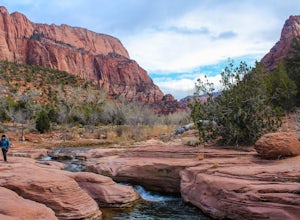
Backpack the La Verkin Creek Trail
5.014 mi / 1200 ft gainI've visited Zion National Park twice this year and the experience between the two visitations were like night and day. Zion National Park is by no means a secret, and for good reason. Hikes such as Angels Landing, and the Narrows are locations which are sought after by every outdoorsman and novi...Read more -
New Harmony, Utah
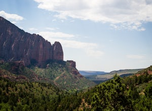
Kolob Arch
4.713.86 miIn the lesser traveled area of Zion National Park sits Kolob Arch, a sandstone arch high up on a cliff tucked back in the canyon. To get to Kolob Arch take exit 40 on I-15 in Utah. You'll see a Zion National Park Visitor's Center. Here you can fill up on water, use the bathroom, and get a map to...Read more -
New Harmony, Utah
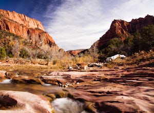
Backpack Kolob Canyons, Zion NP
5.016 mi / 1000 ft gainOverview Starting at Lee Pass trailhead the trail descends down to run alongside the Timber Creek, past the open finger canyons of the nearby cliffs. At roughly mile 3 the trail will bend slowly to the left and climb up before descending again to run upstream and alongside La Verkin creek. Camps...Read more -
New Harmony, Utah
Trans-Zion Trek, Zion NP
5.0100.6 miThe following adventure guide for the Trans-Zion Trek will actually consist of six separate trails. The trails listed below are listed in order, going West to East. If the individual trail adventure is composed on the site as going east to west, it will be indicated that the reverse hike will be...Read more -
Springdale, Utah
Camp at Lava Point
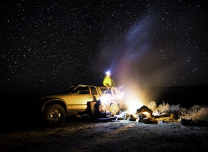
Didn't make a reservation? Are all the Zion campgrounds full as usual? Don't worry, the less popular and more secluded Lava Point Campground is just about a 45 minute drive away and it's free! We camped here because we rolled in late at night to Zion National Park and everything was full. It turn...Read more -
Springdale, Utah
Hike Wildcat Canyon Trail, Zion NP
5.05.88 miThis 5.8 mile (one-way) trek is a multi-functional trail. The trail can serve as standalone trail allowing hikers to get in either a solid in-and-out day hike or as a leg to a much bigger and epic Trans-Zion Trek. For those interested in the later, the Wildcat Canyon Trail is the leg of the journ...Read more -
Hurricane, Utah
West Rim Trail, Zion NP
5.014.41 mi / 3000 ft gainThis 14.5 mile (one-way) trek is a multi-functional trail. The trail can serve as standalone trail allowing hikers to get in either a solid in-and-out day hike or as a leg to a much bigger and epic Trans-Zion Trek. For those interested in the later, the West Rim Trail is the leg of the journey th...Read more -
Toquerville, Utah
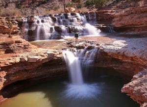
Toquerville Falls
4.811.75 mi / 2044 ft gainToquerville Falls is a hidden waterfall nearby a small town named Toquerville. The road is rugged - saying rugged is kind of an understatement. Medium or high profile 4x4 is recommended. I drove a Toyota FJ Cruiser and it took me about half an hour to get there from Toquerville. The picture doesn...Read more -
Virgin, Utah
Bike "Holy Guacamole" Outside of Zion NP
4.011 mi / 600 ft gainThis incredibly scenic ride is just out of Zion National Park and is a great place to escape the tourists. The ride starts at the end of Dalton Wash Rd just off of Route 9. High clearance vehicles are recommended and one should not attempt to drive this road in wet conditions. If you are having t...Read more -
Virgin, Utah
Camp on Dalton Wash Road
5.00.5 mi / 500 ft gainZion National Park. Truly one of the beauties of the American Southwest. With red walls and orange sunsets, Zion is a must-see. However, during the busy season of the parks, finding a campsite that hasn't been snagged can be difficult. That's why I'd suggest looking for a quieter, equally as beau...Read more -
Pine Valley, Utah
Forsyth to Wipple to Forsyth Loop
24.71 mi / 6319 ft gainForsyth to Wipple to Forsyth Loop is a loop trail where you may see local wildlife located near Pine Valley, Utah.Read more -
Hurricane, Utah
Aid Climbing Moonlight Buttress
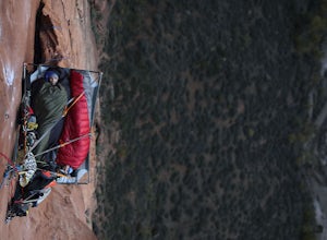
Moonlight Buttress follows an amazing system of cracks up some really solid sandstone. The route is 5.8 C1 and is very straightforward. Hauling on the first few pitches is an absolute nightmare, but spending the night on the wall is spectacular. To get more info on the route check out the followi...Read more -
Springdale, Utah
Angels Landing, West Rim, Telephone Loop
14.6 mi / 3740 ft gainAngels Landing, West Rim, Telephone Loop Trail is a loop hike that takes you past scenic scenic located near Springdale, Utah.Read more -
Hurricane, Utah
Red Cliffs Recreation Nature Trail
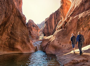
4.51.39 mi / 266 ft gainHike along streams that run through red sandstone - the blue water makes a fun contrast against the red rocks and sand. To get to the trailhead, drive to the Red Cliffs Campground about 20 minutes north of St. George. There is a small fee to park or camp at the campground. This trail starts in ...Read more -
Duck Creek Village, Utah
Hike The Narrows: Top Down
5.015.38 miTHE NARROWS This by far one of the most scenic and awesome hikes available in any National Park. There is no place in Zion National Park more sublime in its beauty and awe inspiring in its creation as you hike through the crystal clear Virgin River and marvel at the myriad of red, orange, yellow...Read more -
Hurricane, Utah
Running Windmill Trail
8 miWindmill trail and trailhead sits just down the road from Gooseberry Mesa Trailhead in Apple Valley, Utah. Head out on this figure-8 loop for as long as you want. If you're smart, you'll bring your MTB, and you can ride the singletrack once you're done getting your run in.This is also a great spo...Read more

