The Best Camping in Black Mountain
Looking for the best camping in Black Mountain? We've got you covered with the top trails, trips, hiking, backpacking, camping and more around Black Mountain. The detailed guides, photos, and reviews are all submitted by the Outbound community.
Top camping spots in and near Black Mountain
-
Black Mountain, North Carolina
Graybeard Trail
9.2 mi / 2274 ft gainGraybeard Trail is an out-and-back trail that takes you by a waterfall located near Old Fort, North Carolina.Read more -
Barnardsville, North Carolina
Mountains to Sea Trail: Bearpen Gap to Ox Creek
7.11 mi / 568 ft gainMountains to Sea Trail: Bearpen Gap to Ox Creek is a point-to-point trail where you may see beautiful wildflowers located near Barnardsville, North Carolina.Read more -
Barnardsville, North Carolina
Blue Ridge Parkway: Craggy Gardens to Mount Pisgah
42.22 mi / 5436 ft gainBlue Ridge Parkway: Craggy Gardens to Mount Pisgah is a point-to-point trail where you may see beautiful wildflowers located near Swannanoa, North Carolina.Read more -
Asheville, North Carolina
Mountains to Sea Trail: US 74A to French Broad River
9.56 mi / 860 ft gainMountains to Sea Trail: US 74A to French Broad River is a point-to-point trail where you may see beautiful wildflowers located near Asheville, North Carolina.Read more -
Burnsville, North Carolina
Higgins Bald via Black Mountain Camp
5.73 mi / 1772 ft gainHiggins Bald via Black Mountain Camp is a loop trail that takes you by a river located near Burnsville, North Carolina.Read more -
Burnsville, North Carolina
Big Butt Peak, Cattail Peak, Mount Mitchell and Gibbs Mountain
24.38 mi / 5919 ft gainBig Butt Peak, Cattail Peak, Mount Mitchell and Gibbs Mountain is a point-to-point trail where you may see beautiful wildflowers located near Burnsville, North Carolina.Read more -
Burnsville, North Carolina
Colbert Ridge to Mount Mitchell to Maple Camp Ridge Loop
18.22 mi / 5066 ft gainColbert Ridge to Mount Mitchell to Maple Camp Ridge Loop is a loop trail that takes you through a nice forest located near Burnsville, North Carolina.Read more -
Micaville, North Carolina
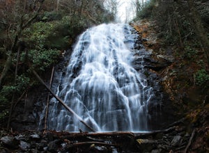
Crabtree Falls
4.92.83 mi / 525 ft gainStarting from the old store parking area at MP 339.5 on the Blue Ridge Parkway, follow the trail through a meadow past the campground amphitheater. After crossing the paved road to the campground, the trail will come to a T-intersection. Take the trail to the right for the shortest way to the fal...Read more -
Burnsville, North Carolina
Black Crest Trail and Mount Mitchell
16.15 mi / 4987 ft gainBlack Crest Trail and Mount Mitchell is a point-to-point trail where you may see local wildlife located near Burnsville, North Carolina.Read more -
Burnsville, North Carolina
Backpack the Black Mountain Crest Trail
12 mi / 5390 ft gainThe Black Mountain Crest Trail is legendary among hikers in the southeast. It is the highest trail east of the Mississippi, as it traverses the summit of several peaks over 6,000 feet. It is also widely acknowledged as one of the premier hikes on the east coast. To whit, the trail immediately asc...Read more -
Asheville, North Carolina
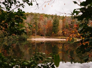
Explore Lake Powhatan
Lake Powhatan is located just minutes away from Asheville, NC and offers a number of fun activities for you, your friends, and your family. In the warm summer months, the Lake is a popular spot for swimming. The small stretch of beach along the lake is a nice place to lay out and soak in the sun....Read more -
Burnsville, North Carolina
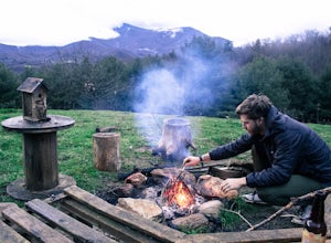
Camp at Snaggy Mountain
Snaggy Mountain is privately owned land that offers a beautiful camping spot located just outside of the Pigsah National Forest. It's completely secluded by an Apple Orchard and is a great home base for several hiking adventures in the area. The location on the map will get you to the parking spo...Read more -
Horse Shoe, North Carolina
Mullinax Trail, Squirrel Gap, Bradley Creek and Laurel Creek Trail
12.45 mi / 2290 ft gainMullinax Trail, Squirrel Gap, Bradley Creek and Laurel Creek Trail is a loop trail that takes you by a river located near Horse Shoe, North Carolina.Read more -
Horse Shoe, North Carolina
South Fork Mills Riverside Trail
7.16 mi / 945 ft gainSouth Fork Mills Riverside Trail is a loop trail that takes you by a river located near Mills River, North Carolina.Read more -
Marion, North Carolina
Camp in the Linville Gorge via the Pinch In Trail
1.5 miWe are pretty notorious for passing up a good campsite but we are learning our lessons. We got a late but interesting start on Pinch-In trail. We climbed down a steep 600+ feet after passing this ledge only to climb right back to it a third of a mile in. If we come up to an awesome spot, we somet...Read more -
Marion, North Carolina
Hike the Rock Jock Trail
6 mi / 700 ft gainOne of the first things I noticed when researching this hike was the conflicting information regarding finding the trail head, length of the hike, and the hike's correct route. Hopefully, as of September 2017, this report will contain the most up-to-date information currently available. To find t...Read more


