The Best Camping in Cary
Looking for the best camping in Cary? We've got you covered with the top trails, trips, hiking, backpacking, camping and more around Cary. The detailed guides, photos, and reviews are all submitted by the Outbound community.
Top camping spots in and near Cary
-
Raleigh, North Carolina
Pott's Branch Trail
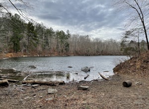
1.32 mi / 121 ft gainPott's Branch Trail is a loop trail that takes you by a lake located near Raleigh, North Carolina.Read more -
Raleigh, North Carolina
Oak Rock Trail
0.58 mi / 92 ft gainOak Rock Trail is a loop trail that takes you by a river located near Raleigh, North Carolina.Read more -
Raleigh, North Carolina
Sal's Branch Trail
5.02.55 mi / 331 ft gainSal's Branch Trail is a loop trail that takes you by a lake located near Morrisville, North Carolina.Read more -
Apex, North Carolina
Camp at Jordan Lake State Park
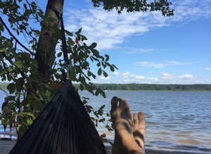
4.0We passed by Jordan Lake on the way home from a soccer match, and the kids asked if we could camp there before summer's end. We lucked out and found a spot available online to reserve Labor Day weekend, so we packed up and headed out for a couple of relaxing days by the lake.The camping offerings...Read more -
Wake Forest, North Carolina
Falls Lake Trail
12.68 mi / 1362 ft gainFalls Lake Trail is an out-and-back trail that takes you by a lake located near Wake Forest, North Carolina.Read more -
New Hill, North Carolina
New Hope Overlook Blue Route
2.77 mi / 358 ft gainNew Hope Overlook Blue Route is a loop trail that takes you by a lake located near Moncure, North Carolina.Read more -
Durham, North Carolina
New Hope Creek Trail North
4.83 mi / 377 ft gainNew Hope Creek Trail North is a loop trail where you may see beautiful wildflowers located near Durham, North Carolina.Read more -
Durham, North Carolina
Cabelands Trail To Eno Quarry Trail
2.26 mi / 364 ft gainCabelands Trail To Eno Quarry Trail is a loop trail that takes you by a lake located near Durham, North Carolina.Read more -
Durham, North Carolina
Bobbitt Hole Trail to Cole Mill Trail Loop
2.61 mi / 197 ft gainBobbitt Hole Trail to Cole Mill Trail Loop is a loop trail that takes you by a river located near Durham, North Carolina.Read more -
Durham, North Carolina
Cole Mill Trail
1.28 mi / 167 ft gainCole Mill Trail is a loop trail that takes you by a river located near Durham, North Carolina.Read more -
6101 Cole Mill Road, North Carolina
Eno Trace Trail
0.68 mi / 115 ft gainEno Trace Trail is a loop trail that takes you by a river located near Durham, North Carolina.Read more -
Durham, North Carolina
Buckquarter Creek Trail
1.56 mi / 184 ft gainBuckquarter Creek Trail is a loop trail that takes you by a river located near Hillsborough, North Carolina.Read more -
Durham, North Carolina
Fanny's Ford Trail
1.36 mi / 138 ft gainFanny's Ford Trail is a loop trail that takes you by a river located near Hillsborough, North Carolina.Read more -
Durham, North Carolina
Holden's Mill Trail
4 mi / 515 ft gainHolden's Mill Trail is a loop trail that takes you by a river located near Hillsborough, North Carolina.Read more -
Durham, North Carolina
Ridge and Shakori Trails Loop
3.96 mi / 463 ft gainRidge and Shakori Trails Loop is a loop trail that takes you by a river located near Durham, North Carolina.Read more -
Lillington, North Carolina
Campbell Creek and Lanier Falls Loop Trail
4.83 mi / 584 ft gainCampbell Creek and Lanier Falls Loop Trail is a loop trail that takes you by a waterfall located near Lillington, North Carolina.Read more


