The Best Camping in Culberson County
Looking for the best camping in Culberson County? We've got you covered with the top trails, trips, hiking, backpacking, camping and more around Culberson County. The detailed guides, photos, and reviews are all submitted by the Outbound community.
Top camping spots in and near Culberson County
-
31.896709,-104.828030
Hike Tejas And Bear Canyon Loop To The Bowl Trail
9.8 mi / 2 ft gainTejas and Bear Canyon Loop to the Bowl Trail is a 9.8 mile loop hike where you may see beautiful wild flowers located near Salt Flat, TX.Read more -
Culberson County, Texas
Hike Bush Mountain Trail To Blue Ridge Loop
15.2 mi / 4 ft gainBush Mountain Trail to Blue Ridge Loop is a 15.2 mile loop hike where you may see local wildlife located near Salt Flat, TX.Read more -
Culberson County, Texas
Tejas Trail to Mckittrick Canyon
18.2 mi / 3 ft gainTejas Trail to Mckittrick Canyon is a 17.5 mile point-to-point hike that takes you past great forest setting located near Salt Flat, TX.Read more -
Culberson County, Texas
Hike Bush Mountain
12.5 mi / 3 ft gainBush Mountain is a 12.5 mile out and back hike where you may see beautiful wild flowers located near Salt Flat, TX.Read more -
Culberson County, Texas
Pratt Lodge Via McKittrick Canyon Trail
4.8 mi / 341 ft gainPratt Lodge via McKittrick Canyon Trail is a 4.8 mile out and back hike that takes you by a river located near Salt Flat, TX.Read more -
Culberson County, Texas
Hike Mc Kittrock Canyon To Pine Springs
21.9 mi / 6 ft gainMcKittrock Canyon to Pine Springs is a 21.87 mile point-to-point hike where you may see beautiful wild flowers located near Salt Flat, TX.Read more -
Culberson County, Texas
Hike Camp Wilderness Ridge Trail
14.5 mi / 3 ft gainPermian Reef Trail and Camp Wilderness Ridge Trail is a 14.5 mile out and back hike hike where you may see beautiful wild flowers located near Salt Flat, TX.Read more -
Culberson County, Texas
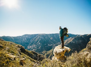
McKittrick Canyon Trail to McKittrick Ridge Campground
5.014.27 mi / 3274 ft gainThis hike is not for the faint of heart or the out of shape. Bolstering 2000ft of elevation gain over 10 miles of rough terrain, this hike will challenge you but grant you an immense reward if you can persevere. Make sure you've packed plenty of water. There are NO backcountry water supply points...Read more -
Balmorhea, Texas
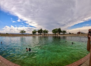
San Solomon Springs
5.0In the middle of the West Texas desert lies Balmorhea State Park, a literal oasis among the scrubland. The river here has been routed into the swimming pool of your dreams, with clear fresh water, a rocky bottom, dozens of fish and marine life, AND a diving board. From the surface, Balmorhea look...Read more


