The Best Camping in Skykomish
Looking for the best camping in Skykomish? We've got you covered with the top trails, trips, hiking, backpacking, camping and more around Skykomish. The detailed guides, photos, and reviews are all submitted by the Outbound community.
Top camping spots in and near Skykomish
-
Skykomish, Washington
Hike the Necklace Valley Trail to Jade Lake
16 mi / 3200 ft gainThis hike is definitely one of our all-time favorites. The first time we did it was in August 2015 and due to the exceptionally mild winter that year, fall was already beginning to show its colors. We wanted to see it again in the springtime when everything was in bloom, so we decided to go again...Read more -
Skykomish, Washington
Trout Lake, Middle and Upper Copper Falls and Malachite Falls
6.87 mi / 2356 ft gainTrout Lake, Middle and Upper Copper Falls and Malachite Falls is an out-and-back trail that takes you by a lake located near Skykomish, Washington.Read more -
Skykomish, Washington
Trout Lake and Copper Lake via West Fork Foss Lakes Trail
8.6 mi / 2769 ft gainTrout Lake and Copper Lake via West Fork Foss Lakes Trail is an out-and-back trail that takes you by a lake located near Skykomish, Washington.Read more -
Skykomish, Washington
Hike to Lake Deer via Lake Dorothy Trailhead
12.6 mi / 1600 ft gainStart off by traveling along Highway 2 and turning towards the Money Creek Campground. Turn off onto Forest Road 6410 and follow that to the Lake Dorothy Trailhead (about 9 miles).This first section of the hike can be pretty crowded on a nice summer day as the trail is very family friendly and it...Read more -
Skykomish, Washington
Backpack from Dorothy Lake Trailhead to Snoqualmie Lake
18 mi / 1900 ft gainThe trail was not crowded although when we got to Snoqualmie Lake there were only a couple camping spots left. The trail up from Dorothy is not too hard at all. The weather was perfect. After passing Dorothy you have to ford a creek where the bridge has been washed out. We went through it on foot...Read more -
Gold Bar, Washington
Hike to Barclay Lake
4.44.4 mi / 500 ft gainWith less than 500 feet of total elevation and 4.4 miles of round trip hiking, the Barclay Lake trail is a perfect hike for beginners, families, or those looking for a quick morning or afternoon jaunt. Yet dont let the simplicity of the hike fool you. The end result of the hike is nothing short o...Read more -
Leavenworth, Washington
Evergreen Mountain Lookout
4.52.88 mi / 1522 ft gainThis is a relatively short hike, at only 2.6 miles round trip, that takes you up to the nearly 5600 foot summit. The hike may be short but it is extremely steep, gaining 1300ft in the 1.3 miles to the summit, so be prepared for a good leg workout. On the way to the top you will walk through field...Read more -
Skykomish, Washington
Pacific Crest Trail's Section J: Stevens Pass to Snoqualmie Pass
70.27 mi / 14911 ft gainThis is the Section J hike of the Pacific Crest Trail between Stevens and Snoqualmie Pass. It is about a 70 mile hike, and I started near Stevens Pass heading South. The PCT starts at the Stevens Pass Ski Resort off of Highway 2. The trail starts out under chairlifts and through ski runs – I chos...Read more -
Skykomish, Washington
Thunder Mountain Lakes Trail
12.7 mi / 3855 ft gainThunder Mountain Lakes Trail is an out-and-back trail that takes you by a lake located near Skykomish, Washington.Read more -
Skykomish, Washington
Hike to Josephine Lake
10.4 mi / 2100 ft gainStarting in the parking lot at Steven's Pass Ski Resort (roughly 4,062 feet in elevation; I recommend parking in E lot), start by walking between the two main lodges towards the ski lifts. You'll see a trail on the northwest-facing slope that switches back across the mountain - this is the PCT. O...Read more -
Leavenworth, Washington
Skyline Lake Trail
4.52.41 mi / 1020 ft gainThis 2.5 mile roundtrip hike with a little over 1,000 feet of elevation gain is a great winter trip for beginners. The trail is typically well-worn, making it easy to stay on target even in some of the most difficult conditions. If you have route finding and off trail skills, you can venture ou...Read more -
North Bend, Washington
Taylor River Trail
11.16 mi / 994 ft gainTaylor River Trail is an out-and-back trail that takes you by a waterfall located near North Bend, Washington.Read more -
North Bend, Washington
Rainy Lake Trail
4.09 mi / 3205 ft gainThis is an abandoned trail that heads south along Rainy Creek, off of the downstream section of the Middle Fork Snoqualmie Trail, and up to Rainy Lake. The lake is popular among fisherman, since it is home to lots of trout, but be warned -- route-finding skills are a must on this trip. I do my be...Read more -
Gold Bar, Washington
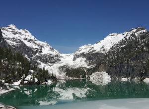
Winter Backpack to Blanca Lake
7.5 mi / 3300 ft gainSince Blanca Lake is a very popular place for folks to explore and with the nice and sunny weekend. I drove out Friday night and slept in my Jeep. Got up at 7:30am when folks first started arriving to the trail head.A couple of things to keep in mind before you start this hike. The 7.5 miles ro...Read more -
North Bend, Washington
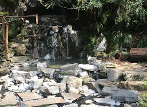
Hike to Goldmyer Hot Springs
3.54.5 miGoldmyer Hot Springs is a beautiful little gem nestled within the wilderness of the stunning Cascade Mountains. This hot springs complex is situated on the old remains of a mining town, and delivers steadily flowing water to a set of tiered pools along the mountainside. The “cave” pool at the top...Read more -
Leavenworth, Washington
Hike to the Summit of Mt. McCausland
8 mi / 1800 ft gainBegin by driving a fairly smooth Forest Road 6700 for 2.5 miles to the Smith Brook Trailhead and park in the space on the left. Much of the signage has been taken down along the trail, so it may be helpful to bring some written directions with you. The hike begins by keeping close to the road, me...Read more

