Climb the Malinche Volcano
San Francisco Tetlanohcan, Mexico
Details
Distance
7 miles
Elevation Gain
3674 ft
Route Type
Out-and-Back
Description
Added by Javier Casillas
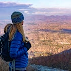
It's an amazing four hour hike through the forest to the summit of the volcano with a height of 14,500 ft. At the summit you can appreciate a panoramic view of the three highest mountains in México.
To do so, you have to first get to the city of Huamantla, located in the Tlaxcala state. Once you are there, you must take road 136 and drive 8 miles before taking the exit to Teacalco. After 4 miles there is the Malinzi shelter, where there are many options. You can rent a cabin and eat at its restaurant or leave your car there and go camping in the forest. Next to the shelter, the path to start the hike begins to the top of La Malinche at 10,826 ft.
The way to the summit is a hike that doesn't requires much time and even you can do it on a one-day trip, but the best option is to camp there and spend some time on the volcano. The path next to the shelter is very well marked so it's very hard to lose track of it. The hike starts in the forest at the height of 10,826 ft. The forest ends at 13,123 ft. Just when the path of trees open you can see the volcano and the peak, which you can reach in 4 hours.
Download the Outbound mobile app
Find adventures and camping on the go, share photos, use GPX tracks, and download maps for offline use.
Get the appFeatures
Reviews
I absolutely loved the chance to hike this volcano! It is possible to reach this by public transportation, but it requires several bus changes. Ask around in Puebla for the best updated info. I would agree that the elevation and pitch of the hike, as well as several sections with loose dirt, make this a challenging ascent, but still very doable and a wonderful experience.
5.0
A great hike but definitely challenging. Coming from Colorado where it’s quite popular for us to climb 14ers and 13ers, I would respectfully disagree with the author of this post stating the skill level is beginner. It’s a respectable 14er, and you need to be able to handle what comes with that. The hike is basically an uphill climb the whole way and no switchbacks. Prepare with proper layers and bring a hiking pole. Really enjoyed this one!
5.0
This climb reminded me of everything I learned on Central Oregon's volcanoes - including insane amounts of scree. Malinche is a very straightforward mountain with only one slight false summit, which makes it otherwise easy to navigate to the top. We parked in the restaurant lot and cut through the road on manmade use trails, which added on a few miles / elevation / time. Definitely stick around to try the food at the restaurant after your climb, and trust the hostess to tell you what's best on the menu.
5.0
Leave No Trace
Always practice Leave No Trace ethics on your adventures and follow local regulations. Please explore responsibly!
Nearby
Bouldering in Tlaxcala
Rock Climb in Los Pericos
Explore El Aguacate Waterfall
Climb the Iztaccihuatl Volcano
Summit Iztaccihuatl
Night Photography at Popocatépetl
Community
© 2023 The Outbound Collective - Terms of Use - Privacy Policy


