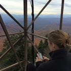
Explore Halls Top Fire Tower
Newport, Tennessee
Details
Distance
1 miles
Elevation Gain
200 ft
Route Type
Out-and-Back
Description
Added by Jared Beeler
Halls Top Fire Tower offers beautiful views of the Great Smoky Mountains.
Halls Top Fire Tower is a special untouched spot in the Cherokee National Forest. The road that leads you into the CNF is known as Halls Top Road just a few miles off of Interstate I-40. This road will take you 4.4 miles to the next turn onto Stone Mountain Road this road is 2.1 miles to the gate before the tower.
On the way to the tower about 1 mile down Stone Mountain rd there is a great pull-off spot to set up tents and hammocks and a great place to make a fire at night with a well established fire pit. Also on Stone Mountain Road is an old cemetery from early settlers on the mountain some ranging back to the late 1700s. The cemetery area also has some small walking trails to explore. Once you reach the top of Stone Mountain Road at the gate you will need to pull your car off the gravel road and hike the rest to the top, in the case that the gate is open then you can just drive straight to the tower. Around the tower are other places to camp and to hang hammocks. While climbing the tower you must be very careful because it was built in 1934 and has not been renovated since so some of the steps may be rotten away.
Download the Outbound mobile app
Find adventures and camping on the go, share photos, use GPX tracks, and download maps for offline use.
Get the appFeatures
Reviews
Okay, so the first row of stairs ARE removed BUT! You can still climb if you're up for it. Just use the casings where the stairs used to be and tiptoe up the side, there's still a railing so you can hold your balance and make it up to the top. Flip of the coin though if the gate is unlocked or not. Careful though, about a 3rd of the way up there is a piece of wood missing that you could potentially step through. But once you make it to the top the 360 degree view is completely worth it. I stayed until dawn and got the two early morning shots I included here. So is it harder to get to than 1st appears? Yes. Is it doable? Heck yes! I'm a lifelong resident of Cocke County and it's still one of my favorite places to visit and hang out.
5.0
Cool area. They have removed the first row of stairs to the fire tower. Wanted to give others a heads up on the type of vehicle needed because I wish we would have known before going.
3.0
we attempted to make the tower for sunset, but when the gps lost signal and left us in a very remote location on the way up, with unpaved roads for miles, we turned around. we decided not to get lost in the dark with no signal so we turned around and never made it there. the drive up was a bit difficult and we couldn’t quite map it. read the directions to get there prior to the trip, since there is not signal for the last half hour of the drive.
2.0
Great place to check out and watch the sunset!
5.0
Leave No Trace
Always practice Leave No Trace ethics on your adventures and follow local regulations. Please explore responsibly!
Nearby
Whitewater Rafting the Pigeon River
Hike to Mouse Creek Falls
Hike to Mt. Sterling's Fire Tower
Hike to Hen Wallow Falls in Great Smoky Mountains NP
Hike to the Mount Cammerer Lookout Tower
Maddron Bald - Albright Grove Loop
Community
© 2023 The Outbound Collective - Terms of Use - Privacy Policy


