Explore the Mountains of Vermont on a Route 100 Road Trip
At 216.6 miles, Vermont’s longest state highway is also one of the most scenic and well-loved, meandering through the Green Mountains and charming New England villages.
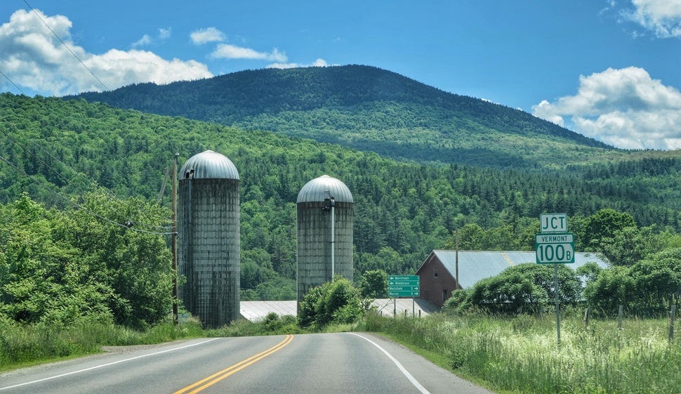
Route 100 runs straight through the center of Vermont, from north to south. Along the way, you’ll find a wealth of recreation opportunities that are perfect for every type of adventurer.
If you’ve got five days to spend in the Green Mountains, then we have the perfect Vermont road trip itinerary for you. Explore all that route 100 has to offer, from pristine mountain lakes and secret swimming holes to magnificent vistas and quiet campgrounds.
The Green Mountains are a little slice of heaven for outdoor lovers of every persuasion. We’ll start our journey in Southern Vermont, in the little town of Wilmington and head north to Newport, just south of the Canadian border.
Day 1: Wilmington, Vermont: A Cute Mountain Getaway
Sailboats on Lake Whitingham in Wilmington, Vermont. Photo by Tara Schatz.
Wilmington is a tiny village in Southern Vermont with more than its fair share of hiking and paddling opportunities, not to mention a cute, walkable downtown with lots of charm.
Just south of the village is the beautiful Lake Whitingham, also known as Harriman Reservoir. Covering more than 2,000 acres, Lake Whitingham is the largest lake in Southern Vermont. It’s the perfect place for swimming, sailing, paddling, and fishing, and yes, you’ll see a good number of cruisers, speedboats, and jet skis too. The beaches and picnic areas that surround the lake are free to use, and there’s even a clothing-optional zone, which is just a short hike from Ward’s Cove.
Where to Eat: Locals love Dot’s Diner for a big, traditional breakfast, and we’d recommend Cask & Kiln Kitchen for upscale, eclectic dining and crafted cocktails.
Where to camp: If you’re looking to pitch your tent, head a few miles east to Molly Stark State Park, where you’ll find a quiet, wooded campground with private sites and hot showers. Be sure to hike to the top of Mt. Olga (1.5-mile loop) for stunning views of the surrounding mountains.
Day 2: Wilmington to Ludlow (53 miles)
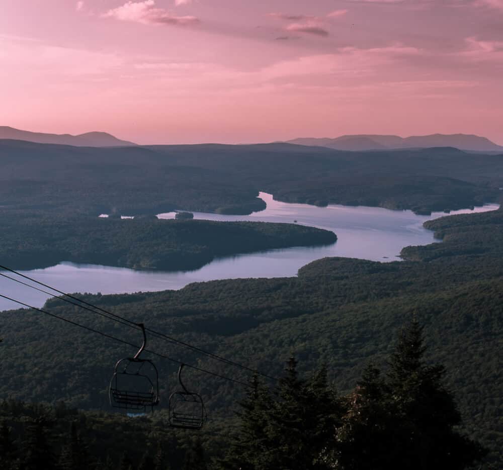
A view of Somerset Reservoir from Mount Snow. Photo by Tara Schatz.
This section of route 100 travels through the Green Mountain National Forest, and past Mount Snow Resort in West Dover. Mount Snow is open in all four seasons, offering world-class skiing and riding in the winter, and lift-serviced mountain biking in the summer. You can also ride the gondola to the top for fantastic views of Somerset Reservoir and the surrounding mountains.
Mount Snow is also one of the premier ski resorts in Southern Vermont, attracting visitors from all over the US and beyond. It is the closest major ski resort to major metropolitan areas in the northeast, with 85 trails spread across four mountain faces.
Jamaica, Vermont
As you head north, you will go through the tiny town of Jamaica. There isn’t much to the town, but if your tummy is growling as you pass through, be sure to pop into Honeypie for a burger. Jamaica State Park is located just outside the village and features awesome swimming in the West River, and a great hike to Hamilton Falls (6-miles round trip).
Ludlow, Vermont
Next, make your way to Ludlow, Vermont, located in Okemo Valley and home to Okemo Mountain Resort. Ludlow is a small community, but you will find a few unique shopping and dining opportunities, as well as several trails and swimming holes. Buttermilk Falls is a popular swimming spot at the base of a lovely waterfall. Not to be missed on a hot summer day!
Where to eat and sleep: For really unique dining and lodging, you have to check out Homestyle Hostel. The small, neighborhood restaurant serves up an eclectic mix of local dishes, all created fresh daily and lovingly prepared. Rooms are a mix of dorm-style, singles, and family-friendly suites, and all are beautifully decorated. Homestyle Hostel is nothing like hostels you may have stayed in during your youth. It is both welcoming and incredibly cozy, and a great place to connect with travelers from around the world.
Day 3: Ludlow to Waitsfield (70 miles)
This section of route 100 is characterized by very small towns, mountainous terrain, and acres of farmland. For much of the drive, you will following the eastern slope of the Green Mountains, along the border of the Green Mountain National Forest. There are too many fun stops to mention, so I’m going to focus on my favorites.
Plymouth Notch, VT
About 18 miles north of Ludlow, turn right on route 100A and drive a mile to President Calvin Coolidge State Historic Site. Plymouth Notch is the birthplace and boyhood home of our 30th president, and his homestead and the surrounding village are virtually unchanged since the 20th century. The village is known as the Plymouth Notch Historic District and is on the National Register of Historic Places. Meander around the 600 acres, visit the Calvin Coolidge Museum and Education Center and check out dozens of historically preserved buildings.
Long Trail Brewing Company
After leaving Plymouth, continue north on 100A to the town of Bridgewater Corners, where you’ll find the famous Long Trail Brewing Company. This quaint riverside pub and restaurant is the perfect lunch spot, and the view is pretty great too! In addition to their popular Long Trail Ale, they make a variety of delicious seasonal craft beers.
Moss Glen Falls, Granville
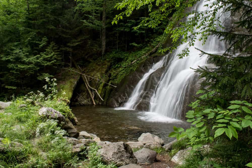
Moss Glen Falls in Granville. Photo by Tara Schatz.
This beautiful waterfall is more of a roadside attraction than anything else, but it is one of the loveliest waterfalls in the state, so I urge you to stop for a little visit. Because Moss Glen Falls is located right off of route 100, it will only take a few minutes to check it out. Bring your camera!
There’s no swimming at Moss Glen Falls, so if you’re passing through on a hot summer day, and you didn’t already embark on a tubing adventure, please continue north to Warren Falls for a little dip.
Dining and Lodging in Waitsfield, VT
After a long day of driving, swimming, and adventuring, it’s time to settle in at one of the first settled farms in the Mad River Valley. Lareau Farm Inn is a beautiful place to tuck in for the night, providing guests with lovely, pet-friendly accommodations on a working farm. The bed and breakfast is surrounded by expansive meadows, quiet woods, and the Mad River. Right next door is the original American Flatbread Pizza — undoubtedly the best wood-fired pizza in the state of Vermont.
Right across the road from Lareau Farm Inn is one of the most spectacular swimming holes in the state – Lareau Swimming Hole. Avoid visiting on hot summer weekends, but if you are passing through during the week, this place is a must-visit.
Day 4: Waitsfield to Johnson (40 miles)
While this section is short, it is packed with things to do! The Waterbury/Stowe area is fabulous in all four seasons, and if you’re feeling short on time, give it an extra day.
Waterbury, Vermont
Ben & Jerry’s Factory in Waterbury, VT. Photo by Tara Schatz.
Waterbury is about 14 miles north of Waitsfield. It is home to Ben & Jerry’s Factory Store, where guided tours are offered daily. Learn how Vermont’s famous ice cream is made, and be sure to stop at the flavor graveyard to pay your respects to the “dearly de-pinted”.
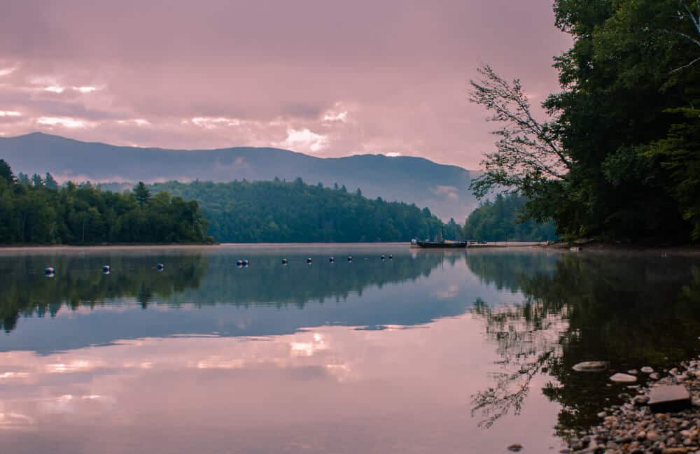
Waterbury Center State Park is located just off of route 100 and is one of our favorite spots for paddling, fishing, picnicking, and remote camping. The park is located on a 90-acre peninsula on the shores of the Waterbury Reservoir. The reservoir was constructed by the CCC in the 1930s as a flood control project to protect the towns and villages along the Winooski River. The reservoir is surrounded by mountains, and a gorgeous spot to spend the day. There is front-country camping available on Waterbury Reservoir at Little River State Park, which is one of the best state park for kids in the whole state.
Sunrise on the Waterbury Reservoir. Photo by Tara Schatz.
Stowe, Vermont
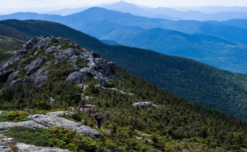
Stowe is home to Mt. Mansfield, Vermont’s highest mountain. There are several trails leading to the top, but if you don’t have time for an all-day hike, consider the auto toll road at Stowe Mountain Resort. The road takes you to the top of Mt. Mansfield (the nose), where you’ll have stunning views of Lake Champlain and the Adirondacks in New York. From the nose, you can hike along the ridge of the mountain to the chin (2.8 miles round trip), which is the highest point in Vermont at 4,395 feet.
Hiking Mt. Mansfield in Stowe. Photo by Tara Schatz.
After your hike, be sure to stop at the Alchemist Brewery and Visitor Center to try out New England’s most famous beer, Heady Topper. The brewery and visitor center is located on Cottage Club Road in the village of Stowe. You will likely meet many fellow road trippers here — people come from near and far to stock up on the local brews. You are usually limited to 6 four packs of any variety.
Where to camp: Smuggler's Notch State Park is located on the Mountain Road in Stowe, just a short drive from the town's best restaurants and shopping. Campsites offer up plenty of wooded privacy for both tent and RV campers. Be sure to meander across the road from the campground, where you'll find a short hike to one of Vermont's most beautiful waterfalls.
Day 5: Hyde Park to Newport (40 miles)
A moose in Vermont's Northeast Kingdom. Photo by Tara Schatz.
The last part of your road trip is characterized by a wild stretch of road that is mostly forested. As you head through the town of Hyde Park, be sure to take in the spectacular views of Mt. Mansfield behind you. You have entered the famous Northeast Kingdom, an area known for its wild and rugged beauty. The further north you go, the better your chances of seeing one of North America’s largest mammals, the massive moose. Be on the lookout for these gentle giants, especially along the roadside, where they pose a threat to unsuspecting motorists.
Newport, Vermont
You’ll pass through several small towns, including Eden, Lowell, Westfield, and Troy, before heading into the relative metropolis of Newport. Located on the shores of Lake Memphremagog, Newport is a bustling place these days. Main Street is lined with restaurants, boutiques, and galleries. Several waterfront overlooks allow you to take in the majestic views of the massive glacial lake, which covers 41 square miles.
In the summer months, you can rent kayaks and bikes from the Great Outdoors to explore Newport’s natural beauty. Lake Memphremagog can be windy, so your best bet is to stick to South Bay, as well as the Black and Barton Rivers, which flow into it. The Newport Bebee Bike Path starts in the downtown area and runs for about six miles along the shore of the lake and into Canada (bring your passport if you choose to cross the border).
Where to Eat: For casual waterfront dining, check out the Eastside Restaurant & Pub. If you’re looking for the best Thai and sushi in the Northeast Kingdom, you have to try Dusit Thai Cuisine. The owners relocated from Thailand in 2015, and have been wowing locals and visitors with their delicacies ever since.
Where to Camp: With 75 huge campsites for both tents and RVs, a swimming beach, and a playground area, Prouty Beach & Campground is a fun and inexpensive way to explore Newport and the surrounding communities. It’s a county park, right next to the bike path, and less than a mile from downtown Newport.
A variation of this article first appeared on Back Road Ramblers. Cover photo by Tara Schatz.
We want to acknowledge and thank the past, present, and future generations of all Native Nations and Indigenous Peoples whose ancestral lands we travel, explore, and play on. Always practice Leave No Trace ethics on your adventures and follow local regulations. Please explore responsibly!
Do you love the outdoors?
Yep, us too. That's why we send you the best local adventures, stories, and expert advice, right to your inbox.


