Details
Distance
7.43 miles
Elevation Gain
292 ft
Route Type
Out-and-Back
Description
This is a new adventure! Be the first to share your experience.
Join a supporting community of travelers and adventurers sharing their photos and local insights.
Added by The Outbound Collective
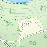
Hemlock Gorge to Covered Bridge is an out-and-back trail that takes you by a lake located near Loudonville, Ohio.
Download the Outbound mobile app
Find adventures and camping on the go, share photos, use GPX tracks, and download maps for offline use.
Get the appFeatures
Camping
Fishing
Mountain Biking
Running
Hiking
Dog Friendly
Family Friendly
Forest
Lake
River
Scenic
Wildflowers
Wildlife
Reviews
Have you done this adventure? Be the first to leave a review!
Leave No Trace
Always practice Leave No Trace ethics on your adventures and follow local regulations. Please explore responsibly!
Nearby
Photograph Clear Fork Gorge
The hardest part of this adventure is finding parking, especially on a late October afternoon. There's two different observation decks to take photos of the gorge from, and both have excellent views of the overall gorge. Having grown up just up the road from Mohican State Park, "The Gorge" has always been a favorite spot of mine, and its truly worth some time during a visit. While fall gets the...
Hike the Pleasant Hill Lyons Falls Loop
To get to this trail you can go to the Dam that is a part of Pleasant Hill Lake and there is a parking area across the street. After you start walking you reach signs that will ask where you want to go, either to the covered bridge or to the Lyons Falls.By going towards the covered bridge first you get an easy path with amazing views of both the Mohican Memorial Forest and the Clearfork-Mohican...
Photograph Mt. Jeez
While it might not seem like much, Mt. Jeez stands 1,310' feet above sea level, making it one of the higher "peaks" in Ohio. Because of that, it's one of the few spots in the Buckeye State that allow for grand, sweeping vistas with a 270 degree view for a few miles in most directions. Originally named Poverty's Knob, it earned its now modern-day name mainly because of the difficulty of climbing...
Photograph Honey Run Waterfall
Getting to Honey Run Falls is incredibly easy! There are two parking lots for the park, one on the west side of the road for the Honey Run Highlands, and one on the east side of the road in the forest for the falls. From the forest parking lot, follow the trail south for roughly 500 ft until you reach the base of the waterfall. On most days, you'll hear the falls from the parking lot, its that ...
Hike the Quarry Rim-Chestnut Trail
Starting at the eastern trailhead off of Gratiot Rd, follow the paved Blackhand Trail for 0.2 mile till you arrive at the sign of the Quarry Rim Trail, a 0.9 mile trail that roughly parallels the bike trail, but takes you along the rim of the old sandstone quarry that was in operation in the late 1800's, as a source for sand for nearby glass factories. After the Quarry Rim Trail, a short 0.1 mi...
Bike the Blackhand Trail
Both the eastern and western trailhead have ample parking and access to the Blackhand Trail, which winds its way along the banks of the Licking River for a 4.3 mile one way trip. While the trail isn't terribly long, it makes up for it in its scenery, staying within eyesight of the Licking River for almost its entire length, and passing through sections of sandstone walls towering dozens of feet...
Community
© 2023 The Outbound Collective - Terms of Use - Privacy Policy


