Siphon Draw to Flatiron Summit
Apache Junction, Arizona
Details
Distance
5.6 miles
Elevation Gain
3415 ft
Route Type
Out-and-Back
Description
Added by Kevin Kaminski
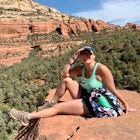
This will take you about 4-5 Hours and the elevation gain is 2781' to Flatiron Summit (5057 ft.) and 2977' to Superstition Peak #5024 (4861 ft) with 360 views and epic sunsets. You will see Hoodoo rock formations, a slick rock basin with possible waterfall, which provides a great workout and awesome photography.
Flatiron is one of the most popular day hikes in the Superstition Wilderness, just outside of Phoenix, AZ. The hike begins at Lost Dutchman State Park in Apache Junction. Once inside the park, drive to the last parking area and look for a sign for the Siphon Draw Trailhead. The Siphon Draw Trail is clearly marked and easy to follow for the first few miles as you begin a gradual ascent to the basin, which sits at 3,100 ft. elevation. If you’re hiking Siphon Draw just after a rain, you will likely see waterfalls running through the basin, which is unique for southern Arizona hiking. The slide rock basin is a common stopping point, as the next mile to the top of the Flatiron is not maintained by the park and involves a bit of boulder scrambling, including a 12-foot vertical climb at the very top. But don’t let this deter you, because the views at the top are well worth the additional 2,000 ft. elevation gain to get there! Although the end of the trail is technically unmaintained, its popularity makes it easy enough to follow. When in doubt, just look around for white markings on the rock or cairns.
Once you reach the top, you have two options: turn right to reach the popular Flatiron Summit, or take the road less traveled and continue straight up to Superstition Peak #5024. The Flatiron Summit lookout point offers amazing views of the Apache Junction Valley, and is a perfect spot to take a snack break. If you’re looking for a little more of a challenge and much more solitude, opt for the trail straight up to the summit of Superstition Peak. This route is a bit tricky to follow, as you will be hiking through overgrown cacti and brush, but also provides unique views as it weaves in and out of Hoodoo rock formations. After bushwhacking your way through a bit of desert brush, you will be rewarded by incredible 360 degree views from the top of Superstition Peak, including a great view of the iconic Weavers Needle. Be sure to bring a camera, as the photography opportunities at the top are spectacular!
Whether you turn around at the rock basin, make it to the Flatiron Summit, or venture all the way to the top of Superstition Peak, you will not be disappointed by the ever changing rock formations, beautiful views, and rigorous workout! Lost Dutchman State Park offers both RV and tent camping if you’re planning a weekend getaway, and Apache Junction has a few restaurants and bars within 2-5 miles of the park entrance if you want to reward yourself with a cold beer after your hike.
Download the Outbound mobile app
Find adventures and camping on the go, share photos, use GPX tracks, and download maps for offline use.
Get the appFeatures
Reviews
I do this hike every winter, usually in January or February. The hike up to Siphon Draw slowly gains elevation but is quite mild. The waterfall in Siphon Draw is often running in the cooler months and is a perfect spot for a snack and a photo opp before beginning the climb to the top. The rocks are quite slick in this area and the incline gets very steep. From this point on it's all uphill climbing and boulder hopping. Be sure to get an early start because you don't want to be coming down this in the dark. Once you reach the top the views of the valley are incredible.
5.0
This is by far the best hike in the city! When in doubt stick to the left. I definitely got off trail and scrambled up some loose rock. Stick to what looks like a water runoff when approaching the summit.
5.0
everything about this hike is awesome. lots of great scrambling but no real exposure. trail wastes zero time gaining elevation. beautiful views! not very remote though so there will be crowds and you have a view of the city so not very off grid but very worth it!
5.0
Flatiron is awesome to say the least. Quite a steep and long climb but worth every step. Usually a lot of people there so go early or on a weekday if you want some quiet time.
5.0
Great hike with amazing views and beautiful rock formations, plants and flowers.
5.0
This is an awesome spot. Once you get to the slick rock area, it will get more steep. Once you get past that spot be careful not to go too far to your right, it's easy to miss the real trail. The best way up is to stay low in the middle of the canyon all the way up. (Even though it will be steep.)
5.0
Siphon Draw is a fun trail to get some exercise. It's definitely a different way to see some of the Arizona desert in the East Valley. If you have it in you hike the almost vertical mile to Flat Iron. The view of Apache Junction is...well...congrats on making it to the top at least. The trail proceeds beyond the slick rock of Siphon Draw. Follow the blue dots. Recommend avoiding during the summer months.
4.0
This trail is one of my favorites. It takes me about 2-3 hours to complete depending on hoe fast I want to power through it. Its a hike that gets my legs burning but I love it!
5.0
I hiked flat iron with one of my buddies and let me just say this hike is definitely one to challenge your spirits, especially in the middle of the summer! Once you park and reach the base of the mountain you are just blown away by this astonishing sight of massive rock structures and of course the long journey that awaits to the top. Climbing over rocks, going up a slick dried up waterfall and trying not to slip off of a 75 foot drop are just some of the challenges you'll face. The designated trail was a bit rough to find on the way up so we had to detour a little bit. Up towards the top you're greeted by birds zooming past you at what seems like 100mph doing tricks similar to airplanes at air shows. If you're lucky enough you'll even see a gila monster! At the top of flat iron if you face west on a clear day you can see as far as Phoenix. The US-60 runs slightly off to the side and you can see all over the valley. To the north are the mountains leading towards Payson along SR-87. Look closely and you can see the lakes in between them. Of course the sight of four peaks is always breathtaking. Snowy in the winter and just big and menacing in the summer months. Enjoy the windy breeze you'll get on top of the peak, just be sure you don't fall off! Take a trip to the eastern part of flat iron behind the higher rocks and you'll be able to see weaver's needle and the rest of the Superstition Mountains as a whole. Personally this is my favorite view as I grew up looking at them every day as a kid. Once I finally climbed it my whole perspective on it changed. Going down the mountain can be tricky. Loose rock and lots of brush get in the way at times. Be sure to bring plenty of water and sunscreen! Hiking up takes about 3 hours at a steady pace for roughly a 6 hour round trip. You certainly have to have respect for the mountain as it has claimed a few victims before. I recommend doing this at some point in your life! While you're at it take some time and read into the history of Jacob waltz and the lost dutchman's gold. Thank you and enjoy!
5.0
Leave No Trace
Always practice Leave No Trace ethics on your adventures and follow local regulations. Please explore responsibly!
Nearby
Hike to Praying Hands in Lost Dutchman State Park
Photograph Cactus Blooms at Lost Dutchman
Treasure Loop Trail
Camp at Lost Dutchman State Park
Drive Through The Apache Trail
Catch a Sunset at Goldfield Ranch
Community
© 2023 The Outbound Collective - Terms of Use - Privacy Policy


