
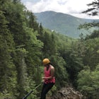
Hike to Glen Onoko Falls
Jim Thorpe, Pennsylvania
Details
Distance
4.1 miles
Elevation Gain
987 ft
Route Type
Loop
Description
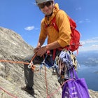
Added by Ryan Stone
*This hike is CURRENTLY CLOSED! This 4.1 mile trail (ranked #2 Most Epic Hiking Spot in Pennsylvania) offers a scenic, rough-terrain adventure of the beautiful Glen Onoko falls and Jim Thorpe mountainside. It is best to hike in dry weather, several days after a good rain to see the waterfalls in full effect!
*Again, this hike is CURRENTLY CLOSED
There are several WRONG ways to do this trail. Follow these simple instructions to get the most out of all Glen Onoko has to offer:
Parking:
Parking in the correct location is the most important step to this trail. Beware: typing in Glen Onoko Falls in Google Maps does NOT take you to the trailhead. (instead taking you 1.5 miles up the mountain north of the trails). You must navigate to the D & L Trail, which is part of the Lehigh Gorge Trail. Driving in from Main Street, you will turn left onto the D & L Trail (you will see Lehigh Gorge Trail sign at this intersection). Drive along the base of the mountainside and train tracks until you cross the wooden bridge. Parking here will give you access to the trail by walking down the steps at the Falls Trail sign and turning right under the bridge.
The Hike Up:
Here the fun begins! Fair warning; wear hiking boots. The trail is very rough, often times leading through unmarked rock formations at steep inclines (be ready to get down and dirty!). When you come to the second trail information sign, with the trail map, veer left. If you are confused, just go towards the sound of the fall. The trail is blazed orange, and goes up along the side of the falls. At some points the trail becomes unmarked, but the idea is to just keep going up! You are guaranteed to find the trail again.
The Top of the Trail (VERY IMPORTANT!):
You will hit the top of the falls relatively quick (about 45 minutes for me). This step is very important, and messing it up will leave you lost/missing the second half of the trail. The top of the falls is marked by a "fire ring". It is more like a large opening at the base of large rock formations, with small remnants of a fire. If you walk too far past this, you will run into a gravel road that runs along the mountain. This takes you onto James Run trail and away from the Falls Trail, so turn around and go back to the fire ring. At the fire ring, there is also sign pointing to a return trail (this will take you back down the mountain). If you wish to do the full loop though, you have to go UP the rock formations instead of following the return sign. It is unmarked at first, but you will come upon the orange blazes soon enough. This takes you up makeshift rock "steps" and deeper into the forest away from the falls. In about half a mile you will hit the climax of the hike (a clearing with a breathtaking view of the Borough of Jim Thorpe). At this point, you will see the orange trail veering sharp to the right that takes you back down the mountain. Get ready to drop some major elevation!
Additional Hiking Options:
There is an option to continue hiking beyond the view of Jim Thorpe, instead of going back down the mountain immediately. Continuing takes you off the Falls Trail and will bring you to views of the Lehigh River and Oxbow Bend. I have not hiked this portion, but it is supposedly marked with blue blazes. The easiest way back down the mountain is to return back to the view of Jim Thorpe and taking the trail that veers sharp right.
At the trailhead you will also see an old train tunnel across the Lehigh River. You can check this out by walking across the wooden bridge you came in on, and turning left about 50 yards ahead at the next parking lot. The tunnel is pretty cool, with old railway ties still remaining and a sweet view of the river. Be careful though because the tunnel is unlit and slippery at times.
I hope this post helps you experience all the awesomeness that Glen Onoko has to offer!
Download the Outbound mobile app
Find adventures and camping on the go, share photos, use GPX tracks, and download maps for offline use.
Get the appFeatures
Reviews
Thankfully I was able to do this a few times before it closed. A shame that it had to close due to so many accidents. Wierd because there are far more dangerous hikes and trips that people can do. Hopefully then can restore it to make it safe for the average person
5.0
Unfortunately, this trail has been closed. If it ever opens up again, definitely check it out! It is a beautiful hike with lots of history.
5.0

Unfortunately this trail has officially been closed due to many injuries and deaths over the years. The township doesn't have the money to maintain it the way that it needs to be. They are claiming a $200 fine per person if found hiking. I do believe that there is another trail in the gorge that will take you to the top of the falls, but it just isn't the same. Skip it and go to Ricketts Glen early on a weekday!
5.0
Fished that creek in the late 1950's really hasn't changed much, still the hard hike up to the top. One must be careful the rock on the third falls is very slick, easy to fall about 30 feet straight down. Very cool to hike on a hot day the water is cold and the spray is refreshing, best to go back down on the longer trail.
4.0

This trail is very difficult, and can also be very dangerous. If you do not have proper footwear, water, etc you may regret doing this hike. It is not for the faint of heart, as the climbs can be incredibly difficult. Please make sure you are properly prepared for this hike. Every summer there are numerous accidents, slip & falls off the mountainside and even an occasional death.
3.0
There is no sign telling you where the trail begins and it's very easy to miss the old splotch of red paint on one tree to tell you to go right instead of left. Going left will lead you an hour up a difficult trail which leads to nowhere. Good luck!
4.0

My first impression of the entrance was nothing compared to what my thoughts were after the hike up the falls! The first part of the trail was flat dirt pathways but then - to my liking - gave away to steep and rocky inclines which were definitely worth the effort. Make sure you have sturdy sneakers or - even better - hiking shoes. I'm eager to go back to this photography friendly place and get my hands dirty again.
5.0
Once you reach the campsite at the top the second half of the hike, leading up to the view of Jim Thorpe and the decent down, are now blazed in red
5.0
I came in March as the snow was melting. Before crossing the wooden bridge, be sure to check out the cave on the right. It's barely bright enough to walk though without a light, but your cell phone should do. At the end you get a nice view of the river and the start of the trail. You must come back out the way you come in as the cave ends at the river, about 20 feet up (don't worry there's a fence). Once you cross the bridge, the falls trail is on your right. When you head down the stairs you'll want to make a right and head under the bridge, then make another right and the train should be visible once you go up he hill about 50 feet. After this the trail is easy to follow but at times, hard to navigate. Wear hiking shoes and bring a hiking stick. The falls, all 3 of them, are enough to leave you with a smile on your face. There's an easy trail to head down at the top of the third falls on your right so you don't have to go down the same way you came up; it's also easier on the knees.
5.0

This hike is excellent! I have been here many times, taking every trail to and from the falls. The main trail is very steep, so expect to climb a bit to get to the top. Also, expect crowds during the summer. People enjoy cooling off in the falls. For warm days, I'd suggest wearing a bathing suit so you can too! If you don't enjoy crowds, I still highly recommend taking the main trail on the way up simply because it is an awesome experience. However, once at the top, you can take another trail down to the bottom. It is fairly hidden, but you should be able to get to it using the description above. The alternate trail is less steep (and thus less fun) and has little to no views, but the trade-off is that it is usually empty. It makes for a very good running trail if you're looking for one!
5.0
Leave No Trace
Always practice Leave No Trace ethics on your adventures and follow local regulations. Please explore responsibly!
Nearby

Bike the Switchback Trail around Mauch Chunk Lake Park

Bike the Lehigh Gorge Trail: Lock #2

Tank Hollow Vista

Hike to Bake Oven Knob

Hike the Falls Trail at Beltzville State Park

Shades of Death Trail
Community
Mobile Apps

© 2023 The Outbound Collective - Terms of Use - Privacy Policy