The Best Hiking in South Lake
Looking for the best hiking in South Lake? We've got you covered with the top trails, trips, hiking, backpacking, camping and more around South Lake. The detailed guides, photos, and reviews are all submitted by the Outbound community.
Top hiking spots in and near South Lake
-
Lake Isabella, California
Isabella Lake
1.06 mi / 43 ft gainIsabella Lake is a loop trail that is good for all skill levels located near Lake Isabella, California.Read more -
Kernville, California
Cannell Meadow Trail
21.02 mi / 5623 ft gainCannell Meadow Trail is a loop trail where you may see wildflowers located near Kernville, California.Read more -
Kernville, California
Cannell Peak from Sierra Way
28.76 mi / 7707 ft gainCannell Peak from Sierra Way is an out-and-back trail where you may see wildflowers located near Kernville, California.Read more -
Kernville, California
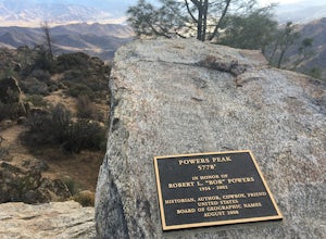
Hike up Powers Peak in Kernville
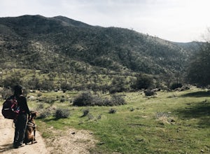
10 mi / 3200 ft gainHigh Level Details: ~10 Miles Round Trip~3,200 feet total elevation gain for tripTrailhead elevation: 2,811 feetHighest Point on the trail: Powers Peak, 5,778 feetEstimated Time to complete: 4-5 hoursNo water source along the way, so bring plenty of water Dog friendly? Yes! We love bringing Linco...Read more -
Kernville, California
Whiskey Flat Trail
11.94 mi / 1316 ft gainWhiskey Flat Trail is an out-and-back trail that takes you by a river located near Kernville, California.Read more -
Kernville, California
Bull Run Creek Trail
1.65 mi / 75 ft gainBull Run Creek Trail is an out-and-back trail that takes you by a river located near Kernville, California.Read more -
Kern County, California
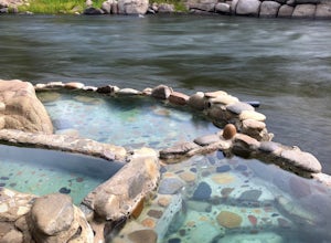
Remington Hot Springs
2.00.27 mi / 36 ft gain...One thing about hot springs is that no matter where it may be, they always bring an attraction of people. I can honestly say I don't think I've ever been to a hot spring that didn't gather more then 20+ people in a single sitting. I mean, in all seriousness aside, what's not to like about a ba...Read more -
Kern County, California
Remington Ridge Trail
11.45 mi / 3927 ft gainTo get to the trailhead, take Highway 178 and turn onto Borel Road, then turn onto Kern Canyon Road and follow the road. It might be easiest to put the Hot Springs into Google Maps and use that to navigate you to the parking lot. Park in the lot and walk across the road, where you'll see a sign l...Read more -
Wofford Heights, California
Unal Trail
3.25 mi / 846 ft gainUnal Trail is a loop trail where you may see local wildlife located near Wofford Heights, California.Read more -
Onyx, California
Bird Spring Pass to Skinner Peak
8.53 mi / 2270 ft gainBird Spring Pass to Skinner Peak is an out-and-back trail that takes you past scenic surroundings located near Weldon, California.Read more -
Bakersfield, California
Kern River Trail
5.93 mi / 1522 ft gainKern River Trail is an out-and-back trail that takes you by a river located near Bodfish, California.Read more -
Bakersfield, California
Kern Canyon Trail
9.76 mi / 3320 ft gainKern Canyon Trail is an out-and-back trail where you may see beautiful wildflowers located near Caliente, California.Read more -
Bakersfield, California
Hike the Mill Creek Trail to Breckenridge Road
7.5 mi / 3000 ft gainStarting at about 2000 elevation this hike is very gentle and nice for the first 2 miles. On the third mile it is a steep climb with short lengths of level ground the rest of the way. The junction at Breckenridge Road is at about 5500 elevation. If you hit the trail in the winter, there are some ...Read more -
Posey, California
Sunday Peak Trail
1.64 mi / 1060 ft gainThis short and easy summit is located just outside of Kernville, California. To get there, follow Highway 178 towards Kernville and turn left on Highway 155 towards Wofford Heights. After a long, steep incline you’ll reach the top of Greenhorn Summit, marked by large parking areas on either side....Read more -
Inyokern, California
Long Valley Trail
4.77 mi / 627 ft gainLong Valley Trail is an out-and-back trail that is moderately difficult located near Inyokern, California.Read more -
Kern County, California
Walker Pass Campground Trail
1.84 mi / 240 ft gainWalker Pass Campground Trail is an out-and-back trail where you may see wildflowers located near Onyx, California.Read more


