The Best Hiking in San Bernardino County
Looking for the best hiking in San Bernardino County? We've got you covered with the top trails, trips, hiking, backpacking, camping and more around San Bernardino County. The detailed guides, photos, and reviews are all submitted by the Outbound community.
Top hiking spots in and near San Bernardino County
-
San Bernardino, California
Borea Canyon via Daley Canyon Road
6.13 mi / 1637 ft gainBorea Canyon via Daley Canyon Road is an out-and-back trail where you may see wildflowers located near Patton, California.Read more -
San Bernardino, California
Cloudland Truck Trail
9.55 mi / 2405 ft gainCloudland Truck Trail is an out-and-back trail where you may see local wildlife located near San Bernardino, California.Read more -
San Bernardino, California
Marshall Peak Trail
3.05 mi / 650 ft gainMarshall Peak Trail is an out-and-back trail that provides a good opportunity to see wildlife located near San Bernardino, California.Read more -
San Bernardino, California
Sawpit Canyon via Bailey Forest Road
20.16 mi / 5449 ft gainSawpit Canyon via Bailey Forest Road is an out-and-back trail where you may see beautiful wildflowers located near Cedarpines Park, California.Read more -
Crestline, California
Lake Gregory Trail
2.36 mi / 197 ft gainLake Gregory Trail is a loop trail where you may see beautiful wildflowers located near Crestline, California.Read more -
Crestline, California
HWY 138 V.O.E. Trail
2.05 mi / 738 ft gainHWY 138 V.O.E. Trail is an out-and-back trail where you may see beautiful wildflowers located near Lake Arrowhead, California.Read more -
Crestline, California
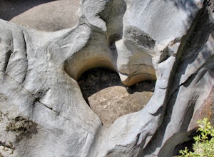
Heart Rock Trail
1.68 mi / 354 ft gainHeart Rock Trail is a loop trail that takes you by a waterfall located near Crestline, California.Read more -
Crestline, California
Hike the Heart Rock Trail
4.51.8 miThis short but nice hike near Crestline, CA in the San Bernadino Forest is one for the whole family. Although finding the trailhead/parking lot can be a bit confusing, it is definitely worth it. Driving in from the Inland Empire/LA Area, follow The Rim of the World Trail (SH18) until you see the...Read more -
San Bernardino, California
West City Creek Truck Trail and Daley Canyon Rd
10.4 mi / 2218 ft gainWest City Creek Truck Trail and Daley Canyon Rd is a point-to-point trail where you may see wildflowers located near San Bernardino, California.Read more -
Rimforest, California
Dogwood Campground Loop
3.33 mi / 604 ft gainDogwood Campground Loop is a loop trail that provides a good opportunity to see wildlife located near Rimforest, California.Read more -
Colton, California
Hidden Bear Trail
5.98 mi / 912 ft gainHidden Bear Trail is a loop trail where you may see beautiful wildflowers located near Colton, California.Read more -
Hesperia, California
Black Oak Picnic Area to Jamajab Point
4.61 mi / 364 ft gainBlack Oak Picnic Area to Jamajab Point is an out-and-back trail that takes you by a lake located near Cedarpines Park, California.Read more -
Loma Linda, California
Razor Ridge to Jedi Trail to Beaumont Ridge Trail Loop
6.2 mi / 1026 ft gainRazor Ridge to Jedi Trail to Beaumont Ridge Trail Loop is a loop trail where you may see wildflowers located near Loma Linda, CaliforniaRead more -
Loma Linda, California
Beaumont Ridge Trail Loop
2.51 mi / 371 ft gainBeaumont Ridge Trail Loop is a loop trail where you may see wildflowers located near Loma Linda, California.Read more -
Loma Linda, California
Scott Canyon Trail to Jedi Trail
5.18 mi / 719 ft gainScott Canyon Trail to Jedi Trail is a loop trail where you may see beautiful wildflowers located near Redlands, California.Read more -
Loma Linda, California
Razor Ridge Trail and Canyon Road Loop
2.7 mi / 328 ft gainRazor Ridge Trail and Canyon Road Loop Is a loop trail that takes you past scenic views located near Loma Linda, CaliforniaRead more


