The Best Hiking in Shasta
Looking for the best hiking in Shasta? We've got you covered with the top trails, trips, hiking, backpacking, camping and more around Shasta. The detailed guides, photos, and reviews are all submitted by the Outbound community.
Top hiking spots in and near Shasta
-
Redding, California
Fishermen's Trail
1.95 mi / 157 ft gainFishermen's Trail is a loop trail that takes you by a river located near Redding, California.Read more -
Redding, California
Mount Shasta Mine Loop Trail
3.06 mi / 587 ft gainMount Shasta Mine Loop Trail is a loop trail that takes you by a river located near French Gulch, California.Read more -
Redding, California
Middle Creek Trail
6.23 mi / 525 ft gainMiddle Creek Trail is an out-and-back trail that takes you by a river located near Redding, California.Read more -
Redding, California
Westside Trails
3.47 mi / 604 ft gainWestside Trails is an out-and-back trail where you may see beautiful wildflowers located near Redding, California.Read more -
Redding, California
Wintu Loop
3.53 mi / 676 ft gainWintu Loop is a loop trail where you may see wildflowers located near Redding, California.Read more -
Shasta County, California
Hike Kanaka Peak
4.53.5 mi / 1100 ft gainHead to the Peltier Bridge Campground after entering Whiskeytown National Recreation Area and then go 1.1 miles along the road through the campground until you reach the trailhead for Kanaka Peak. The road from the campground is open from late spring to late fall, otherwise hikers will need to pa...Read more -
Shasta County, California
Hike to the top of South Fork Mountain
5 mi / 4181 ft gainStarting from the Kanaka Peak Trailhead, follow the Kanaka Peak Trail all the way, continuing on past the Peltier Trail Junction and the Kanaka Cutoff Trail Junction until the trail begins to head east (about 2-2.5 miles from the trailhead) and there is a gently sloping hill on your right that is...Read more -
Redding, California
Mule Ridge Trail
14.64 mi / 1841 ft gainMule Ridge Trail is an out-and-back trail where you may see beautiful wildflowers located near Redding, California.Read more -
Igo, California
Hike to Brandy Creek Falls in Whiskeytown National Recreation Area
5.03 mi / 500 ft gainMy favorite hike in Whiskeytown National Recreation Area. From the visitor center you will take Kennedy Memorial Drive towards the dam, make a left at Brandy Creek Road. At a junction for Sheep camp/Shasta Bally make a left. You will arrive at the trailhead. This hike follows a beautiful stream t...Read more -
Redding, California
Mule Ridge to Princess Ditch Loop
8.32 mi / 1631 ft gainMule Ridge to Princess Ditch Loop is a loop trail that provides a good opportunity to view wildlife located near Redding, California.Read more -
Redding, California
Arboretum Loop Trail
3.52.07 mi / 43 ft gainArboretum Loop Trail is a loop trail that takes you by a river located near Redding, California.Read more -
Redding, California
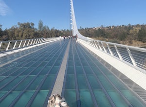
Hilltop Trail Head to Sundial Bridge
4.02.27 mi / 167 ft gainHilltop Trail Head to Sundial Bridge is an out-and-back trail where you may see wildflowers located near Redding, California.Read more -
Redding, California
Flanagan and Chamise Peak Trail
5.04.64 mi / 906 ft gainFlanagan and Chamise Peak Trail is an out-and-back trail where you may see beautiful wildflowers located near Redding, California.Read more -
Igo, California
Cloverdale Loop
1.76 mi / 177 ft gainCloverdale Loop is a loop trail that takes you by a river located near Redding, California.Read more -
Anderson, California
Piety Hill Loop
4.25 mi / 505 ft gainPiety Hill Loop is a loop trail that takes you by a river located near Igo, California.Read more -
Redding, California
Clear Creek Greenway Trail
10.95 mi / 531 ft gainClear Creek Greenway Trail is an out-and-back trail where you may see beautiful wildflowers located near Redding, California.Read more


