The Best Hiking in Crescent City
Looking for the best hiking in Crescent City? We've got you covered with the top trails, trips, hiking, backpacking, camping and more around Crescent City. The detailed guides, photos, and reviews are all submitted by the Outbound community.
Top hiking spots in and near Crescent City
-
Crescent City, California
Howland Hill Road
5.76 mi / 791 ft gainHowland Hill Road is a point-to-point trail that takes you by a river located near Crescent City, California.Read more -
Crescent City, California
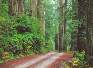
Explore Stout Grove via the Howland Hill Road
4.4The Howland Hill Road is the premier drive through Redwood National and State Parks. Approximately 6 miles long, the hard-packed gravel road varies in surface durability depending on season and when the road was last graded. Expect plenty of dust in the dry summer months and keep an eye out for p...Read more -
Crescent City, California
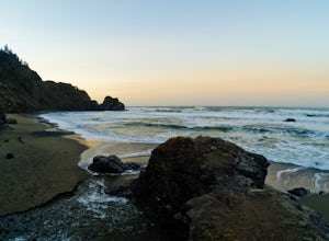
Point Saint George
0.92 mi / 23 ft gainPoint Saint George is an out-and-back trail where you may see wildflowers located near Crescent City, California.Read more -
Crescent City, California
Long Trail to Sweet Potato Creek Loop
3.63 mi / 105 ft gainLong Trail to Sweet Potato Creek Loop is a loop trail that is moderately difficult located near Fort Dick, California.Read more -
Crescent City, California
Crescent Beach Loop Walk
0.92 mi / 7 ft gainCrescent Beach Loop Walk is a loop trail that provides a good opportunity to see wildlife located near Crescent City, California.Read more -
Crescent City, California
St George Light House View Trail
0.16 mi / 20 ft gainSt George Light House View Trail is an out-and-back trail where you may see local wildlife located near Crescent City, California.Read more -
Crescent City, California
Camp at Nickel Creek
4.05 mi / 300 ft gainFirst, check in at the Crescent City Ranger Information Center in Crescent City to pick up your free backcountry permit and get permission to park your car at the Crescent City Beach Education Center off of Enderts Beach Road. This is the safest place to park at due to numerous car break-ins at t...Read more -
Klamath, California
Rellim Ridge Trail to Mill Creek Loop
10.2 mi / 1916 ft gainRellim Ridge Trail to Mill Creek Loop is a loop trail that takes you by a river located near Crescent City, CaliforniaRead more -
Crescent City, California
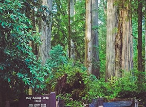
Hike the Boy Scout Tree Trail
5.0With a profusion of titanic trees and an ever expanding landscape, the extraordinary Boy Scout Tree Trail is not so much a hike as it is a showcase of the world's most scenic old growth redwoods. Located within Redwood National and State Parks, this pristine trail feels wonderfully remote. Hardly...Read more -
Crescent City, California
Fern Falls via Boy Scout Tree Trail
4.93 mi / 1050 ft gainFern Falls via Boy Scout Tree Trail is an out-and-back trail that takes you by a waterfall located near Crescent City, California.Read more -
Crescent City, California
Camp at Jedediah Smith Redwoods Campground
5.0/ 0 ft gainJedediah Smith Redwoods State Park offers activities for everyone: you can backpack and hike through lush rainforests, or fish, snorkel, and kayak in the Smith River (popular film The Last of the Mohicans was filmed just upstream!). Howland Hill Road is perfect for a scenic drive filled with uniq...Read more -
Del Norte County, California
Hobbs Wall Trail
3.45 mi / 804 ft gainHobbs Wall Trail is a loop trail where you may see wildflowers located near Klamath, California.Read more -
Crescent City, California
Simpson-Reed Trail
0.92 mi / 36 ft gainSimpson-Reed Trail is a loop trail that takes you by a river located near Crescent City, California.Read more -
Crescent City, California
Hatton Trail
3.26 mi / 682 ft gainHatton Trail is an out-and-back trail that takes you by a river located near Crescent City, California.Read more -
Crescent City, California
Leiffer and Ellsworth Loop
1.92 mi / 463 ft gainLeiffer and Ellsworth Loop is a loop trail that is moderately difficult located near Crescent City, California.Read more -
Crescent City, California
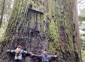
Hike Stout Grove via the Stout Grove Trailhead
4.50.6 miMarked with adequate signage, parking for the Stout Grove Trailhead is off Highland Hill Road, a road through the south end of the park. It's a narrow, dirt road so be cautious traveling through the state park. Pit toilets are available in the parking area. The trail is a .6-mile loop. It is wide...Read more


