The Best Hiking in Santa Barbara County
Looking for the best hiking in Santa Barbara County? We've got you covered with the top trails, trips, hiking, backpacking, camping and more around Santa Barbara County. The detailed guides, photos, and reviews are all submitted by the Outbound community.
Top hiking spots in and near Santa Barbara County
-
Santa Barbara, California
Parma Park Trail
3.28 mi / 748 ft gainParma Park Trail is a loop trail where you may see wildflowers located near Santa Barbara, California.Read more -
Santa Barbara, California
Arroyo Burro Beach Loop
1.26 mi / 62 ft gainArroyo Burro Beach Loop is a loop trail where you may see wildflowers located near Santa Barbara, California.Read more -
Santa Barbara, California
Rattlesnake Canyon Trail to Tunnel Trail
7.7 mi / 2526 ft gainRattlesnake Canyon Trail to Tunnel Trail is an out and back trail that takes you past scenic views located near Santa Barbara, CaliforniaRead more -
Santa Barbara, California
Santa Barbara Botanic Garden
5.01.33 mi / 210 ft gainSanta Barbara Botanic Garden is a loop trail where you may see beautiful wildflowers located near Santa Barbara, California.Read more -
Santa Barbara, California
Hike to Inspiration Point
4.03.5 mi / 800 ft gainHike up the 3.5 mile trail to an unbeatable vista that will leave you smiling! This hike has a steady uphill climb from the trailhead off of Tunnel Rd into Los Padres National Forest. Keep in mind this trail can get pretty crowded on weekends, so you're best to be at the trail early in the mornin...Read more -
Santa Barbara, California
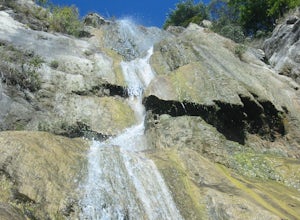
Seven Falls Trail
4.03.39 mi / 1033 ft gainSeven Falls Trail is an out-and-back trail that takes you by a waterfall located near Santa Barbara, California.Read more -
Santa Barbara, California
Hike La Cumbre Peak via Tunnel Trail
10 mi / 3000 ft gainTunnel Trail is a great way to get to the top of La Cumbre Peak. You get to the trail head by taking Tunnel Road until it dead ends at a large water tower, there you can park your car and start on foot. You take spyglass ridge road up which is a paved fire road until it becomes dirt when you get ...Read more -
Santa Barbara, California
Cathedral Peak Trail
4.8 mi / 2438 ft gainCathedral Peak Trail is an out-and-back trail where you may see beautiful wildflowers located near Santa Barbara, California.Read more -
Montecito, California
Montecito Peak Trail
6.45 mi / 2398 ft gainMontecito Peak Trail is a loop trail that takes you by a waterfall located near Santa Barbara, California.Read more -
Montecito, California
Cold Spring Trail Loop
5.02.67 mi / 883 ft gainCold Spring Trail Loop is a loop trail that takes you by a river located near Santa Barbara, California.Read more -
Montecito, California
Hike the Cold Spring Trail to Montecito Peak
6.8 mi / 1939 ft gainPark in the lot east of where Cold spring creek intersects Mountain Road. The correct trailhead is the one with the wooden sign, do not take the trail with a rusty metal sign. Begin your ascent and at the first fork stay right on East Fork. You will cross two mild creeks before the next fork, aga...Read more -
Montecito, California
Hike to Tangerine Falls
4.52.5 miThis waterfall can be fairly dry during the year, so keep your eyes out for a recent rainstorm to really get things going. When you start the hike on East Folk Trail, at 0.25 miles, cross over the creek and join West Fork Trail. A little over another half mile, West Fork starts to head uphill, bu...Read more -
Montecito, California
Hike the West Fork of Cold Spring
If you love the mountains above Santa Barbara but hate the crowds, stick to the canyon trails on the east side. The trails running up Cold Spring canyon offer a variety of experiences without all the noise.To find the West Fork of Cold Spring Trail, take the Olive Mill Rd. exit from the 101 freew...Read more -
Montecito, California
Hike the Cold Springs Loop Trail
1.8 mi / 682 ft gainThis trail is a 1.8 mile loop that is ideal for families or anyone looking for a short but spectacular hike. Begin at the trailhead where Cold Spring Creek crosses Mountain Drive. Follow the trail with a wooden sign--not the one with a rusty sign. Stay right at every fork. There will be a couple ...Read more -
Montecito, California
Hike the Saddle Rock Loop
4.02.9 mi / 895 ft gainBegin at the trailhead in the parking area on E. Valley Road. You'll gain some elevation (don't forget your water). You'll know when you arrive at Saddle Rock--you can't miss this conspicuous rock formation. Enjoy the sights from here. If you plan carefully and hike up on a clear day, you may eve...Read more -
Montecito, California
Hammonds Meadow Trail
0.36 mi / 20 ft gainHammonds Meadow Trail is an out-and-back trail that is good for all skill levels located near Santa Barbara, California.Read more


