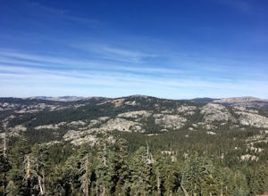
The Best Hiking in Soda Springs
Looking for the best hiking in Soda Springs? We've got you covered with the top trails, trips, hiking, backpacking, camping and more around Soda Springs. The detailed guides, photos, and reviews are all submitted by the Outbound community.
Top hiking spots in and near Soda Springs
-
Soda Springs, California
Lower and Upper Lola Montez Lakes
8.2 mi / 1486 ft gainLower and Upper Lola Montez Lakes is an out-and-back trail that is moderately difficult located near Soda Springs, California.Read more -
Soda Springs, California
Lola Montez Trail
6.33 mi / 981 ft gainLola Montez Trail is an out-and-back trail that is moderately difficult located near Soda Springs, California.Read more -
Soda Springs, California
Mariah Point via Big Ben, Reindeer, Castle Pass and Helman's Way
8.31 mi / 1168 ft gainMariah Point via Big Ben, Reindeer, Castle Pass and Helman's Way is an out-and-back trail that is moderately difficult located near Soda Springs, California.Read more -
Soda Springs, California
Deer Lake, Kidd Lake, Cascade Lakes and Long Lake
8.63 mi / 673 ft gainDeer Lake, Kidd Lake, Cascade Lakes and Long Lake is an out-and-back trail where you may see wildflowers located near Norden, California.Read more -
Soda Springs, California
Big Ben, Killy's Cruise, Lyle's Lookout, Crosscut, Palisade
2.8 mi / 144 ft gainBig Ben, Killy's Cruise, Lyle's Lookout, Crosscut, Palisade is a loop trail where you may see wildflowers located near Soda Springs, California.Read more -
Soda Springs, California
Palisade to Kilborn Lake
4.89 mi / 482 ft gainPalisade to Kilborn Lake is an out-and-back trail that takes you through a nice forest located near Soda Springs, California.Read more -
Norden, California
Palisade Peak Trail via Kat's Walk
2.04 mi / 404 ft gainPalisade Peak Trail via Kat's Walk is an out-and-back trail that takes you past scenic surroundings located near Soda Springs, California.Read more -
Norden, California
Palisade Peak Trail
2.25 mi / 627 ft gainPalisade Peak Trail is an out-and-back trail that takes you through a nice forest located near Soda Springs, California.Read more -
Soda Springs, California
Crows Nest
3.99 mi / 922 ft gainCrows Nest is an out-and-back trail that provides a good opportunity to see wildlife located near Norden, California.Read more -
Soda Springs, California
Crows Peak via Claim Jumper
3.7 mi / 928 ft gainCrows Peak via Claim Jumper is an out-and-back trail that takes you through a nice forest located near Truckee, California.Read more -
Soda Springs, California
Point Mariah and Sterling's Canyon Trail
4.77 mi / 587 ft gainPoint Mariah and Sterling's Canyon Trail is an out-and-back trail where you may see wildflowers located near Soda Springs, California.Read more -
Soda Springs, California
Hike to the Top of Andesite Peak
5 mi / 1000 ft gainFrom the trail map sign, follow the dirt path straight, following signs for the cross-country skiing route, not snowmobiling. Continue until you see a trail marker. You'll veer left to head over to the Hole in the Ground trail. Once you see another identical trail map board, you'll head left. Thi...Read more -
Truckee, California
Donner Lake Rim, Summit Lake and PCT Loop
5.68 mi / 630 ft gainDonner Lake Rim, Summit Lake and PCT Loop is a loop trail that takes you by a lake located near Truckee, California.Read more -
Truckee, California
Andesite Peak Trail
4.62 mi / 1007 ft gainAndesite Peak Trail is an out-and-back trail where you may see wildflowers located near Soda Springs, California.Read more -
Truckee, California
Hole-In-The-Ground Trail
11.87 mi / 1463 ft gainHole-In-The-Ground Trail is a point-to-point trail that provides a good opportunity to see wildlife located near Soda Springs, California.Read more -
Truckee, California
Castle Valley Loop Trail
3.69 mi / 617 ft gainCastle Valley Loop Trail is a loop trail where you may see wildflowers located near Soda Springs, California.Read more


