The Best Hiking in Tahoma
Looking for the best hiking in Tahoma? We've got you covered with the top trails, trips, hiking, backpacking, camping and more around Tahoma. The detailed guides, photos, and reviews are all submitted by the Outbound community.
Top hiking spots in and near Tahoma
-
Tahoma, California
General Creek
2.81 mi / 161 ft gainGeneral Creek is an out-and-back trail that is good for all skill levels located near Tahoma, California.Read more -
Tahoma, California
The Dolder Nature Trail
2.26 mi / 184 ft gainThe Dolder Nature Trail is a loop trail that takes you by a lake located near Tahoma, California.Read more -
Tahoma, California
Noonchester Mine Trail
2.53 mi / 400 ft gainNoonchester Mine Trail is a loop trail that takes you to a cave located near Homewood, California.Read more -
Tahoma, California
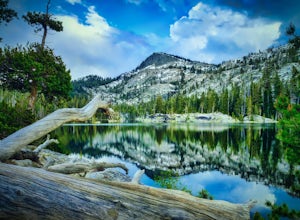
Backpack to Crag Lake
4.011.1 mi / 1220 ft gainDay 1:This trip is a great early season trip while you are waiting for the snow to melt in the high country or it could be a good first backpacking trip because of its proximity to the trailhead and the fact that it's a relatively easy hike. Also, you get to camp by a beautiful lake with a drama...Read more -
Tahoma, California
Meeks Bay to Emerald Bay via Tahoe Yosemite Trail
16.58 mi / 3146 ft gainMeeks Bay to Emerald Bay via Tahoe Yosemite Trail is a point-to-point trail that takes you by a lake located near Tahoma, California.Read more -
Tahoma, California
Crag Lake and Rubicon Lake Trail to PCT
22.07 mi / 3353 ft gainCrag Lake and Rubicon Lake Trail to PCT is an out-and-back trail that takes you by a lake located near Tahoma, California.Read more -
Tahoma, California
Tahoe-Yosemite Trail Section 1: To Echo Summit
32.67 mi / 5341 ft gainTahoe-Yosemite Trail Section 1: To Echo Summit is a point-to-point trail where you may see wildflowers located near Tahoma, California.Read more -
Tahoma, California
Lake Genevieve and Crag Lake via Meeks Bay Trail
9.82 mi / 1214 ft gainLake Genevieve and Crag Lake via Meeks Bay Trail is an out-and-back trail where you may see wildflowers located near Tahoma, California.Read more -
Homewood, California
Lily Lake and Miller Creek Trail
4.87 mi / 466 ft gainLily Lake and Miller Creek Trail is an out-and-back trail that is moderately difficult located near Tahoma, California.Read more -
Homewood, California
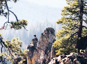
Eagle Rock
4.00.84 mi / 105 ft gainStarting at an outcrop off Highway 89 in Tahoe Pines, hikers make their way up the trail through a gradually sloping forest. Climbing rocks and logs, it is strenuous at times but only takes about 15-20 minutes to accomplish. Once at the top, the elevation is 6,286 feet and consists of an absolute...Read more -
Tahoe City, California
Camp at Kaspian Campground
/ 6298 ft gainKaspian Campground is a short walk from the shores of Lake Tahoe, less than 10 miles from popular Meeks Bay. The campsites are relatively private and are surrounded by pine and fir trees. Each campsite has a fire ring, grill, and picnic table. The campground provides bathrooms, potable water, and...Read more -
South Lake Tahoe, California
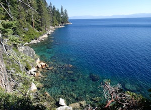
Hike the Rubicon Trail
5.07 mi / 400 ft gainThe Rubicon Trail is a through hike connecting D.L. Bliss State Park and Emerald Bay State Park. You can start at either point. I opted to start at D.L. Bliss State Park to avoid the long walk uphill to catch the Nifty Fifty shuttle. Also, there is more available parking at Bliss. Park your c...Read more -
South Lake Tahoe, California
Explore the Lighthouse Trail
2.3 mi / 449 ft gainD.L. Bliss State Park is known for its camping, beaches, and enjoyable hiking trails. There is a day-use fee for entry into the park - you can pay at the ranger kiosk or a self-serve pay box. The park closes around the end of September, but you can typically park your car outside the main entranc...Read more -
South Lake Tahoe, California
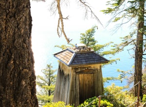
Hike the Lighthouse Trail at D.L. Bliss State Park
4.82.3 mi / 505 ft gainThe Lighthouse Trail is a 2.3 mile loop located in D.L. Bliss State Park on the lower west side of world famous Lake Tahoe. To get the trail, enter the park through the main entrance ($10 parking fee), the follow the road until you see two parking areas of the left side with about 6 or 7 spots e...Read more -
Tahoe City, California
Camp at William Kent Campground
/ 6282 ft gainWilliam Kent Campground is a few miles south of Tahoe City on Lake Tahoe's western shore. Access to the lake is just a short walk from the campground. The campground provides bathrooms, campfire rings, a trash dump station, firewood vendor, grills, picnic tables, and food storage lockers. Pets ar...Read more -
Tahoe City, California
Hike the Ellis Peak Trail
5.06.3 mi / 1660 ft gainThe Ellis Peak Trail is close to North Lake Tahoe. The trail features scenic wildflowers in the spring and summer. Dogs are allowed on the trail but must be kept on leash. Directions from Truckee: Take Highway 80 south and drive to Tahoe City - continue south on Highway 89 from Tahoe City for 4....Read more


