The Best Hiking in Palmdale
Looking for the best hiking in Palmdale? We've got you covered with the top trails, trips, hiking, backpacking, camping and more around Palmdale. The detailed guides, photos, and reviews are all submitted by the Outbound community.
Top hiking spots in and near Palmdale
-
Palmdale, California
Barrel Springs Trail
2.55 mi / 46 ft gainBarrel Springs Trail is an out-and-back trail where you may see local wildlife located near Palmdale, California.Read more -
Palmdale, California
Sgt. Steve Owen Bench Trail
3.3 mi / 449 ft gainSgt. Steve Owen Bench Trail is an out-and-back trail that takes you by a river located near Palmdale, California.Read more -
Santa Clarita, California
Pacific Crest Trail: Bouquet Canyon
5.88 mi / 1368 ft gainPacific Crest Trail: Bouquet Canyon is an out-and-back trail where you may see beautiful wildflowers located near Palmdale, California.Read more -
Santa Clarita, California
Hike the PCT and Foot Trail Loop through Vasquez Rocks
5.05.5 mi / 287 ft gainThe Pacific Crest Trail and foot trail hike is a 5-mile loop with a quick PCT branch-off that leads under the 14 freeway through a long, well-maintained (but very dark) tunnel. Pull into the well-marked parking lot and stop in the visitor center to take a look at the topographical park model and...Read more -
Palmdale, California
Pacific Crest Trail: Angeles Forest Highway to Soledad Canyon Road
25.66 mi / 4836 ft gainPacific Crest Trail: Angeles Forest Highway to Soledad Canyon Road is a point-to-point trail where you may see beautiful wildflowers located near Palmdale, California.Read more -
Palmdale, California
Mount Gleason Trail
18.37 mi / 2881 ft gainMount Gleason Trail is an out-and-back trail where you may see beautiful wildflowers located near Palmdale, California.Read more -
Palmdale, California
Mount Pacifico Loop Trail
11.85 mi / 2598 ft gainMount Pacifico Loop Trail is a loop trail where you may see beautiful wildflowers located near Acton, California.Read more -
Agua Dulce, California
Vasquez Rocks Extended Loop via PCT
3.47 mi / 466 ft gainVasquez Rocks Extended Loop via PCT is a loop trail that takes you by a river located near Santa Clarita, California.Read more -
Santa Clarita, California
PCT: CA Section E - Agua Dulce to Tehachapi Pass
109.33 mi / 19902 ft gainPCT: CA Section E - Agua Dulce to Tehachapi Pass is a point-to-point trail that takes you by a river located near Acton, California.Read more -
Agua Dulce, California
Vasquez Rocks
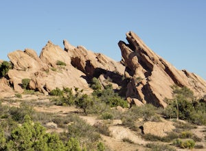
5.02.42 mi / 367 ft gainThis is a Natural Park Area located in Santa Clarita, within the Sierra Pelona Mountains. It features amazing diagonal rock formations, created because of the force between two tectonic plates pushing against each other. This place is a photographer's paradise, and every spot in this 900+ acre l...Read more -
Agua Dulce, California
Vasquez Rocks Trail
2.42 mi / 367 ft gainVasquez Rocks Trail is a loop trail where you may see wildflowers located near Santa Clarita, California.Read more -
Santa Clarita, California
Jupiter Mountain Loop
3.04 mi / 1437 ft gainJupiter Mountain Loop is a loop trail where you may see local wildlife located near Santa Clarita, California.Read more -
Santa Clarita, California
Grass Mountain via San Francisquito Canyon Road
4.55 mi / 1286 ft gainGrass Mountain via San Francisquito Canyon Road is a loop trail where you may see beautiful wildflowers located near Santa Clarita, California.Read more -
Pearblossom, California
Camp at Horse Flats Campground
3.0The Horse Flats Campground is located 29 miles up Highway 2 from Interstate 210. You will turn left at the Santa Clara Divide Road(this intersection is also known as 3 Points). 3 miles down the road you will turn left to enter the campground. I have camped here a few times and its always been pre...Read more -
Pearblossom, California
Mt. Hillyer Trail from Horse Flats Campground
3.33 mi / 541 ft gainMt. Hillyer Trail from Horse Flats Campground is an out-and-back trail where you may see beautiful wildflowers located near Mount Wilson, California.Read more -
Lancaster, California
Little Butte Trail
4.02.09 mi / 213 ft gainLittle Butte Trail is an out-and-back trail that is moderately difficult located near Llano, California.Read more


