The Best Hiking in Calabasas
Looking for the best hiking in Calabasas? We've got you covered with the top trails, trips, hiking, backpacking, camping and more around Calabasas. The detailed guides, photos, and reviews are all submitted by the Outbound community.
Top hiking spots in and near Calabasas
-
Topanga, California
Hike Calabasas Peak Motorway
7.3 mi / 1817 ft gainGetting There You can, from Los Angeles, go one of three ways: take I-405 to US-101 and head west, or from downtown, take US-101 the whole way, OR, get on I-10 from the Westside or east of there and take that until it becomes PCH, then take that to Topanga Canyon (turn left onto Old Topanga Canyo...Read more -
Calabasas, California
Calabasas Cold Creek Trail
3.87 mi / 804 ft gainCalabasas Cold Creek Trail is an out-and-back trail where you may see wildflowers located near Calabasas, California.Read more -
Topanga, California
Hike the Top of Topanga Overlook
1 mi / 1613 ft gainThe Top of Topanga Overlook is where you can simply park your car, and sit in one of the benches to view the San Fernando Valley. But there is one hiking trail in that area which lets you get better vantage points, as well as a quick workout.Once you get to the overlook, park your car and safely ...Read more -
34.1853982875916,-118.668453097343, California
East Las Virgenes Canyon Trail Loop
0.87 mi / 190 ft gainEast Las Virgenes Canyon Trail Loop is a loop trail that provides a good opportunity to view wildlife located near West Hills, California.Read more -
34.1854293506055,-118.668501377106, California
Laskey Mesa Trail
5.44 mi / 574 ft gainLaskey Mesa Trail is a loop trail where you may see wildflowers located near Woodland Hills, California.Read more -
34.1854870390296,-118.66846382618, California
Victory Trailhead to Simi Valley via Simi Hills
11.86 mi / 1617 ft gainVictory Trailhead to Simi Valley via Simi Hills is a point-to-point trail where you may see wildflowers located near West Hills, California.Read more -
34.1856468,-118.66898, California
Mary Wiesbrock Loop Trail
3.69 mi / 305 ft gainMary Wiesbrock Loop Trail is a loop trail that provides a good opportunity to see wildlife located near West Hills, California.Read more -
Ventura County, California
Hike the Upper Las Virgenes Canyon Open Space Preserve Trail
8.6 mi / 1851 ft gainThe most popular point of entry is through the Victory Trailhead, which has ample parking. You can park on the street or you can pay $3 to park at the trailhead parking lot. You can also enter at the Upper Las Virgenes Canyon Trailhead at the northern end of Las Virgenes Canyon Road in Calabasas....Read more -
Los Angeles County, California
El Escorpion Trail to Hunter Allen Trail
2.62 mi / 377 ft gainEl Escorpion Trail to Hunter Allen Trail is an out-and-back trail where you may see beautiful wildflowers located near West Hills, California.Read more -
Los Angeles, California
Cave of Munits
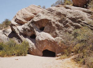
4.51.53 mi / 299 ft gainAre you looking for a hike that offers trail running, scenic views, hiking, and CAVE exploring? This short, but exciting trail leads you on a short 0.8 mile hike to the Cave of Munits. When starting at the main trailhead, El Scorpion Park, take the wide paved dirt road all the way till you get to...Read more -
Los Angeles County, California
Cave of Muntiz via El Escorpion Trail
1.75 mi / 367 ft gainCave of Muntiz via El Escorpion Trail is a loop trail where you may see beautiful wildflowers located near West Hills, California.Read more -
Calabasas, California
Anza Loop Trail to Calabash Canyon Loop Trail
7.8 mi / 1280 ft gainAnza Loop Trail to Calabash Canyon Loop Trail is a loop trail where you may see wildflowers located near Calabasas, California.Read more -
Calabasas, California
Morrison Ranch Trail Loop
3.11 mi / 676 ft gainMorrison Ranch Trail Loop is a loop trail that provides a good opportunity to view wildlife located near Calabasas, California.Read more -
Topanga, California
Red Rock Creek Trail
2.03 mi / 499 ft gainRed Rock Creek Trail is an out-and-back trail where you may see beautiful wildflowers located near Topanga, California.Read more -
Topanga, California
Hike Red Rock Canyon to Calabasas Peak
4.04.2 mi / 1066 ft gainWhen you get to the parking lot be sure to pay the $5 parking fee. You will need to place this in the provided envelope and drop it in the iron ranger. Start the hike by following the fire road behind the gate. About a couple of yards in, you will see a trail on your left which leads to a ghoulis...Read more -
Topanga, California
Red Rock Road
3.3 mi / 741 ft gainRed Rock Road is an out and back trail where you may see wildflowers located near Topanga, CaliforniaRead more


