The Best Hiking in Junction City
Looking for the best hiking in Junction City? We've got you covered with the top trails, trips, hiking, backpacking, camping and more around Junction City. The detailed guides, photos, and reviews are all submitted by the Outbound community.
Top hiking spots in and near Junction City
-
Junction City, California
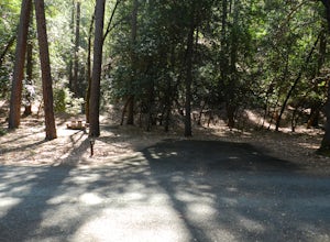
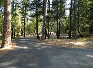
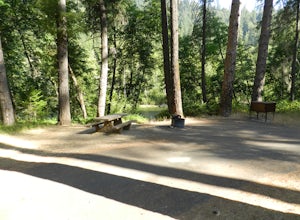
Camp at Junction City Campground
3.0Junction City Campground is home to 22 tent/trailer campsites, paved loop road, vault toilets, potable water, fire rings, and picnic tables. MAX trailer length is 40 feet. The campground is located 1.5 miles west of Junction City on State Highway 299.Dogs are welcome in the campground -- please k...Read more -
Junction City, California
Hike to East Weaver Lake
2.9 mi / 885 ft gainThe trail is used for hiking, trail running and snowshoeing. The last 30 minutes of your drive will be on a windy dirt road. 4WD is recommended. The trailhead on the top of the road features a fire lookout to explore off to the left, and the trail is on the right.Read more -
Douglas City, California
Camp at Douglas City Campground
The campground amenities include 20 tent/trailer campsites, group picnic area, picnic tables, telephone, beach, paved loop road, flush and vault toilets, potable water, and fire rings. MAX trailer length is 28 feet.Douglas City is located along the Trinity River. Follow State Highway 299 to Dougl...Read more -
Douglas City, California
Camp at Steel Bridge Campground
Steel Bridge is located along the Trinity River. About three miles east of Douglas City on State Highway 299, turn north onto Steel Bridge Road and go about 2 miles to the campground.This campground is open from Mid-May until winter weather forces closure. The campground is home to 12 camping s...Read more -
Junction City, California
East Fork Lakes
9.09 mi / 3763 ft gainEast Fork Lakes is an out-and-back trail that takes you by a lake located near Junction City, California.Read more -
Junction City, California
Canyon Creek Lakes Trail
15.2 mi / 2687 ft gainCanyon Creek Lakes Trail is an out-and-back trail that takes you by a lake located near Weaverville, California.Read more -
Junction City, California
Boulder Creek Lakes and Forbidden Lakes
14.58 mi / 2841 ft gainBoulder Creek Lakes and Forbidden Lakes is an out-and-back trail that takes you by a lake located near Junction City, California.Read more -
Junction City, California
Canyon Creek Lakes
4.314.35 mi / 2605 ft gainNumerous starting points with over 550 miles of trail and easily 50+ different featured trails depending on length and what type of activity you are are looking for. One of the more popular trails, and rightfully so, is Canyon Creek Lakes Trail. This 16 mile roundtrip hike has an overall elevatio...Read more -
Junction City, California
Scramble Thompson Peak
4.022.7 mi / 6100 ft gainThis adventure begins at the Canyon Creek Lakes in the Trinity Alps wilderness. Park at the Canyon Creek Trailhead near Junction City and hike the well-maintained and easy-to-follow trail for 8 miles. Once you reach the Canyon Creek Lakes, your off-trail adventure officially begins. I’d recommend...Read more -
Junction City, California
Backcountry Camp in the Canyon Creek Drainage
9 mi / 2600 ft gainThe first half of the Canyon Creek Drainage is one of the most popular destinations within the Trinity Alps, but the second half goes largely unexplored and uninhabited by sojourners. Four peaks – Thompson Peak, Wedding Cake, Mt. Hilton, and Sawtooth Peak – surround the basin and offer adventurer...Read more -
Junction City, California
Canyon Creek Lakes & L Lake Trail
16.93 mi / 3497 ft gainCanyon Creek Lakes & L Lake Trail is an out-and-back trail that takes you by a lake located near Lewiston, California.Read more -
Trinity Center, California
Stuart Fork Trail to Emerald and Sapphire Lakes
5.027.06 mi / 4213 ft gainThe trail begins just past the Trinity Alps Resort, a private collection of cabins near Weaverville, CA. Hikers wanting an early start can spend the night at the Bridge Camp Campground, located next to the trailhead. The path starts out wide and level, following an old road to the wilderness bou...Read more -
Trinity Center, California
Stuart Fork to Alpine Lake
16 mi / 4265 ft gainNestled in the heights of the Trinity Alps, this hike to Alpine Lake is not for the faint of heart. Before embarking on this adventure call the Weaverville Ranger station to check snow levels as well as the flow of the Stuart Fork River. If you are too early in the summer season the snowpack wi...Read more -
Trinity Center, California
Backpack Stuart Fork to Emerald and Sapphire Lake
25 mi / 4448 ft gainThe Stuart Fork to Emerald and Sapphire Lakes trail features many beautiful lakes, meadows, and an area that resembles a jungle. Dogs are able to use this trail. This trail can be done as a day hike, an overnight, or a three-day backpacking trip. If you choose to make it a three day, the meadows ...Read more -
Big Bar, California
Hobo Gulch Trail
5.35 mi / 1063 ft gainHobo Gulch Trail is an out-and-back trail that is dog friendly (on-leash) located near Junction City, California.Read more -
Big Bar, California
Rattlesnake Creek to Papoose Lake
23.2 mi / 5793 ft gainRattlesnake Creek to Papoose Lake is an out and back trail that takes you by a river located near Weaverville, CaliforniaRead more

