The Best Hiking in Laguna Niguel
Looking for the best hiking in Laguna Niguel? We've got you covered with the top trails, trips, hiking, backpacking, camping and more around Laguna Niguel. The detailed guides, photos, and reviews are all submitted by the Outbound community.
Top hiking spots in and near Laguna Niguel
-
Laguna Niguel, California
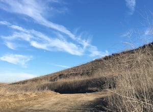
Colinas Ridge Trail
4.24 mi / 561 ft gainColinas Ridge Trail is an out-and-back trail that takes you past scenic surroundings located near Laguna Niguel, California.Read more -
Laguna Niguel, California
Colinas Ridge Trail
2.01 mi / 131 ft gainFirst, you'll be parking in the parking lot for the dog park. It's free parking and there are roughly 40 spaces, so there is plenty of parking. I've never seen more than 20 cars here at any one time. Once parked you'll find the trail head/ start on the northwest side of the lot (opposite the dog ...Read more -
Laguna Niguel, California
Aliso Summit Trail
9.1 mi / 1427 ft gainAliso Summit Trail is an out-and-back trail where you may see wildflowers located near Laguna Niguel, California.Read more -
Laguna Niguel, California
Badlands Park and South Laguna Coast
2.37 mi / 341 ft gainBadlands Park and South Laguna Coast is an out-and-back trail that takes you past scenic surroundings located near Laguna Niguel, California.Read more -
Laguna Niguel, California
Aliso Peak Trail from St Tropez
0.81 mi / 200 ft gainAliso Peak Trail from St Tropez is an out-and-back trail where you may see wildflowers located near Laguna Niguel, California.Read more -
Laguna Niguel, California
Sulphur Creek Reservoir Loop
1.84 mi / 253 ft gainSulphur Creek Reservoir Loop is a loop trail that is good for all skill levels located near Laguna Niguel, California.Read more -
Laguna Niguel, California
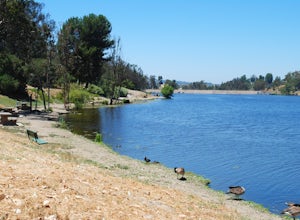
Kick Back at Laguna Niguel Regional Park
This is an awesome tucked away little adventure that will have you occupied all day! With plenty of picnic tables you can be sure to have your own privacy tucked into a corner free from other people. Grab a lake side picnic table or even the numerous ones around the grass fields, they are all won...Read more -
Laguna Niguel, California
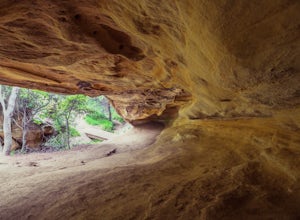
Dripping Cave in the Aliso & Wood Canyons Wilderness
4.47.68 mi / 889 ft gainDripping Cave sits tucked away in a corner of Wood Canyon, part of the Aliso and Wood Canyons Wilderness Park, and the trail to the cave, while short, requires *at least* a 2.25 mile hike in from the nearest trailhead (West Ridge Trail to Mathis Canyon), though this is less than ideal as that rou...Read more -
Laguna Niguel, California
Mathis Canyon and Car Wreck Loop Trail
7.78 mi / 925 ft gainMathis Canyon and Car Wreck Loop Trail is a loop trail that provides a good opportunity to see wildlife located near Aliso Viejo, California.Read more -
Aliso Viejo, California
Hike Aliso Creek and Wood Canyon
11.7 mi / 1332 ft gainThe Aliso Creek and Wood Canyon Trail is shared by trail runners, mountain bikers, horseback riders and hikers. The trail is open for use year-round with abundant wildflowers in the spring. The trail is shaded in parts, but bring sun protection and extra water just in case. Watch for snakes and ...Read more -
Laguna Niguel, California
Aliso and Woods Canyon to Alta Laguna Park Loop
13.7 mi / 1703 ft gainAliso and Woods Canyon to Alta Laguna Park Loop is a loop trail that takes you through a nice forest located near Laguna Niguel, California.Read more -
Aliso Viejo, California
Aliso Creek and Wood Canyon Loop Trail
10.45 mi / 948 ft gainAliso Creek and Wood Canyon Loop Trail is a loop trail that takes you by a river located near Laguna Niguel, California.Read more -
Aliso Viejo, California
Aliso Creek Trail
9.5 mi / 305 ft gainAliso Creek Trail is an out and back trail where you may see wildflowers located near Lake Forest, California.Read more -
Aliso Viejo, California
Aliso Creek Trail to Wood Canyon and Rock It Trail Loop
10.27 mi / 869 ft gainAliso Creek Trail to Wood Canyon and Rock It Trail Loop is a loop trail where you may see wildflowers located near Laguna Niguel, California.Read more -
Laguna Beach, California
Aliso Peak via the Valido Trail
5.01.14 mi / 325 ft gainThe Valido Trail trailhead can be found just off West street off the Pacific Coast Highway, just south of Aliso Beach. Park on West Street past the trailhead. The trail proceeds approximate .5 miles till it intersects with the Aliso Peak Trail. Go left .4 miles to the obvious summit and wooden p...Read more -
Laguna Beach, California
Aliso Peak via Valido Trail
1.14 mi / 325 ft gainAliso Peak via Valido Trail is an out-and-back trail where you may see wildflowers located near Laguna Niguel, California.Read more


