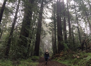
The Best Hiking in La Honda
Looking for the best hiking in La Honda? We've got you covered with the top trails, trips, hiking, backpacking, camping and more around La Honda. The detailed guides, photos, and reviews are all submitted by the Outbound community.
Top hiking spots in and near La Honda
-
La Honda, California
Harrington Creek Trail
8.86 mi / 1509 ft gainHarrington Creek Trail is an out-and-back trail where you may see beautiful wildflowers located near Loma Mar, California.Read more -
Loma Mar, California
Old Stage Road, Uncle Man Road, and Youth Camp Trail
2.99 mi / 876 ft gainOld Stage Road, Uncle Man Road, and Youth Camp Trail is a loop trail that provides a good opportunity to view wildlife located near La Honda, California.Read more -
La Honda, California
Sam McDonald Park Loop
5.012.19 mi / 2192 ft gainThe Pescadero Creek Park Complex is a great place to escape for a day or overnight hike in the heart of the Bay Area. You will need to get a permit to stay overnight - these can be attained on a first-come, first-serve basis from the ranger station. Most of the campsites here are also available f...Read more -
La Honda, California
Heritage Grove Loop Trail
4.3 mi / 1175 ft gainHeritage Grove Loop Trail is a loop trail where you may see beautiful wildflowers located near La Honda, California.Read more -
La Honda, California
East Brook Trail to Pomponio Trail to Bear Ridge Trail Loop
8.14 mi / 1365 ft gainEast Brook Trail to Pomponio Trail to Bear Ridge Trail Loop is a loop trail where you may see local wildlife located near La Honda, California.Read more -
La Honda, California
Hike the Brook Trail Loop
7.1 mi / 1500 ft gainThe Brook Trail Loop is a beautiful hike, starting off in Sam McDonald County Park and later entering into Pescadero Creek County Park. This adventure can be done in any season, with the trails almost entirely shaded for even the hottest summer days. Starting off from the Heritage Grove trailhead...Read more -
Loma Mar, California
Pomponio Loop Trail
3.32 mi / 735 ft gainPomponio Loop Trail is a loop trail where you may see wildflowers located near Loma Mar, California.Read more -
Loma Mar, California
Camp Under the Redwoods at Memorial Park
With old growth redwoods and a creek swimming area, Memorial Park is a perfect escape from the hustle and bustle of the Bay Area. Memorial Park is only a few miles east of the town of Pescadero. To get here, you can either approach from Highway 1 and drive up Pescadero Creek Road or take Highway ...Read more -
Portola Valley, California
Razorback Ridge Trail
4.77 mi / 1263 ft gainRazorback Ridge Trail is an out-and-back trail where you may see beautiful wildflowers located near Portola Valley, California.Read more -
Loma Mar, California
Bike Pescadero Creek County Park
5.012.5 mi / 1350 ft gainPescadero Creek County Park and the connected Sam McDonald and Memorial Park are located deep in the Santa Cruz Mountains holding a vast network of secluded trails. From biking to backpacking, this area is a perfect place for a day or weekend adventure. This area also has the added bonus having r...Read more -
Portola Valley, California
Hamms Gulch, Eagle Trail, and Lost Trail Loop
7.97 mi / 1962 ft gainHamms Gulch, Eagle Trail, and Lost Trail Loop is a loop trail that is moderately difficult located near Portola Valley, California.Read more -
Portola Valley, California
Anniversary Trail
1.03 mi / 135 ft gainAnniversary Trail is a loop trail where you may see wildflowers located near Redwood City, California.Read more -
Redwood City, California
Crazy Pete's and Alpine Road Loop
2.79 mi / 617 ft gainCrazy Pete's and Alpine Road Loop is a loop trail where you may see wildflowers located near Redwood City, California.Read more -
Portola Valley, California
Sunrise Hike at Windy Hill
5.0There are a few options to this hike. Usually I would recommend parking in the lot on Portola Road, but because the preserve doesn't open until 30 minutes before sunrise, it's best to park up on Skyline Boulevard (Highway 35). There are two places to park up on Skyline, but the main parking lot i...Read more -
Redwood City, California
Clouds Rest Trail
2.61 mi / 568 ft gainClouds Rest Trail is a loop trail that takes you past scenic surroundings located near Redwood City, California.Read more -
La Honda, California
Upper Coyote Ridge, Iverson and Summit Trail Loop
8.42 mi / 2169 ft gainUpper Coyote Ridge, Iverson and Summit Trail Loop is a loop trail that takes you by a river located near La Honda, California.Read more


