The Best Hiking in McCloud
Looking for the best hiking in McCloud? We've got you covered with the top trails, trips, hiking, backpacking, camping and more around McCloud. The detailed guides, photos, and reviews are all submitted by the Outbound community.
Top hiking spots in and near McCloud
-
McCloud, California
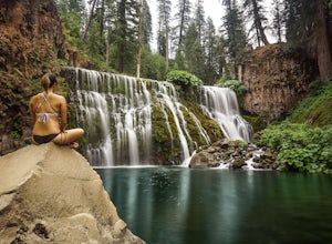
Middle McCloud Falls
4.82.49 mi / 243 ft gainJust 4 hours north of San Francisco, McCloud Falls offers a quick hike and swimming hole for those looking for something less crowded than Burney Falls. McCloud Falls has 3 tiers, but the middle section offers the best views by far. Getting Here To get here, park at the Fowlers Campground which...Read more -
McCloud, California
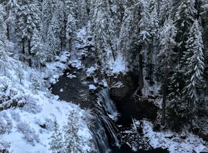
McCloud Waterfalls Trail
3.6 mi / 338 ft gainMcCloud Waterfalls Trail is an out-and-back trail that takes you by a waterfall located near McCloud, California.Read more -
McCloud, California
McCloud Middle Falls Short Trail
3.00.79 mi / 85 ft gainMcCloud Middle Falls Short Trail is an out-and-back trail that takes you by a waterfall located near McCloud, California.Read more -
Dunsmuir, California
Hedge Creek Falls
0.64 mi / 148 ft gainHedge Creek Falls is an out-and-back trail that takes you by a waterfall located near Dunsmuir, California.Read more -
Dunsmuir, California
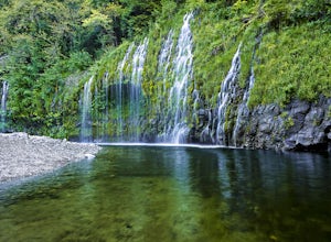
Mossbrae Falls
5.03.01 miDisclaimer: Hiking to the falls is trespassing. Fines can be as much as $300. If you choose to hike to the falls, you're doing so at your own risk so please be cautious and cognizant of your surroundings. If you live anywhere near Northern California or Southern Oregon, you may have heard about ...Read more -
McCloud, California
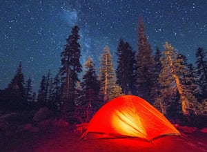
Camp at Panther Meadows
5.0The Panther Meadows Campground is located in the timberline on Mt. Shasta. The free campsite has 10 sites with a fire ring and a table. The elevation of the campground is 7,500 ft, making it the highest campground on Mt. Shasta. Summer nights can get pretty cold, so make sure to bring proper atti...Read more -
McCloud, California
Hike Gray Butte
Mount Shasta is an incredible mountain in Northern California that offers a great variety of activities. The Gray Butte trail is one of the more beautiful trails in the area, and it's not too long (2.8mi, ~2h). We arrived at Shasta by late afternoon, so it was a great hike to do when golden hour ...Read more -
McCloud, California
Panther Meadows Trail
1.04 mi / 217 ft gainPanther Meadows Trail is an out-and-back trail that takes you by a river located near McCloud, California.Read more -
McCloud, California
Mt. Shasta via Clear Creek Route
11.43 mi / 7615 ft gainThe least technical route to the summit of Mt Shasta begins at the Clear Creek Trailhead (elevation 6390 ft). Please note that although this is a less technical route, this is still dangerous and there have been deaths on Mt. Shasta because of falling rock. To start this, you should be a good hik...Read more -
McCloud, California
Panther Springs Trail
0.82 mi / 75 ft gainPanther Springs Trail is an out-and-back trail where you may see wildflowers located near McCloud, California.Read more -
Castella, California
Squaw Valley Creek Trail
8.84 mi / 1365 ft gainSquaw Valley Creek Trail is an out-and-back trail that takes you by a waterfall located near Castella, California.Read more -
Mount Shasta, California
Sand Flat Winter Trails: Overlook Loop
3.12 mi / 377 ft gainSand Flat Winter Trails: Overlook Loop s a loop trail that takes you through a nice forest located near Mount Shasta, California.Read more -
Siskiyou County, California
Climb Mt. Shasta via Avalanche Gulch
5.011 mi / 7200 ft gainThe Avalanche Gulch route is the second easiest, non-technical route to the summit of Mt. Shasta after the Clear Creek Route, but is by far the most popular. Many people complete this climb in one day from the trailhead, but you also have the opportunity to overnight at Horse Camp (7,950 ft.) or ...Read more -
McCloud, California
Mount Shasta via Avalanche Gulch Route
10.73 mi / 7178 ft gainMount Shasta via Avalanche Gulch Route is an out-and-back trail where you may see beautiful wildflowers located near Mount Shasta, California.Read more -
McCloud, California
Casaval Ridge
6.1 mi / 3675 ft gainCasaval Ridge is an out-and-back trail where you may see wildflowers located near Mount Shasta, California.Read more -
McCloud, California
Dog Trail from Bunny Flat
4.11 mi / 804 ft gainDog Trail from Bunny Flat is an out-and-back trail that takes you through a nice forest located near McCloud, California.Read more

