The Best Hiking in Orinda
Looking for the best hiking in Orinda? We've got you covered with the top trails, trips, hiking, backpacking, camping and more around Orinda. The detailed guides, photos, and reviews are all submitted by the Outbound community.
Top hiking spots in and near Orinda
-
Orinda, California
De La Veaga Loop
6.67 mi / 1703 ft gainDe La Veaga Loop is an out-and-back trail where you may see wildflowers located near Orinda, California.Read more -
Orinda, California
Bay Area Ridge and Nature Path Loop
7 mi / 1604 ft gainBay Area Ridge and Nature Path Loop is a loop trail that takes you by a river located near Orinda, CaliforniaRead more -
Oakland, California
Round Top, Volcanic and Skyline Trail Loop
3.54 mi / 666 ft gainRound Top, Volcanic and Skyline Trail Loop is a loop hike where you may see beautiful wild flowers located in Sibley Volcanic Regional Preserve near Orinda, CaliforniaRead more -
Oakland, California
Bay Area Ridge, Round Top Loop, and Volcanic Trail Loop
3.04 mi / 587 ft gainBay Area Ridge, Round Top Loop, and Volcanic Trail Loop is a loop trail where you may see local wildlife located near Orinda, California.Read more -
Orinda, California
Lomas Cantadas to Skyline
11.22 mi / 2418 ft gainLomas Cantadas to Skyline is an out-and-back trail that provides a good opportunity to see wildlife located near Orinda, California.Read more -
Oakland, California
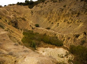
Sibley Volcanic Trail Labyrinths
3.52 mi / 144 ft gainFrom Skyline Blvd, pull into the staging area for Sibley Volcanic Regional Preserve, you'll see the sign. Parking here is usually easy to find. You'll find an unstaffed visitor center with a restroom, park maps and informational displays featuring the history and geology of the park. Sibley is a...Read more -
Oakland, California
Hike the Sibley Volcanic Trail
3.8 mi / 757 ft gainThe Sibley Volcanic Trail is a 3.8 mile loop that is great for all skill levels. The trail is best used from June - December, and is shared by kids, trail runners, mountain bikers, and hikers. Watch for wildlife and wildflowers. There is little to no shade, so wear sunscreen and bring sun protec...Read more -
Orinda, California
Side-O Trail
2.43 mi / 535 ft gainSide-O Trail is an out-and-back trail where you may see beautiful wildflowers located near Berkeley, California.Read more -
Lafayette, California
Lafayette Reservoir Loop
3 mi / 157 ft gainLafayette Reservoir Loop is a loop trail that takes you by a lake located near Lafayette, California.Read more -
Orinda, California
Seaview, Meadows Canyon, Wildcat Gorge, Selby, Grizzly Peak
9.09 mi / 1601 ft gainSeaview, Meadows Canyon, Wildcat Gorge, Selby, Grizzly Peak is a loop trail where you may see beautiful wildflowers located near Orinda, California.Read more -
Orinda, California
Vollmer Peak Via Seaview Trail
1.83 mi / 318 ft gainVollmer Peak Via Seaview Trail is an out-and-back trail that takes you past scenic surroundings located near Berkeley, California.Read more -
Orinda, California
Seaview, Meadows Canyon, Wildcat Gorge, Quarry, Lower Big Springs,
9.13 mi / 1759 ft gainSeaview, Meadows Canyon, Wildcat Gorge, Quarry, Lower Big Springs, is a loop trail where you may see beautiful wildflowers located near Berkeley, California.Read more -
Lafayette, California
Lafayette Reservoir via Nature Area Rim Trail
5.05 mi / 758 ft gainLafayette Reservoir is perfect for canoeing, mountain biking, trail running, and hiking. The Reservoir trail system is also used for nature walks and birding. The loop has several high points that have amazing views. The trails become very muddy after wet weather - so tread with caution. Th...Read more -
Orinda, California
Seaview Trail
5.51 mi / 1086 ft gainSeaview Trail is an out-and-back trail where you may see beautiful wildflowers located near Orinda, California.Read more -
Oakland, California
Hike the Huckleberry Nature Path Trail
5.02.3 mi / 561 ft gainThe hike is shady in most parts. In the spring, wildflowers are abundant (as are Huckleberries and Manzanita). The trail is accessible year round, and is great for hikers, walkers, trail runners, and nature trips. Start the loop from the Skyline Blvd staging area take the Huckleberry Loop.Read more -
Orinda, California
Oursan Trail, Old San Pablo Trail, Inspiration Point
9.78 mi / 1542 ft gainOursan Trail, Old San Pablo Trail, Inspiration Point is an out-and-back trail that takes you by a lake located near Orinda, California.Read more


