The Best Hiking in Pearblossom
Looking for the best hiking in Pearblossom? We've got you covered with the top trails, trips, hiking, backpacking, camping and more around Pearblossom. The detailed guides, photos, and reviews are all submitted by the Outbound community.
Top hiking spots in and near Pearblossom
-
Pearblossom, California
Devil's Punchbowl and Devil's Chair
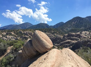
4.57.37 mi / 1870 ft gainWhat a hidden gem! A martian landscape full of faultline desert rock formations and joshua trees against a mountainous backdrop of the San Gabriels. Devil's Punchbowl Natural Area features a 1 mile well-marked, well-maintained single track loop trail inside the Punchbowl (great for kids) and a 7 ...Read more -
Pearblossom, California
Manzanita Trail
11.4 mi / 3051 ft gainManzanita Trail is an out-and-back trail that is moderately difficult located near Valyermo, California.Read more -
Pearblossom, California
Mount Williamson and Pleasant View Ridge via Pacific Crest Trail
6.1 mi / 2156 ft gainMount Williamson and Pleasant View Ridge via Pacific Crest Trail is an out-and-back trail that provides a good opportunity to view wildlife located near Azusa, California.Read more -
Pearblossom, California
Mount Williamson via Pacific Crest Trail
3.85 mi / 1552 ft gainMount Williamson via Pacific Crest Trail is an out-and-back trail that provides a good opportunity to view wildlife located near Valyermo, California.Read more -
Palmdale, California
Barrel Springs Trail
2.55 mi / 46 ft gainBarrel Springs Trail is an out-and-back trail where you may see local wildlife located near Palmdale, California.Read more -
Pearblossom, California
Cooper Canyon Falls Trail
6.29 mi / 1309 ft gainCooper Canyon Falls Trail is a loop trail that takes you by a waterfall located near Mount Wilson, California.Read more -
Pearblossom, California
Cooper Canyon via Cloudburst Summit
7.64 mi / 1739 ft gainCooper Canyon via Cloudburst Summit is an out-and-back trail that takes you by a waterfall located near Palmdale, California.Read more -
Pearblossom, California
Hike to the Cooper Canyon Trail Camp
5 mi / -765 ft gainThere's a small parking lot just below Cloudburst Summit on the way to Waterman Mountain. Start your adventure there. I'd be hard pressed to say it's more than 15 yards from the sign for the summit (7018' AMSL). There's a fire road, if you're newer to altitude and don't know how to read a map (or...Read more -
Pearblossom, California
Winston Peak
2.38 mi / 938 ft gainWinston Peak is a loop trail that is moderately difficult located near Mount Wilson, California.Read more -
Pearblossom, California
Hike Mt. Waterman
5.06 miMt. Waterman is accessed along Highway 2 in the Angeles National Forest. Heading east from La Canada look for mileage marker 58.0 (34 miles from La Canada) just past the closed ski resort. Park at one of the large paved turn outs on your left. Display an Adventure Pass ($5 at Ranger Station or Bi...Read more -
Pearblossom, California
Akawie Peak
1.35 mi / 367 ft gainAkawie Peak is an out-and-back trail where you may see wildflowers located near Mount Wilson, California.Read more -
Pearblossom, California
Islip Saddle to Mt Islip via Little Jimmy Campground
6.59 mi / 1568 ft gainIslip Saddle to Mt Islip via Little Jimmy Campground is an out-and-back trail where you may see beautiful wildflowers located near Mount Wilson, California.Read more -
Pearblossom, California
Islip Saddle to Mt. Williamson Via Pacific Crest Trail
5.19 mi / 1594 ft gainIslip Saddle to Mt. Williamson via Pacific Crest Trail is an out-and-back trail where you may see beautiful wildflowers located near Mount Wilson, California.Read more -
Pearblossom, California
Mount Islip, Middle Hawkins, Mount Hawkins, and Baden Powell via PCT
19.26 mi / 4685 ft gainMount Islip, Middle Hawkins, Mount Hawkins, and Baden Powell via PCT is an out-and-back trail that provides a good opportunity to view wildlife located near Pearblossom, California.Read more -
Los Angeles County, California
Mt. Williamson via Islip Saddle
4.16 mi / 1519 ft gainThe trailhead is immediately off of Angeles Crest Highway CA-2 at Islip Saddle. It's just a touch over 2 miles to reach the summit, through which you'll be hiking among the pine tree forest practically the entire way up (part of this trail doubles as the Pacific Crest Trail). The summit is larg...Read more -
Pearblossom, California
Cooper Canyon Falls
5.03.01 mi / 755 ft gainBurkhart Trail is well-defined and easy to follow through an unbelievable old growth of Jeffrey pines, incense-cedars and surprisingly, redwoods! At 0.25 miles, there is a steep spur trail near a large pile of boulders that leads to a popular swimming area, often frequented by guests of the campg...Read more


