The Best Hiking in Tulare
Looking for the best hiking in Tulare? We've got you covered with the top trails, trips, hiking, backpacking, camping and more around Tulare. The detailed guides, photos, and reviews are all submitted by the Outbound community.
Top hiking spots in and near Tulare
-
Three Rivers, California
Skyline Loop and Salt Creek Falls
6.33 mi / 1601 ft gainSkyline Loop and Salt Creek Falls is a loop trail that takes you by a waterfall located near Three Rivers, California.Read more -
Springville, California
Cahoon Rock from South Fork Campground
28.22 mi / 6880 ft gainCahoon Rock from South Fork Campground is an out-and-back trail that takes you by a river located near Three Rivers, California.Read more -
Springville, California
Ladybug Camp Trail
7.54 mi / 1827 ft gainLadybug Camp Trail is an out-and-back trail that takes you by a river located near Three Rivers, California.Read more -
Springville, California
Balch Park Trail
20.63 mi / 5912 ft gainBalch Park Trail is a loop trail that takes you by a lake located near Springville, California.Read more -
Sequoia National Park, California
Potwisha Campground Trail
1.6 mi / 223 ft gainPotwisha Campground Trail is an out-and-back trail that takes you by a river located near Three Rivers, California.Read more -
Springville, California
Shake Camp Campground to Maggie Lakes
22.8 mi / 5538 ft gainShake Camp Campground to Maggie Lakes is an out-and-back trail that takes you by a lake located near Springville, California.Read more -
Springville, California
Shake Camp and the Tule River
11.41 mi / 3117 ft gainShake Camp and the Tule River is an out-and-back trail that is moderately difficult located near Springville, California.Read more -
Sequoia National Park, California
Paradise Creek Trail
5.29 mi / 1201 ft gainParadise Creek Trail is an out-and-back trail that takes you by a river located near Three Rivers, California.Read more -
Three Rivers, California
Crystal Cave Trail
0.77 mi / 331 ft gainCrystal Cave Trail is an out-and-back trail that takes you by a waterfall located near Three Rivers, California.Read more -
Sequoia National Park, California
Backpack Bearpaw Meadow to Redwood Meadow
21.3 mi / 5400 ft gainRedwood Meadow is absolutely gorgeous - an amazing reward for your backpacking efforts. This trail is a great backpacking route to take in the early spring when elevated trails are still covered in snow. The trail progresses from the foothills to a giant sequoia grove. The rivers can be a bit cha...Read more -
Sequoia National Park, California
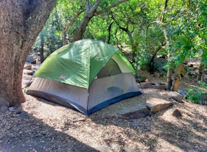
Camp at Buckeye Flat in Sequoia National Park
Entering Sequoia National Park at the Ash Mountain Entrance near the small city of Three Rivers, follow Highway 198 (Generals Highway) through the park until you see a sign for Buckeye Flat Campground off to the right. The campground sign is immediately after you see signs for Hospital Rock. Foll...Read more -
Sequoia National Park, California
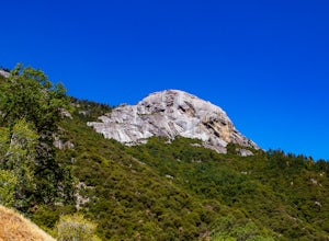
Hike Moro Rock
5.0Moro Rock is a granite dome with a staircase leading to the 6,725 foot summit, where you can enjoy a spectacular view of the Great Western Divide. From Generals Hwy, you can drive up Crescent Meadow Road to the parking lot at the base of Moro Rock (summer weekends the road is closed for shuttles ...Read more -
Sequoia National Park, California
Hike the Hanging Rock Trail
0.5 mi / 108 ft gainThe Hanging Rock Trail offers great views of Morro Rock and is a superb lunch stop. Follow the trail as it turns to the left and then to the right up a ridge toward Hanging Rock. As you head up the slope, you will see two overlooks on the left. Step off the main trail at the first lookout to see ...Read more -
47050 Generals Highway, California
Bear Hill Trail
2.04 mi / 600 ft gainBear Hill Trail is a loop trail that takes you through a nice forest located near Three Rivers, California.Read more -
Sequoia National Park, California
Big Trees Trail
1.33 mi / 262 ft gainBig Trees Trail is a loop trail where you may see beautiful wildflowers located near Stony Creek Village, California.Read more -
47050 Generals Highway, California
Moro Rock Full Trail
3.97 mi / 1237 ft gainMoro Rock Full Trail is an out-and-back trail where you may see beautiful wildflowers located near Stony Creek Village, California.Read more


