The Best Hiking in Agoura Hills
Looking for the best hiking in Agoura Hills? We've got you covered with the top trails, trips, hiking, backpacking, camping and more around Agoura Hills. The detailed guides, photos, and reviews are all submitted by the Outbound community.
Top hiking spots in and near Agoura Hills
-
Agoura Hills, California
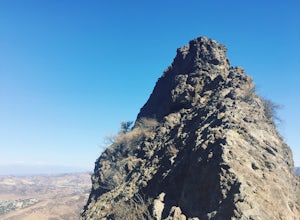
Climb to the Top of Ladyface
4.52 mi / 1150 ft gainLadyface is a volcanic ridge that juts up over Agoura Hills. It is a short but steep hike up the ridgeline, and it offers amazing views to either side. Sections of the trail are steep and sandy so it can be challenging to maintain your footing. Trekking poles are optional and can help with the de...Read more -
Agoura Hills, California
Ladyface Trail
2.06 mi / 971 ft gainLadyface Trail is an out-and-back trail located near Agoura Hills, California.Read more -
Agoura Hills, California
Overlook Trail Loop
2.1 mi / 164 ft gainOverlook Trail Loop is a loop trail that takes you by a river located near Agoura Hills, California.Read more -
Agoura Hills, California
Coyote Canyon Trail to Hacienda Trail Loop
1.01 mi / 108 ft gainCoyote Canyon Trail to Hacienda Trail Loop is a loop trail where you may see wildflowers located near Agoura Hills, California.Read more -
Agoura Hills, California
Paramount Ranch Perimeter Loop
2.24 mi / 177 ft gainParamount Ranch Perimeter Loop is a loop trail that takes you through a nice forest located near Agoura Hills, California.Read more -
Westlake Village, California
Windmill Canyon via Wishbone Trail
2.49 mi / 558 ft gainWindmill Canyon via Wishbone Trail is an out-and-back trail that is good for all skill levels located near Westlake Village, California.Read more -
Agoura Hills, California
Reagan Ranch Trail
2.81 mi / 486 ft gainReagan Ranch Trail is a loop trail that takes you by a river located near Agoura Hills, California.Read more -
Agoura Hills, California
Palo Comado Connector Trail
7.97 mi / 965 ft gainPalo Comado Connector Trail is a loop trail where you may see wildflowers located near Agoura Hills, California.Read more -
Westlake Village, California
Pentachaeta Loop
4.37 mi / 883 ft gainPentachaeta Loop is a loop trail that takes you by a lake located near Westlake Village, California.Read more -
Oak Park, California
Smoke Tree Trail
1.05 mi / 121 ft gainSmoke Tree Trail is an out-and-back trail where you may see beautiful wildflowers located near Oak Park, California.Read more -
Agoura Hills, California
Liberty Canyon Natural Preserve Trail
5.77 mi / 679 ft gainLiberty Canyon Natural Preserve Trail is a loop trail that is good for all skill levels located near Calabasas, California.Read more -
Oak Park, California
Oak Canyon Trail
2.15 mi / 249 ft gainOak Canyon Trail is a loop trail where you may see wildflowers located near Oak Park, California.Read more -
Agoura Hills, California
Cistern Trail to Lookout Trail
1.43 mi / 351 ft gainCistern Trail to Lookout Trail is an out-and-back trail that takes you past scenic surroundings located near Calabasas, California.Read more -
Agoura Hills, California
Cistern Trail to Forest Trail
3.14 mi / 397 ft gainCistern Trail to Forest Trail is a loop trail that takes you by a lake located near Agoura Hills, California.Read more -
Agoura Hills, California
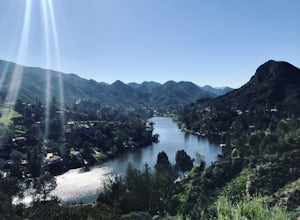
Hike to the Malibu Lake Overlook
5.05 mi / 350 ft gainTo get to the trail, use the address 27800 Mulholland Highway, Agoura Hills, CA 91301. This will take you to a dirt pull off right off the Mulholland Highway. At the southern part of the pull off, you'll see a dirt path leading up and away from the road. This is the Cistern Trail Trailhead. You'l...Read more -
Oak Park, California
Doubletree Trail
2.48 mi / 453 ft gainDoubletree Trail is an out-and-back trail that provides a good opportunity to view wildlife located near Oak Park, California.Read more


