The Best Hiking in Bakersfield
Looking for the best hiking in Bakersfield? We've got you covered with the top trails, trips, hiking, backpacking, camping and more around Bakersfield. The detailed guides, photos, and reviews are all submitted by the Outbound community.
Top hiking spots in and near Bakersfield
-
Bakersfield, California
Bakersfield Bluffs
3.21 mi / 279 ft gainBakersfield Bluffs is a loop trail that takes you by a river located near Bakersfield, California.Read more -
Bakersfield, California
Hart Park Big Loop
6.39 mi / 1001 ft gainHart Park Big Loop is a loop trail that takes you by a river located near Bakersfield, California.Read more -
Bakersfield, California
Hart Park Trail
4.01.97 mi / 436 ft gainHart Park Trail is a loop trail that takes you by a river located near Bakersfield, California.Read more -
Bakersfield, California
Kern River Parkway Trail
20.69 mi / 446 ft gainKern River Parkway Trail is a point-to-point trail that takes you by a river located near Tupman, California.Read more -
Bakersfield, California
Oak Flat Lookout
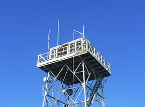
4.0/ 80 ft gainSpend a few nights under the stars in a unique piece of outdoor history. The Oak Flat Lookout, constructed in 1934, was once staffed by rangers providing critical wild life management services on watch for wildfires in the surrounding Sequoia National Forest through the 1980s. The Oak Flat lookou...Read more -
Bakersfield, California
Hike the Mill Creek Trail to Breckenridge Road
7.5 mi / 3000 ft gainStarting at about 2000 elevation this hike is very gentle and nice for the first 2 miles. On the third mile it is a steep climb with short lengths of level ground the rest of the way. The junction at Breckenridge Road is at about 5500 elevation. If you hit the trail in the winter, there are some ...Read more -
Bakersfield, California
Kern Canyon Trail
9.76 mi / 3320 ft gainKern Canyon Trail is an out-and-back trail where you may see beautiful wildflowers located near Caliente, California.Read more -
Bakersfield, California
Kern River Trail
5.93 mi / 1522 ft gainKern River Trail is an out-and-back trail that takes you by a river located near Bodfish, California.Read more -
Bakersfield, California
Hike the San Emigdio Trail in the Wind Wolves Preserve
4.05 mi / 200 ft gainThis area is a family friendly hiking area for beginners. The farthest place to hike on the map is call Reflection Pond and is about a 7 mile hike out and back. The main trail called San Emigdio Trail runs right next to a stream the whole time. It is a really nice area for a day hike to find some...Read more -
Bakersfield, California
Tule Elk Trail to El Camino Viejo Trail
7.45 mi / 1014 ft gainTule Elk Trail to El Camino Viejo Trail is a loop trail where you may see wildflowers located near Bakersfield, California.Read more -
Kern County, California
Remington Ridge Trail
11.45 mi / 3927 ft gainTo get to the trailhead, take Highway 178 and turn onto Borel Road, then turn onto Kern Canyon Road and follow the road. It might be easiest to put the Hot Springs into Google Maps and use that to navigate you to the parking lot. Park in the lot and walk across the road, where you'll see a sign l...Read more -
Kern County, California
Remington Hot Springs
2.00.27 mi / 36 ft gain...One thing about hot springs is that no matter where it may be, they always bring an attraction of people. I can honestly say I don't think I've ever been to a hot spring that didn't gather more then 20+ people in a single sitting. I mean, in all seriousness aside, what's not to like about a ba...Read more -
Wofford Heights, California
Unal Trail
3.25 mi / 846 ft gainUnal Trail is a loop trail where you may see local wildlife located near Wofford Heights, California.Read more -
Frazier Park, California
Eagle Pass Ridge
1.26 mi / 220 ft gainEagle Pass Ridge is an out-and-back trail that takes you by a river located near Frazier Park, California.Read more -
Lake Isabella, California
Isabella Lake
1.06 mi / 43 ft gainIsabella Lake is a loop trail that is good for all skill levels located near Lake Isabella, California.Read more -
Frazier Park, California
Mount Pinos via McGill Trail
4.015.99 mi / 3196 ft gainMount Pinos via McGill Trail is an out-and-back trail that provides a good opportunity to view wildlife located near Frazier Park, California.Read more


