The Best Hiking in Cool
Looking for the best hiking in Cool? We've got you covered with the top trails, trips, hiking, backpacking, camping and more around Cool. The detailed guides, photos, and reviews are all submitted by the Outbound community.
Top hiking spots in and near Cool
-
Cool, California
The Cool to Canyon Loop Trail
5.94 mi / 1083 ft gainThe Cool to Canyon Loop Trail is a loop trail that takes you by a river located near Cool, California.Read more -
Cool, California
Training Hill Loop via Rim Trail and Olmstead Loop
14.96 mi / 2162 ft gainTraining Hill Loop via Rim Trail and Olmstead Loop is a loop trail that takes you by a river located near Cool, California.Read more -
Cool, California
Rim Trail via Olmstead Loop Trail
8.2 mi / 587 ft gainRim Trail via Olmstead Loop Trail is a loop trail that takes you by a lake located near Cool, CaliforniaRead more -
Auburn, California
Rock Climb at the Quarry
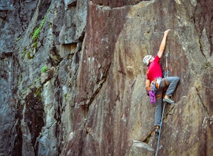
5.02.6 mi / 800 ft gainMany thanks to the Climbing Resource Advocates for Greater Sacramento (CRAGS) and the Access Fund for their hard work in re-opening this location to make it climbing-legal. Where to Park:Put in "Parking lot for the Quarry Trail, California 193, Auburn, CA 95603"This is the designated parking lot ...Read more -
Cool, California
Quarry Trail to Brown's Bar to Goat Hill
9.5 mi / 1532 ft gainQuarry Trail to Brown's Bar to Goat Hill is a loop trail where you may see local wildlife located near Auburn, California.Read more -
Cool, California
Middle Fork American River Quarry Trail
10.99 mi / 1693 ft gainMiddle Fork American River Quarry Trail is an out-and-back trail that takes you by a waterfall located near Auburn, California.Read more -
Auburn, California
Hike the Quarry Trail in the Auburn SRA
4.011 miParking in the Auburn State Recreation Area parking lot has a cost of $10.00. Free parking is allowed on the right side of the road located on the right after driving over the bridge. From here the Quarry Trail parking lot and Trail head are a short walking distance ahead on the left side of th...Read more -
Placer County, California
Clementine Trail to Clark's Pool
4.62 mi / 955 ft gainClementine Trail to Clark's Pool is an out-and-back trail that takes you by a lake located near Cool, California.Read more -
Auburn, California
Hike to the North Fork Dam of Lake Clementine
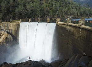
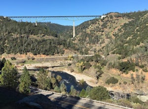
5.04 miLocated only roughly 40 minutes from Sacramento. This trail will allow you to view and walk under the 5th largest bridge in the US as well as enjoy the waterfall spectacle of a top releasing Dam. Once reaching Old Foresthill Road from the town of Auburn, drive over the smaller bridge spanning the...Read more -
Auburn, California
Training Hill
4.52 mi / 1070 ft gainTraining Hill is a loop trail where you may see wildflowers located near Cool, California.Read more -
Auburn, California
Western States Trail to Calcutta Falls
2.13 mi / 233 ft gainWestern States Trail to Calcutta Falls is an out-and-back trail that takes you by a waterfall located near Auburn, California.Read more -
Auburn, California
Hike Training Hill
4.54.5 mi / 1126 ft gainTraining Hill is a 4.5 mile loop trail that features beautiful meadows and wildflowers, with limited views to Folsom Lake and the Auburn canyon. The trail to Training Hill branches off from the Calcutta Falls trail right before the first cement bridge over the American River. Training Hill is r...Read more -
Auburn, California
Western States Trail to Robie Point Fire Break
5.2 mi / 689 ft gainWestern States Trail to Robie Point Fire Break is a loop trail where you may see beautiful wildflowers located near Auburn, California.Read more -
Auburn, California
Confluence and Clementine Trail Loop
6.21 mi / 1371 ft gainConfluence and Clementine Trail Loop is a loop trail that takes you past scenic surroundings located near Auburn, California.Read more -
Auburn, California
Western States Trail to Manzanita Trail Loop
4.38 mi / 771 ft gainWestern States Trail to Manzanita Trail Loop is a loop trail that takes you by a waterfall located near Auburn, California.Read more -
Auburn, California
Robbie Point Trail
2.6 mi / 308 ft gainRobbie Point Trail is a loop trail that takes you past great forest setting located near Auburn, CaliforniaRead more


