The Best Hiking in Death Valley
Looking for the best hiking in Death Valley? We've got you covered with the top trails, trips, hiking, backpacking, camping and more around Death Valley. The detailed guides, photos, and reviews are all submitted by the Outbound community.
Top hiking spots in and near Death Valley
-
Stovepipe Wells, California
Mosaic Canyon Trail
3.53 mi / 1224 ft gainMosaic Canyon Trail is an out-and-back trail that provides a good opportunity to view wildlife located near Death Valley, California.Read more -
DEATH VALLEY, California
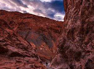
Hike Mosaic Canyon, Death Valley
4.02 mi / 814 ft gainMosaic Canyon is located a quarter mile west of Stovepipe Wells Village. From the 190 Highway, take the 2 mile gravel road to the canyon parking lot. The road is very rough and bumpy, but a regular passenger car will be able to make the drive. A high clearance 4x4 vehicle will not have any proble...Read more -
Death Valley, California
Grotto Canyon
2.09 mi / 702 ft gainGrotto Canyon is an out-and-back trail where you may see local wildlife located near Death Valley, California.Read more -
Death Valley, California
Explore Grotto Canyon
2.1 mi / 649 ft gainThis is a rewarding hike with immediate payoff. After less than half a mile, you'll come across dry falls. Dogs are allowed on this trail but must be kept on leash. Make sure your vehicle has 4WD to avoid getting stuck in the deep sand in the parking area and on the drive.Read more -
Stovepipe Wells, California
Little Bridge Canyon Trail
5.75 mi / 1867 ft gainLittle Bridge Canyon Trail is an out-and-back trail where you may see wildflowers located near Death Valley, California.Read more -
Death Valley, California
Mesquite Flat Sand Dunes Trail
2.86 mi / 59 ft gainMesquite Flat Sand Dunes Trail is an out-and-back trail where you may see wildflowers located near Death Valley, California.Read more -
Death Valley, California
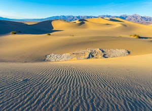
Photographing the Mesquite Flat Sand Dunes
4.9The Mesquite Flat Sand Dunes are the most photographed dunes at Death Valley National Park. To reach the dune’s parking lot from Furnace Creek, drive 22 miles west on Highway 190. Three miles before you reach Stovepipe Wells, the dunes will be clearly visible from the road and you’ll turn right i...Read more -
Inyo County, California
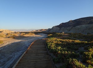
Hike the Salt Creek Interpretive Trail
5.00.9 mi / 26 ft gainThe trail is a loop boardwalk. At the furthest point, there is a sandy footpath that will lead you to a creek and will provide a more secluded experience. Interpretive signs have been placed strategically on the trail, pointing out species of interest. The endangered pupfish is found in this cree...Read more -
Inyo County, California
Historic Stovepipe Well
0.59 mi / 23 ft gainHistoric Stovepipe Well is a loop trail that is good for all skill levels located near Death Valley, California.Read more -
Inyo County, California
Texas Spring Campground
This is one of the best campgrounds in Death Valley that gives you the true experience of camping in the middle of a desert. The campground is surrounded with badlands and hills where you can climb to explore and see a panoramic view of mountains all around. Texas Spring campground offers 92 sit...Read more -
Furnace Creek, California
Texas Springs Trail
1.8 mi / 367 ft gainTexas Springs Trail is an out-and-back trail where you may see beautiful wildflowers located near Death Valley, California.Read more -
Furnace Creek, California
Gower Gulch Loop Trail
4.2 mi / 725 ft gainGower Gulch Loop Trail is a loop trail where you may see local wildlife located near Death Valley, California.Read more -
Furnace Creek, California
Golden Canyon Trail to Red Cathedral
2.91 mi / 617 ft gainGolden Canyon Trail to Red Cathedral is an out-and-back trail where you may see beautiful wildflowers located near Death Valley, California.Read more -
Furnace Creek, California
Hike the Gower Gulch Trail
4.2 mi / 688 ft gainThe Gower Gulch Trail is a surreal desert landscape. Golden Canyon is very colorful, and the short side trail to Red Cathedral i swell worth the scramble up the dry falls. The view of the valley from a higher vantage point is priceless. The portion of the hike in Gower Gulch features subtle canyo...Read more -
Furnace Creek, California
Hike Golden Canyon, Death Valley
5.01.5 mi / 685 ft gainGolden Canyon is located about 10 minutes south of Furnace Creek in Death Valley NP, on Badwater Road. Entering "Golden Canyon, Death Valley" into your phone or GPS will take you to the Golden Canyon parking area. The trail starts right off the parking lot and goes for about 1.5 miles to Red Cath...Read more -
Furnace Creek, California
Desolation Canyon Trail
3.59 mi / 722 ft gainDesolation Canyon Trail is an out-and-back trail where you may see beautiful wildflowers located near Death Valley, California.Read more


