The Best Hiking in Kern County
Looking for the best hiking in Kern County? We've got you covered with the top trails, trips, hiking, backpacking, camping and more around Kern County. The detailed guides, photos, and reviews are all submitted by the Outbound community.
Top hiking spots in and near Kern County
-
Tehachapi, California
TMTA Lehigh Trail Loop
10.26 mi / 1644 ft gainTMTA Lehigh Trail Loop is a loop trail where you may see beautiful wildflowers located near Tehachapi, California.Read more -
Kern County, California
PCT: CA Section F - Tehachapi Pass to Walker Pass
83.69 mi / 15377 ft gainPCT: CA Section F - Tehachapi Pass to Walker Pass is a point-to-point trail where you may see wildflowers located near Mojave, California.Read more -
Bakersfield, California
Hike the Mill Creek Trail to Breckenridge Road
7.5 mi / 3000 ft gainStarting at about 2000 elevation this hike is very gentle and nice for the first 2 miles. On the third mile it is a steep climb with short lengths of level ground the rest of the way. The junction at Breckenridge Road is at about 5500 elevation. If you hit the trail in the winter, there are some ...Read more -
Bakersfield, California
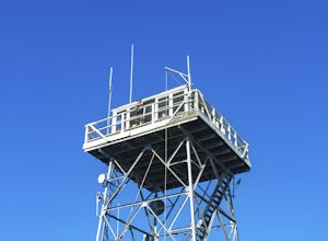
Oak Flat Lookout
4.0/ 80 ft gainSpend a few nights under the stars in a unique piece of outdoor history. The Oak Flat Lookout, constructed in 1934, was once staffed by rangers providing critical wild life management services on watch for wildfires in the surrounding Sequoia National Forest through the 1980s. The Oak Flat lookou...Read more -
Bakersfield, California
Hart Park Trail
4.01.97 mi / 436 ft gainHart Park Trail is a loop trail that takes you by a river located near Bakersfield, California.Read more -
Bakersfield, California
Hart Park Big Loop
6.39 mi / 1001 ft gainHart Park Big Loop is a loop trail that takes you by a river located near Bakersfield, California.Read more -
Bakersfield, California
Kern Canyon Trail
9.76 mi / 3320 ft gainKern Canyon Trail is an out-and-back trail where you may see beautiful wildflowers located near Caliente, California.Read more -
Bakersfield, California
Kern River Trail
5.93 mi / 1522 ft gainKern River Trail is an out-and-back trail that takes you by a river located near Bodfish, California.Read more -
Bakersfield, California
Bakersfield Bluffs
3.21 mi / 279 ft gainBakersfield Bluffs is a loop trail that takes you by a river located near Bakersfield, California.Read more -
Lake Hughes, California
Liebre Mountain via Pacific Crest Trail
7.16 mi / 1939 ft gainLiebre Mountain via Pacific Crest Trail is an out-and-back trail where you may see wildflowers located near Lake Hughes, California.Read more -
Lake Hughes, California
Hike the Pacific Crest Trail from Horse Trail to Bear Campground
11.63 mi / 2396 ft gainThis is part of the Pacific Crest Trail. If you're through-hiking or sectional hiking, you'll have to hit it eventually. Try and avoid it in the late summer or early fall because of heat, and gnats. Find a way to check the bug report, we got marauded by gnats 90% of the way (early October) and ap...Read more -
Lake Hughes, California
Horse Camp Trail
24.18 mi / 4806 ft gainHorse Camp Trail is a moderately trafficked point-to-point trail located near Lake Hughes, California.Read more -
Kern County, California
Remington Ridge Trail
11.45 mi / 3927 ft gainTo get to the trailhead, take Highway 178 and turn onto Borel Road, then turn onto Kern Canyon Road and follow the road. It might be easiest to put the Hot Springs into Google Maps and use that to navigate you to the parking lot. Park in the lot and walk across the road, where you'll see a sign l...Read more -
Kern County, California
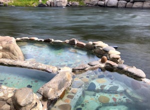
Remington Hot Springs
2.00.27 mi / 36 ft gain...One thing about hot springs is that no matter where it may be, they always bring an attraction of people. I can honestly say I don't think I've ever been to a hot spring that didn't gather more then 20+ people in a single sitting. I mean, in all seriousness aside, what's not to like about a ba...Read more -
Lake Hughes, California
Sandberg Trail
5.27 mi / 1319 ft gainSandberg Trail is a loop trail where you may see local wildlife located near Lake Hughes, California.Read more -
Lake Hughes, California
Gillette Mine Trail
9.96 mi / 2359 ft gainGillette Mine Trail is an out-and-back trail that takes you past scenic surroundings located near Lake Hughes, California.Read more


