The Best Hiking in Los Altos
Looking for the best hiking in Los Altos? We've got you covered with the top trails, trips, hiking, backpacking, camping and more around Los Altos. The detailed guides, photos, and reviews are all submitted by the Outbound community.
Top hiking spots in and near Los Altos
-
Palo Alto, California
Bol Park Bike Path
2.66 mi / 82 ft gainBol Park Bike Path is a loop trail where you may see wildflowers located near Stanford, California.Read more -
Los Altos Hills, California
Rhus Ridge and Chamise Trail
10.1 mi / 1555 ft gainRhus Ridge and Chamise Trail is a point-to-point trail where you may see wildflowers located near Los Altos, CaliforniaRead more -
Los Altos Hills, California
Rhus Ridge and Creek Trail Loop
6.3 mi / 1512 ft gainRhus Ridge and Chamise Trail is a loop trail where you may see wildflowers located near Los Altos, CaliforniaRead more -
Los Altos Hills, California
Rhus Ridge Trail
1.7 mi / 626 ft gainRhus Ridge Trail is an out and back trail where you may see wildflowers located near Los Altos, CaliforniaRead more -
Santa Clara County, California
Hike up Black Mountain (Rhus Ridge Trail)
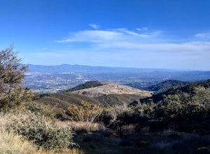
9.8 mi / 2404 ft gainJust outside of Los Altos is a very long ridge of mountains, one of which is Black Mountain. This is a very dry hike, with no tree canopy, so it can get very hot! Be aware that this can make the hike feel a lot more difficult with the sun beating down on you. Follow Rhus Ridge Trail to Black Mou...Read more -
Los Altos Hills, California
Rhus Ridge to Mary Davey and Chamise Loop Trail
2.6 mi / 751 ft gainRhus Ridge to Mary Davey and Chamise Loop Trail is an out and back trail where you may see wildflowers located near Los Altos, CaliforniaRead more -
Mountain View, California
Sylvan Park Loop
0.41 mi / 33 ft gainSylvan Park Loop is a loop trail that is good for all skill levels located near Mountain View, California.Read more -
Palo Alto, California
Meadowlark and Ohlone Trails Loop
4.19 mi / 495 ft gainMeadowlark and Ohlone Trails Loop is a loop trail that provides a good opportunity to see wildlife located near Palo Alto, California.Read more -
Palo Alto, California
Hike the Arastradero Preserve Loop
3.04.5 mi / 600 ft gainGetting There: From Hwy 280, take the Page Mill Road exit and head West on Page Mill Road, away from Downtown Palo Alto (if you're taking 101, exit on Oregon Expressway). Then turn right on Arastradero Road. There will be a small sign indicating the dirt parking lot on the eastern side of the str...Read more -
Palo Alto, California
Arastradero Lake Via Juan Batista de Anza and Wild Rye Trails
1.52 mi / 144 ft gainArastradero Lake Via Juan Batista de Anza and Wild Rye Trails is a loop trail that takes you by a lake located near Palo Alto, California.Read more -
Palo Alto, California
Redtail Loop Trail
1.2 mi / 131 ft gainRedtail Loop Trail Is a loop trail that takes you past scenic views located near Palo Alto, CaliforniaRead more -
Palo Alto, California
Redtail Loop Trail to Arastradero Creek Trail Loop
5.2 mi / 708 ft gainRedtail Loop Trail to Arastradero Creek Trail Loop is a loop trail that takes you by a lake located near Palo Alto, CaliforniaRead more -
Palo Alto, California
Arastradero Lake
1.4 mi / 115 ft gainArastradero Lake is an out-and-back trail where you may see wildflowers located near Palo Alto, California.Read more -
Palo Alto, California
North Bayfront Loop Trail
5.3 mi / 125 ft gainNorth Bayfront Loop Trail is a loop trail where you may see beautiful wildflowers located near Palo Alto, California.Read more -
Palo Alto, California
Adobe Creek Trail
5.86 mi / 194 ft gainAdobe Creek Trail To Shoreline Lake Park is an out-and-back trail that takes you by a lake located near Palo Alto, California.Read more -
Los Altos, California
Park Day at Foothills Park
1.7Disclaimer: Foothills Park requires proof of residence in Palo Alto or being accompanied by a resident of the city. Learn more here.Foothills Park is 2.7 miles west of 280 after exiting Page Mill. After exiting you take a short scenic drive up the hill and come to the park entrance on your right...Read more


