The Best Hiking in Palomar Mountain
Looking for the best hiking in Palomar Mountain? We've got you covered with the top trails, trips, hiking, backpacking, camping and more around Palomar Mountain. The detailed guides, photos, and reviews are all submitted by the Outbound community.
Top hiking spots in and near Palomar Mountain
-
Palomar Mountain, California
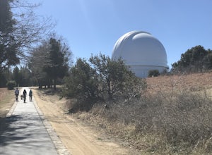
Palomar Observatory Trail
4.83 mi / 764 ft gainPalomar Observatory Trail is an out-and-back trail where you may see local wildlife located near Palomar Mountain, California.Read more -
Palomar Mountain, California
Hike to Palomar Observatory from the Palomar Observatory Campground
5.04.4 mi / 718 ft gainSituated in the Palomar Mountains of Cleveland National Forest, Palomar Observatory Campground offers many amenities for enjoyable camping and exploring the area. A portion of the campsites loop has been cleared of trees with level cement pads to allow campers to set up their own telescopes. Dr...Read more -
Warner Springs, California
Oak Grove Trail to High Point
13.43 mi / 3655 ft gainOak Grove Trail to High Point is an out-and-back trail where you may see wildflowers located near Warner Springs, California.Read more -
Warner Springs, California
Camp at Oak Grove Campground
/ 2772 ft gainApart from being visually appealing, the campground features open, yet secluded sites that are perfect for stargazing and shooting-star spotting. Each campsite has a picnic table and a grill. There are vault toilets and flush toilets. There is also potable water. If you are interested in seeing b...Read more -
Warner Springs, California
Barker Valley Spur Trail
7.48 mi / 1145 ft gainBarker Valley Spur Trail is an out-and-back trail that takes you by a waterfall located near Warner Springs, California.Read more -
Palomar Mountain, California
Hike Thunder Spring and Chimney Flat Loop
3.04 mi / 900 ft gainPalomar Mountain is the hidden gem of San Diego. Well, not so hidden per se- but most don't know that the little climb up the mountain can transport you from the prevalent brush-filled terrain of SD to a lush, diverse forest.The great thing about Palomar is that every day you visit could be compl...Read more -
Palomar Mountain, California
Hike to French Valley
5.03.8 mi / 450 ft gainWhen it comes to Palomar Mountain State Park, most people stick to Doane Lake and Upper Doane Valley. Yet on the far right of the parking lot at Doane Pond, there is actually a trailhead that will guide you to a completely different section of the park. The Lower Doane Valley trail is, in my opti...Read more -
Palomar Mountain, California
Lower Doane and Weir Trail Loop and Doane Pond
2.78 mi / 453 ft gainLower Doane and Weir Trail Loop and Doane Pond is a loop trail that is good for all skill levels located near Aguanga, California.Read more -
Palomar Mountain, California
Doane Valley Nature Trail
1.12 mi / 174 ft gainDoane Valley Nature Trail is a loop trail where you may see wildflowers located near Aguanga, California.Read more -
Palomar Mountain, California
Lower Doane Valley and French Valley
3.83 mi / 541 ft gainLower Doane Valley and French Valley is a loop trail that takes you by a waterfall located near Pauma Valley, California.Read more -
Palomar Mountain, California
Thunder Spring Trail
3.92 mi / 781 ft gainThunder Spring Trail is a loop trail where you may see wildflowers located near Aguanga, California.Read more -
Palomar Mountain, California
Cedar Trail, Weir Trail, Lower Doane Trail Loop
3.53 mi / 751 ft gainCedar Trail, Weir Trail, Lower Doane Trail Loop is a loop trail that takes you past scenic surroundings located near Palomar Mountain, California.Read more -
Palomar Mountain, California
Scotts Cabin Trail
3.16 mi / 784 ft gainScotts Cabin Trail is an out-and-back trail that takes you by a lake located near Aguanga, California.Read more -
Palomar Mountain, California
Boucher Hill Loop
1.93 mi / 295 ft gainBoucher Hill Loop is a loop trail that provides a good opportunity to see wildlife located near Palomar Mountain, California.Read more -
Palomar Mountain, California
Boucher Trail, Thunder Spring, Silvercrest Trail
5.88 mi / 1184 ft gainBoucher Trail, Thunder Spring, Silvercrest Trail is a loop trail where you may see wildflowers located near Palomar Mountain, California.Read more -
Palomar Mountain, California
Silvercrest Loop
1.53 mi / 174 ft gainSilvercrest Loop is a loop trail that takes you past scenic surroundings located near Aguanga, California.Read more


