The Best Hiking in Carbondale
Looking for the best hiking in Carbondale? We've got you covered with the top trails, trips, hiking, backpacking, camping and more around Carbondale. The detailed guides, photos, and reviews are all submitted by the Outbound community.
Top hiking spots in and near Carbondale
-
Carbondale, Colorado
Rio Grande Trail: Carbondale to Mulford
6.17 mi / 82 ft gainRio Grande Trail: Carbondale to Mulford is an out-and-back trail that takes you past scenic surroundings located near Carbondale, Colorado.Read more -
Carbondale, Colorado
Red Hill via Blue Ribbon and Three Gulch Trail
2.98 mi / 909 ft gainRed Hill via Blue Ribbon and Three Gulch Trail is a loop trail where you may see beautiful wildflowers located near Carbondale, Colorado.Read more -
Carbondale, Colorado
Mushroom Rock
2.04 mi / 797 ft gainMushroom Rock is an out-and-back trail that takes you by a river located near Carbondale, Colorado.Read more -
Carbondale, Colorado
Red Hill Via Three Poles, Mushroom Rock, Roller Coaster and Skeeter's Ridge Loop
3.31 mi / 883 ft gainRed Hill Via Three Poles, Mushroom Rock, Roller Coaster and Skeeter's Ridge Loop is a loop trail that provides a good opportunity to view wildlife located near Carbondale, Colorado.Read more -
Carbondale, Colorado
Rio Grande Trail: Carbondale Campground to Roaring Fork River
7.25 mi / 79 ft gainRio Grande Trail: Carbondale Campground to Roaring Fork River is an out-and-back trail where you may see beautiful wildflowers located near Carbondale, Colorado.Read more -
Carbondale, Colorado
Trail Run Mushroom Rock and Red Hill
5.03 miMushroom Rock sits high above Colorado Highway 82 overlooking the town of Carbondale. With huge views up the Crystal and Roaring Fork River Valleys, terrain that inspires more desert-Utah than Rocky-Mountain-Colorado, this recreation area feels like a getaway even when it is minutes from Main Str...Read more -
Carbondale, Colorado
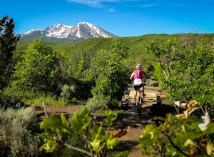
Mountain Bike Prince Creek
Turn south off Colorado State Highway 82 onto Highway 133 toward Carbondale. Continue south past the Carbondale Main Street roundabout. After two miles, turn East onto Prince Creek Road. Follow this four miles to where the pavement ends. This is the best place to park to start biking or running.F...Read more -
Glenwood Springs, Colorado
Babbish Gulch
3.19 mi / 551 ft gainBabbish Gulch is a loop trail located near Glenwood Springs, Colorado.Read more -
Basalt, Colorado
Thomas Lakes Trail
8.13 mi / 1716 ft gainThomas Lakes Trail is an out-and-back trail that takes you by a lake located near Basalt, Colorado.Read more -
Basalt, Colorado
Camp at Thomas Lake and Summit Mt. Sopris
5.013 mi / 4400 ft gainWith the Elk Mountain range behind it, It appears to be standing by itself, and has the resemblance of a grand volcano.From Hwy 133 out of Carbondale, turn down Prince Creek Road and drive 6 miles to the trailhead. The trail is a nice mixture of meadows and woods, with excellent views of the vall...Read more -
Basalt, Colorado
Hike Hay Park
Head south out of Carbondale on Highway 133. Two miles from the Main Street roundabout, take a left on Prince Creek Road. Follow this road up to Dinkle Divide and follow the signs to Dinkle Lake. Continue up the road until you see a large, fenced in parking area with a toilet on the left. This is...Read more -
New Castle, Colorado
Beaver Creek Trail to Marion Gulch
13.2 mi / 2648 ft gainBeaver Creek Trail to Marion Gulch is an out-and-back trail where you may see beautiful wildflowers located near Glenwood Springs, Colorado.Read more -
Carbondale, Colorado
Lake Ridge Lakes Trail
5.08 mi / 2011 ft gainLake Ridge Lakes Trail is an out-and-back trail that takes you by a river located near Carbondale, Colorado.Read more -
Basalt, Colorado
Arbaney Kittle Trail
20.86 mi / 4619 ft gainArbaney Kittle Trail is an out-and-back trail where you may see beautiful wildflowers located near Basalt, Colorado.Read more -
Basalt, Colorado
Arbaney Kittel Day Hike
3.46 mi / 1411 ft gainArbaney Kittel Day trail is an out-and-back trail where you may see beautiful wildflowers located near Basalt, Colorado.Read more -
Glenwood Springs, Colorado
Hike the Grizzly Creek Trail
5.07.9 mi / 1900 ft gainTake exit 121 off Interstate 70 (a rest stop exit), and follow signs to a secondary parking lot near Grizzly Creek. This is a great addition to the nearby Hanging Lake & Spouting Rock hikes just 4 miles East on I-70. Because these two are so popular, Grizzly Creek is a great, not very well kn...Read more


