The Best Hiking in Montrose
Looking for the best hiking in Montrose? We've got you covered with the top trails, trips, hiking, backpacking, camping and more around Montrose. The detailed guides, photos, and reviews are all submitted by the Outbound community.
Top hiking spots in and near Montrose
-
Crawford, Colorado
Warner Route
4.33 mi / 3228 ft gainWarner Route is an out-and-back trail that takes you by a river located near Montrose, Colorado.Read more -
Crawford, Colorado
Warner Point Nature Trail
5.01.52 mi / 279 ft gainWarner Point Nature Trail is an out-and-back trail that takes you by a river located near Montrose, Colorado.Read more -
Montrose County, Colorado
Snowshoe in Black Canyon of the Gunnison National Park
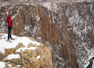
2 mi / 377 ft gainWinter is a great time to visit Black Canyon of the Gunnison National Park. Covered in snow, the canyon seems even more dramatic and sheer. The park road is plowed up until the visitor center, and there is no entrance fee in the winter. The rest of the park road is groomed for cross country skiin...Read more -
Crawford, Colorado
Sunset View Trail
0.09 mi / 30 ft gainSunset View Trail is an out-and-back trail where you may see local wildlife located near Montrose, Colorado.Read more -
Crawford, Colorado
Dragon Point Trail
0.37 mi / 52 ft gainDragon Point Trail is an out-and-back trail where you may see local wildlife located near Montrose, Colorado.Read more -
Crawford, Colorado
Cedar Point Nature Trail
0.42 mi / 167 ft gainCedar Point Nature Trail is an out-and-back trail that takes you by a river located near Montrose, Colorado.Read more -
Montrose, Colorado
Hike to Tomichi Point and Gunnison Point Overlooks
5.02 miTo access the South Rim of the Black Canyon of the Gunnison National Park, take US 50 and CO 347 to the south entrance, 15 miles east of Montrose. There is no bridge between the north and south rims of the canyon - make sure you enter from the Montrose side.After passing through the entrance stat...Read more -
Montrose, Colorado
Devils Lookout Trail
0.52 mi / 243 ft gainDevils Lookout Trail is an out-and-back trail that takes you past scenic surroundings located near Montrose, Colorado.Read more -
Montrose, Colorado
Rock Point Trail
0.38 mi / 56 ft gainRock Point Trail is an out-and-back trail that takes you past scenic surroundings located near Montrose, Colorado.Read more -
Crawford, Colorado
Hike to the Painted Wall
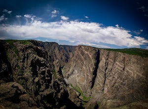
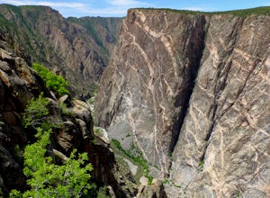
4.51 mi / 25 ft gainAt 2,250 feet, the Painted Wall in Black Canyon of the Gunnison is a sight that cannot be truly captured in photos. The layers of rock along the cliff's wall resembles a canvas with streaks from a paintbrush. This canyon took eons to create, and this view of the river and canyon walls is the high...Read more -
Crawford, Colorado
Painted Wall View Trail
0.24 mi / 59 ft gainPainted Wall View Trail is an out-and-back trail where you may see beautiful wildflowers located near Montrose, Colorado.Read more -
Montrose, Colorado
Hike the Gunnison Route
5.02 mi / 1800 ft gainImmediately upon arriving, secure a permit to scramble down 1,800ft in one mile to the Gunnison River. There are no hiking trails below the rim of the canyon, and because of its relentless steepness and rock exposure, the only existing routes are incredibly steep and loose. To protect the delicat...Read more -
Montrose, Colorado
Pulpit Rock Overlook Trail
0.12 mi / 98 ft gainPulpit Rock Overlook Trail is an out-and-back trail that provides a good opportunity to view wildlife located near Montrose, Colorado.Read more -
Montrose, Colorado
Cross Fissures Trail
0.27 mi / 52 ft gainCross Fissures Trail is an out-and-back trail that takes you past scenic surroundings located near Montrose, Colorado.Read more -
Montrose, Colorado
Tomichi Trail
1.26 mi / 1722 ft gainTomichi Trail is an out-and-back trail that takes you by a river located near Cimarron, Colorado.Read more -
Montrose, Colorado
Oak Flat Loop Trail
1.38 mi / 335 ft gainOak Flat Loop Trail is a loop trail where you may see beautiful wildflowers located near Cimarron, Colorado.Read more


