The Best Hiking in Sisters
Looking for the best hiking in Sisters? We've got you covered with the top trails, trips, hiking, backpacking, camping and more around Sisters. The detailed guides, photos, and reviews are all submitted by the Outbound community.
Top hiking spots in and near Sisters
-
Sisters, Oregon
Peterson Ridge Trail
14.84 mi / 981 ft gainPeterson Ridge Trail is a loop trail that takes you by a river located near Sisters, Oregon.Read more -
Bend, Oregon
Peterson Ridge Overlook
4.41 mi / 476 ft gainPeterson Ridge Overlook is an out-and-back trail that provides a good opportunity to view wildlife located near Sisters, Oregon.Read more -
Sisters, Oregon
Whychus Creek Overlook
0.86 mi / 30 ft gainWhychus Creek Overlook is a loop trail that takes you by a river located near Sisters, Oregon.Read more -
Sisters, Oregon
Whychus Rim and Creek Loop
4.73 mi / 531 ft gainWhychus Rim and Creek Loop is a loop trail that takes you by a river located near Sisters, Oregon.Read more -
Camp Sherman, Oregon
Black Butte
4.53.94 mi / 1493 ft gainJust outside of Sisters Oregon is the stunning and popular day hike to the summit Black Butte (Elevation 6,436 feet). At the top, spectacular views of the surrounding Cascades await the intrepid hiker. To get to the trailhead, turn off of Highway 22 onto National Forest Road (NFR) 11, also known...Read more -
Deschutes County, Oregon
Explore Skylight Cave
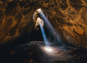
4.40.2 mi / -25 ft gainThe hardest part about getting to Skylight Cave is the drive. Start by coming from Sisters, Oregon, and use the driving directions below to find it. The Google Maps pin is accurate, and if you like coordinates, you can use 44°20'55.3"N 121°42'55.9"W as well. It's recommended you download an offli...Read more -
Deschutes County, Oregon
Chush Falls
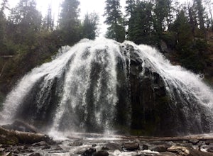
3.35.75 mi / 823 ft gainJust outside of Sisters, Oregon, near Bend, is a beautiful hike to a picturesque waterfall. It is rarely crowded thanks (and no thanks) to the Pole Creek Fire, which ravaged the area several years ago. Because of the fire, the hike and landscape have been drastically altered. What used to be a 2-...Read more -
Deschutes County, Oregon
Summit Black Crater
5.08 mi / 2211 ft gainThe Black Crater Trailhead parking lot is accessed off the McKenzie Pass (Hwy 242). The trailhead starting elevation is 5,040ft. (using the iPhone app "Topo Maps". Great app) with a 3.8 Mile hike one way to the Black Crater Summit at 7,251ft of elevation. Some parts of the trail are steep and g...Read more -
Camp Sherman, Oregon
Historic Black Butte Trail # 4026
9.85 mi / 3360 ft gainHistoric Black Butte Trail # 4026 is an out-and-back trail where you may see beautiful wildflowers located near Camp Sherman, Oregon.Read more -
Deschutes County, Oregon
Camp at Lava Lake
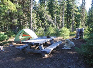
4.5Beautiful spot to set your tent up for a night or longer.About 12 spots scatter the immediate campground area, but while hiking we spotted several more dispersed throughout the towering Ponderosa Pine trees. Most of the spots circle a small lake. The ground in this site is a VERY soft dirt, perfe...Read more -
Deschutes County, Oregon
Matthieu Lakes via Lava Camp Lake Trail
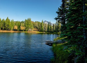
2.06 mi / 922 ft gainBegin your hike at the Lava Camp Lake Trailhead. The trail winds through a forest flush with hemlock and fir while opening up into black lava flows. Continue for a little over two miles until you reach North Matthieu Lake. This is your first stop. Go for a swim out to the little island and have a...Read more -
Deschutes County, Oregon
North Martthieu Lake Trail
5.52 mi / 846 ft gainNorth Martthieu Lake Trail is an out-and-back trail that takes you by a lake located near Sisters, Oregon.Read more -
Camp Sherman, Oregon
Fir Trail and Pine Trail Loop from South Trailhead
5.53 mi / 361 ft gainFir Trail and Pine Trail Loop from South Trailhead is a loop trail where you may see local wildlife located near Camp Sherman, Oregon.Read more -
Camp Sherman, Oregon
West Metolius Loop from Camp Sherman
2.17 mi / 151 ft gainWest Metolius Loop from Camp Sherman is a loop trail that takes you by a river located near Camp Sherman, Oregon.Read more -
Bend, Oregon
Park Meadow Trail to Golden Lake
13.12 mi / 1522 ft gainPark Meadow Trail to Golden Lake is an out-and-back trail where you may see beautiful wildflowers located near Sisters, Oregon.Read more -
Deschutes County, Oregon
Dee Wright Observatory
4.70.93 mi / 20 ft gainOn your way to Proxy Falls from Bend? Stop by the Dee Wright Observatory to take some photos of the gorgeous mountains. The Observatory is at the summit of McKenzie Pass in Oregon's Cascade Mountains. Built right in the middle of a large lava flow, the open structure itself is actually construct...Read more


