The Best Hiking in Maryland
Looking for the best hiking in Maryland? We've got you covered with the top trails, trips, hiking, backpacking, camping and more around Maryland. The detailed guides, photos, and reviews are all submitted by the Outbound community.
Top hiking spots in and near Maryland
-
Potomac, Maryland
Great Falls and the Billy Goat Trail
4.54.61 mi / 272 ft gainJust outside of Washington DC is a great hike and rock scramble you don't want to miss. Great Falls lies in both Virginia and Maryland and has beautiful views of the Potomac River. Start out at the Great Falls Tavern parking lot (Maryland side), and keep in mind it is $10 to park here if you don...Read more -
Pylesville, Maryland
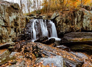
Hike to Kilgore Falls
3.81.2 miThis 1.2 mile roundtrip hike leads to the second tallest waterfall in the state of Maryland. It is a short hike that's great for families and bringing the dog. In the warmer months, you can swim in the pool at the base of the waterfall. People have cliff jumped here, but exercise caution and do s...Read more -
Elkridge, Maryland
Cascade Falls Loop
3.02.31 mi / 381 ft gainThis hike is a great place to escape the city feel of Baltimore and disappear into the wilderness. Enter through the Avalon Area entrance. There is a cash fee to enter the park. Once you pass the front gate continue past the initial picnic area. Continue through the park to the Orange Grove Area...Read more -
Knoxville, Maryland
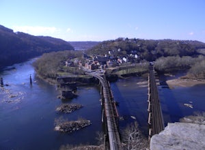
Hike to Maryland Heights
4.82.8 mi / 900 ft gainMaryland Heights is at the convergence of Maryland, West Virginia and Virginia, as well as the Potomac and Shenandoah Rivers. The Appalachian Trail and C&O Canal Towpath are also easily accessible from the trailhead parking lot. The parking lot holds about 16 cars and is between Locks 33 and ...Read more -
Myersville, Maryland
Hike to Annapolis Rock and Black Rock Cliff
4.48 mi / 840 ft gainHike along the Appalachian Trail as it passes through South Mountain State Park, taking you to a number of very scenic lookout spots.From the parking area, take the connector trail a short distance until you see blue blazes on the left – these will lead you to the Appalachian Trail (white blazes)...Read more -
Thurmont, Maryland
Hike Catoctin Mountain
4.58.4 mi / 1370 ft gainPark at Catoctin Mountain Visitor Center. The hike starts at the end of the gravel parking lot across from the visitor center. This is definitely a popular hiking location, so come early on the weekends to guarantee a parking spot and to avoid the crowds. To start, take the right trail towards th...Read more -
Smithsburg, Maryland
Hike to Cunningham Falls
4.22.8 miThis 78-foot waterfall, among the largest in the state, is easily accessible by two short trails. Lower Trail (0.5 miles) leads directly to the falls, whereas Cliff Trail (0.75 miles) has slightly more difficult terrain and takes you to a viewing platform. To lengthen the adventure, Hunting Creek...Read more -
Knoxville, Maryland
Hike the AT to Weverton Cliffs
4.93 mi / 1500 ft gainThe trailhead is located right off Weverton Cliff's Road in Knoxville, Maryland. Park at a Park and Ride on the right side of the road, then walk right out of the parking lot down Weverton Cliff's Road until you see the white blazes of the Appalachian Trail. Follow that trail for 1.5 miles along ...Read more -
Hagerstown, Maryland
Hike Thurston Griggs to Appalachian Trail to Black Rock
5.03.4 mi / 900 ft gainPark on White Oak road to access the trailhead for this magnificent hike. Be sure to wear sturdy hiking boots--the trail is rocky at parts and there are streams to cross. Accessible February-November.Read more -
Dickerson, Maryland
Hike the Sugarloaf Mountain Trail
4.76.05 mi / 1509 ft gainPark on Sugarloaf Mountain Drive (as indicated on the map below) to access the trail. It is open from March-November and is dog friendly.Read more -
Elkridge, Maryland
Hike the Cascade Falls and Rootball Loop Trail
4.72.4 mi / 285 ft gainPark on the shoulder of Landing Drive (see map) to access the trailhead. This trail is open April-September. Dogs allowed on leash.Read more -
Thurmont, Maryland
Hike Chimney Rock at Catoctin Mountain Park
4.25 mi / 600 ft gainChimney Rock is the quintessential breathtaking view that makes a hike worthwhile. By parking at the most northeast parking lot on the trail map you are able to include the sweeping views of Thurmont Vista, and Wolf Rock on your way to Chimney Rock. Highly recommend visiting in the fall, and on w...Read more -
Oldtown, Maryland
Hike to Paw Paw Tunnel
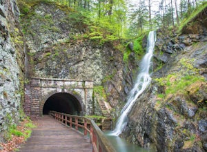
3.82.4 miThis hike is short and sweet, with it only being 2.4 miles to the other side of the tunnel and back. It's easily accessible, located right off the highway at the Paw Paw Tunnel Campground on the Potamac River at the border of Maryland and West Virgina. The town of Paw Paw is on the West Virgina s...Read more -
Potomac, Maryland
Hike Billy Goat Trail Section B
3.72.7 mi / 68 ft gainPark in the lot on MacArthur Blvd. (see map) to access the trailhead. Trail is well-defined but little-traveled. You may want to bring a field guide for identifying wildflowers and the critters of the region.Read more -
Oakland, Maryland
Hike the Swallow Falls Loop
4.71.1 mi / 125 ft gainThis park has plenty to do—forest hiking, swimming at Herrington Manor, and camping—but the main attraction, unsurprisingly, is Swallow Falls. The Swallow Falls Canyon Trail (1.1 miles) follows Muddy Creek and features a number of other falls, including Muddy Creek Falls (53 ft).Read more -
Knoxville, Maryland
Explore Point of Rocks/ Potomac River Overlook
4.00.2 mi / 95 ft gainPark at the Chesapeake and Ohio Canal parking lot. Walk to the US 15 and cross the road. Trail is not marked, though its faint traces can be detected as you continue on. GPS is recommended. Enjoy the overlook and when you're ready to go back, retrace your steps.Read more
Quick links
- The best hiking trails in Maryland
- The best backpacking in Maryland
- The best camping in Maryland
- Top adventures in Maryland

