The Best Hiking in Detroit
Looking for the best hiking in Detroit? We've got you covered with the top trails, trips, hiking, backpacking, camping and more around Detroit. The detailed guides, photos, and reviews are all submitted by the Outbound community.
Top hiking spots in and near Detroit
-
Detroit, Oregon
Stahlman Point Trail
4.05 mi / 1391 ft gainStahlman Point Trail is an out-and-back trail that takes you by a lake located near Gates, Oregon.Read more -
Detroit, Oregon
Dome Rock via the Upper Trailhead
2.36 mi / 479 ft gainFrom Highway 22 at the Breitenbush River Bridge, in Detroit, turn north on to French Creek Rd. Drive up French Creek about 7.7 miles to the Upper TH #3379/3381 to Dome Rock and Tumble Lake. The trail can be found on the left side of the road and is easily seen after you pass it. It's best to pass...Read more -
Detroit, Oregon
Elk Lake to Twin Lakes
11.13 mi / 2260 ft gainElk Lake to Twin Lakes is an out-and-back trail that takes you by a lake located near Lyons, Oregon.Read more -
Detroit, Oregon
Battle Ax Mountain
5.05.09 mi / 1594 ft gainWith no officially marked trailhead, this hike begins slightly west of Elk Lake in Marion County. Take Highway 22 to Detroit, OR. East of the bridge over Breitenbush River, turn onto (FR) Forest Road 46, with signs pointing to Breitenbush River. After 4.5 miles turn left at a sign for Elk Lake, a...Read more -
Detroit, Oregon
Bagby Trail #54 and Battle Ax Mountain Trail #3340
5.78 mi / 1617 ft gainBagby Trail #54 and Battle Ax Mountain Trail #3340 is a loop trail where you may see local wildlife located near Detroit, Oregon.Read more -
Detroit, Oregon
Twin Lakes via Battle Ax Mountain and Bagby Trails Loop
13.49 mi / 3123 ft gainTwin Lakes via Battle Ax Mountain and Bagby Trails Loop is a loop trail that takes you by a lake located near Detroit, Oregon.Read more -
Marion County, Oregon
Gold Butte Fire Lookout
4.32.44 mi / 741 ft gainGold Butte Fire Lookout is a real gem in the Willamette National Forest. At 4618 feet elevation, the nearby Cascade Mountain views are nothing short of spectacular! At the summit, sits a L-4 Ground Structure Type Fire Lookout that was built in1934 to be used as a Fire Lookout. Additionally, durin...Read more -
Gates, Oregon
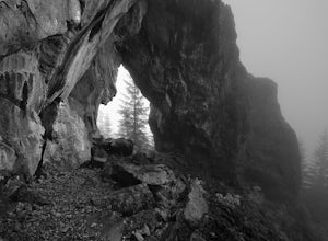
Hike Natural Rock Arch Trail
5.00.6 mi / 460 ft gainThe Santiam Forest is well known for its many beautiful spots, but this one is fairly uncommon. It's likely you will be the only person out here. Since it's such a short hike, just about a mile round trip, you could easily make it a pit stop on your way to or from someplace else and not have to w...Read more -
Linn County, Oregon
Bachelor Mountain Trail
3.71 mi / 1270 ft gainBachelor Mountain Trail is an out-and-back trail where you may see beautiful wildflowers located near Cascadia, Oregon.Read more -
Detroit, Oregon
Boca Cave & Triangulation Peak
4.04.75 mi / 1053 ft gainTriangulation Peak, Spire Rock and Boca Cave TH #3372 The trail starts on level ground where you travel east along the top of the ridge. There are multiple trees that have fallen across the trail making the hike quite adventurous. Some trees you'll go over and some you will need to go under. Dep...Read more -
Linn County, Oregon
Coffin Mountain Fire Lookout
5.02.67 mi / 873 ft gainCoffin Mountain Fire Lookout is a beautiful day hike that takes you to its summit at 5771 feet elevation, covering roughly 1070 feet elevation gain. To get to the Coffin Mt. trailhead from Detroit OR, travel east on Highway 22 for approximately 19.5 miles to Forest Road 11 (Straight Creek Road)....Read more -
Gates, Oregon
Battle Axe Summit via Whetstone, Twin Lakes, Elk Lake
33.77 mi / 7323 ft gainBattle Axe Summit via Whetstone, Twin Lakes, Elk Lake is a loop trail that takes you by a waterfall located near Detroit, Oregon.Read more -
Lyons, Oregon
Backpack the Opal Creek Wilderness
11.5 mi / 900 ft gainOn Saturday, I slid into the backseat alongside weekend belongings crammed in the car trunk. Backpacks with patches and streaks of dust. Bags of food that could be cooked over the flames of a fire.We drove south on the 5, leaving Portland and crossing through Salem, as Lake Street Dive albums pla...Read more -
Lyons, Oregon
Opal Creek Pools Loop
4.66.6 mi / 663 ft gainNote: this trail is closed due to fire damage. For more updates, please visit the Forest Service website. The Opal Creek pools are a wonderful place to visit year-round, but they’re a true oasis on a hot summer day. With a variety of rock outcroppings and ledges to jump off of, and plenty of ro...Read more -
Idanha, Oregon
Bachelor Mountain via Bugaboo Ridge
7.4 mi / 1998 ft gainBachelor Mountain via Bugaboo Ridge is an out-and-back trail where you may see beautiful wildflowers located near Detroit, Oregon.Read more -
Lyons, Oregon
Henline Falls Trail
5.01.71 mi / 312 ft gainThe trail is a washed out, old mining road making its way through a lush forest with a mix of ferns, moss covered trees, and towering Douglas Firs with trees blown over from wind storms lining both sides of the trail. I call those Big Foot traps. The trail comes to a fork, stay to the left you ar...Read more


