The Best Hiking in Gold Canyon
Looking for the best hiking in Gold Canyon? We've got you covered with the top trails, trips, hiking, backpacking, camping and more around Gold Canyon. The detailed guides, photos, and reviews are all submitted by the Outbound community.
Top hiking spots in and near Gold Canyon
-
Apache Junction, Arizona
Brittlebush Trail to High Point Trail
1.64 mi / 338 ft gainBrittlebush Trail to High Point Trail is an out-and-back trail where you may see beautiful wildflowers located near Apache Junction, Arizona.Read more -
Apache Junction, Arizona
Brittlebush and Crest Trail
2.39 mi / 469 ft gainBrittlebush and Crest Trail is a loop trail where you may see beautiful wildflowers located near Apache Junction, Arizona.Read more -
Apache Junction, Arizona
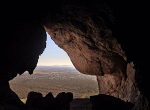
Monument Canyon and Broadway Cave
3.63.69 mi / 866 ft gain...Who doesn't enjoy a short adventure to an scenic location?! If I were to guess, I'd say a good majority of us. This four mile, low trafficked hike to the Broadway Cave will lead you to one of the best spots to hang out or watch the sunset. The Broadway trailhead is located by taking Highway 60...Read more -
Gold Canyon, Arizona
Peak 5057 via Hieroglyphic Trail
7.45 mi / 3045 ft gainTo get to the trailhead from US60, turn north onto Kings Ranch Road where you will begin the winding path through the neighborhoods. From Kings Ranch Road, turn east on Baseline Ave, north on Mohican Road, west on Valley View Drive, north on Whitetail Road, and east on Cloudview Ave until it com...Read more -
Gold Canyon, Arizona
Lost Goldmine and Cougar Loop
3.87 mi / 335 ft gainLost Goldmine and Cougar Loop is a loop trail where you may see wildflowers located near Gold Canyon, Arizona.Read more -
Gold Canyon, Arizona
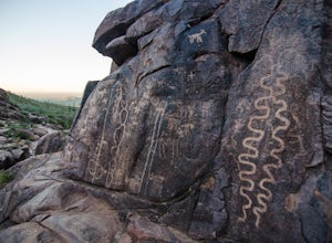
Hieroglyphic Trail
5.02.9 mi / 614 ft gainThis hike is a great beginner hike for those who want to experience the beauty of the Superstitions. I suggest going early in the morning because this trail gets very crowded later in the day (especially on weekends). To get to the trailhead from US60, turn north onto Kings Ranch Road where you ...Read more -
Gold Canyon, Arizona
Superstition Peak 5057 via Carney Springs
5.07.71 mi / 2831 ft gainThis is the true beast hike of the Superstitions. If you think Flatiron is a toughy, give this a whirl! You will be poked, prodded, slapped, smacked, jolted, tripped and stabbed the entire way, but rewarded with arguably the finest sights the valley of the sun has to offer: the entire Superstitio...Read more -
Gold Canyon, Arizona
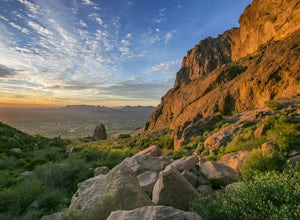
Catch a Sunset at Three Sisters
5.0Three Sisters is a huge rock formation in the southern area of the Superstition Mountains. This spot is only about an hour outside of Phoenix and it's a great spot to do photography in the evening or morning.This is accessed from the Wave Cave parking lot on the way to the nearby Peralta Trailhe...Read more -
Gold Canyon, Arizona
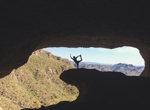
Wave Cave Trail
4.63 mi / 948 ft gainFrom the trail-head you will follow the old and wide dirt road for a while until you reach the wilderness fence line. It's easy to get lost. When you reach the fence there's an area to go through. It's difficult to see. Make sure you look closely. DO NOT follow the signs that say "trail". Once yo...Read more -
Apache Junction, Arizona
Hike to Praying Hands in Lost Dutchman State Park
4.04.3 mi / 954 ft gainBegin your hike in the Cholla parking lot, and start Treasure Loop Trail (this is the north side of the loop, heading east). Once you get to the base of the main cliffs, and the trail starts to veer to the right, this is where you branch off. Instead of veering right, go straight and off to the...Read more -
Apache Junction, Arizona
Siphon Draw to Flatiron Summit
4.95.6 mi / 3415 ft gainFlatiron is one of the most popular day hikes in the Superstition Wilderness, just outside of Phoenix, AZ. The hike begins at Lost Dutchman State Park in Apache Junction. Once inside the park, drive to the last parking area and look for a sign for the Siphon Draw Trailhead. The Siphon Draw Trail ...Read more -
Apache Junction, Arizona
Treasure Trail and Siphon Draw Loop
3.04 mi / 564 ft gainTreasure Trail and Siphon Draw Loop is a loop trail where you may see wildflowers located near Apache Junction, Arizona.Read more -
Apache Junction, Arizona
Cross Cut, Prospector and Jacob's Trail #58 Loop
5.56 mi / 1073 ft gainCross Cut, Prospector and Jacob's Trail #58 Loop is a loop trail where you may see beautiful wildflowers located near Apache Junction, Arizona.Read more -
Apache Junction, Arizona
Jacob's Crosscut and Siphon Draw Trail
2.34 mi / 174 ft gainJacob's Crosscut and Siphon Draw Trail is a loop trail where you may see wildflowers located near Apache Junction, Arizona.Read more -
Apache Junction, Arizona
Treasure Loop Trail
4.82.34 mi / 571 ft gainLocated about 40 miles east of Phoenix right off AZ-88 E/N Apache Trail. The initial trail begins at an elevation of 2000 feet within the Sonoran Desert. The trail can be accessed via the Cholla (northern side) Day-use Area or the Saguaro (southern) Day-use Area. Once you're on the trail you wil...Read more -
Apache Junction, Arizona
Camp at Lost Dutchman State Park
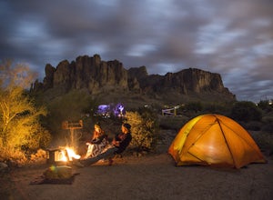
4.8Lost Dutchman State Park is located near the Superstition Mountains in central Phoenix, about 40 miles from Phoenix. There is a $7 day use fee to enter the park, which is waived if you’re camping ($15/night). The park offers 134 campsites, each with a picnic table, barbeque grill, and fire pit, a...Read more


