The Best Hiking in Marble Canyon
Looking for the best hiking in Marble Canyon? We've got you covered with the top trails, trips, hiking, backpacking, camping and more around Marble Canyon. The detailed guides, photos, and reviews are all submitted by the Outbound community.
Top hiking spots in and near Marble Canyon
-
Marble Canyon, Arizona
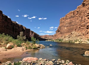
Cathedral Wash Trail
5.03.28 mi / 597 ft gainCathedral Wash Trail is an out-and-back trail that takes you by a river located near Marble Canyon, Arizona.Read more -
Marble Canyon, Arizona
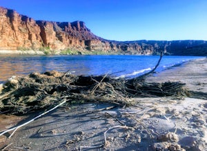
Explore Paria Beach
5.0The area directly below Lee's Ferry campground is known as the Paria Riffle and Beach. The Paria is a small river that feeds into the Colorado River just north of the campground. Just park at the campground parking lot next to the river and walk a short distance to the sandy beach area where you ...Read more -
Marble Canyon, Arizona
Paria Canyon from Lees Ferry
5.6 mi / 522 ft gainParia Canyon from Lees Ferry is an out-and-back trail that takes you by a river located near Page, Arizona.Read more -
Marble Canyon, Arizona
Lees Ferry and Spencer Trail Lookout
3.82 mi / 1706 ft gainLees Ferry and Spencer Trail Lookout is an out-and-back trail that takes you by a river located near Marble Canyon, Arizona.Read more -
Page, Arizona
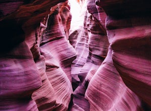
Hike through Upper Waterholes Canyon
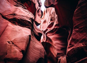
4.81.5 mi / 300 ft gainWaterholes Canyon is a gorgeous slot canyon located just south of Page, Arizona that empties into Glen Canyon. The Upper Part of the Canyon is an easy, largely non-technical section that is easily accessed from Highway 89 and a clear parking turnoff on the left side of the road if you're heading ...Read more -
Marble Canyon, Arizona
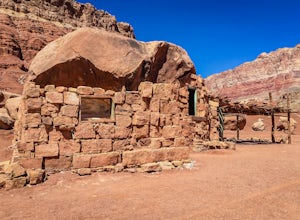
Explore the Cliff Dwellers in Marble Canyon
4.00.5 mi / 0 ft gainThe Cliff Dwellers is a unique tale that takes place the same year Prohibition began. Bill & Blanche Russel were driving through Marble Canyon when their automobile broke down. After several attempts to fix it, they found themselves camping overnight. As the sun rose the next day, they ironi...Read more -
Page, Arizona
Explore the Horseshoe Bend Crack
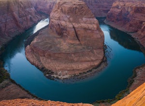
5.01.9 miHorseshoe Bend is an iconic viewpoint, and a must-see for photographers. Check out Tiffany Nguyen's post, Hike to Horseshoe Bend, for more details on that part of the adventure. Because of its popularity and easy access, the Horseshoe Bend viewpoint is thoroughly photographed and can be very cro...Read more -
Williams, Arizona
Horseshoe Bend
4.71.52 mi / 157 ft gainHorseshoe Bend in Page, Arizona is classic bucket list material and for good reason. Even if they don’t know what it’s called or where it is, everyone has seen this famous spot somewhere. Rest assured; pictures cannot convey the massive scale of this place. From your vantage point 1,000 feet abov...Read more -
Page, Arizona
Hike Cathedral Canyon
5.01 mi / 50 ft gainCathedral Canyon is located just south of Page, Arizona and west of Coppermine Road and is entirely on Navajo Land, so access is possible only by permission from a local or with a permit from one of the licensed tour companies, of which Chief Tsosi is currently the only one permitted to give perm...Read more -
Page, Arizona
Hike the Page Mesa Trail
13.2 mi / 800 ft gainThe best way to loop is counter-clockwise, to avoid unnecessary uphill distance. The trail features wonderful wildflowers in the spring, and is open year round. The Page Mesa Trail typically takes between 1 and 3 hours to hike. The trail is also a fabulous location for mountain biking and is dog ...Read more -
Page, Arizona
Hiking the Ropes Trail in Page Arizona
5.0The Ropes Trail is an old hiking trail below Glen Canyon Dam that has long since been abandoned by the park service. It is also one of the few trails that leads down the steep walls into the canyon. Let me say that again, it's steep. Getting there Take Highway 89 from Page going north and take th...Read more -
Page, Arizona
Hike the Glen Canyon Dam Overlook
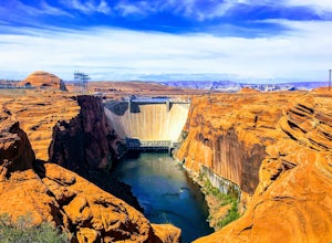
5.00.11 mi / 124 ft gainThe Glen Canyon Dam separates the Colorado River from Lake Powell. The terrain on this hike is uneven and rocky. The overlook is located on Scenic View Drive off of highway 89. Glen Canyon Dam is located in Glen Canyon National Recreation Area.Read more -
Page, Arizona
Hike Pedestal Alley
3 mi / 240 ft gainAlthough this is a relatively short hike, the desert conditions are harsh. Make sure you are properly prepared, hydrated, and protected from the sun before starting out. Directions: From the Bullfrog Visitor Center, take Highway 276 north approximately 4.4 miles (7 km) to the marked junction with...Read more -
Page, Arizona
Hike the Page Rimview Trail
10 mi / 652 ft gainThis trail is open for use year round. Be aware of snakes along the trail. Due to the exposed terrain and dry, hot climate, be sure to bring more water than you think you need.Read more -
Page, Arizona
Page Rimview Trail
9.98 mi / 764 ft gainPage Rimview Trail is a loop trail where you may see wildflowers located near Page, Arizona.Read more -
Page, Arizona
Explore The Chains
1 mi / 15 ft gainThe lake is very deep at this location, make sure your entire party has relatively strong swimming skills. North of the parking area, you will find slick rock sand formations. Directions: Just east of the Glen Canyon Dam, take a dirt road heading north off of highway 89.Read more

